
|
|

|

|


** Use at Your Own Risk **
08A |
Liebre Mountain |
5760' |
Location: Los Angeles County, about 19 miles southeast of Gorman, 70 miles from Los Angeles
Maps
| Auto Club | Los Angeles and Vicinity |
| Forest Service | Angeles National Forest |
| USGS Topo | Liebre Mountain 7½ |
| Official HPS Maps | TPO file - Save to your computer then open with National Geographic TOPO! |
| Viewable PDF file - Approximately 4.2 megs | |
| GPX file or Google Earth KML file to download to GPS units and other map software (How to use GPX and KML files) | |
| Routes as shown on CalTopo using the above files (How to use CalTopo) |
Nearby Peaks: Burnt Peak, Sawtooth Mountain
ROUTE 1
(USFS Adventure Pass may be required)- Distance: 7 miles round trip
- Gain: 1850'
- Time: 3 hours round trip
- Rating: Class 1, moderate
- Navigation: Easy
- Leader Rating: "O", normal conditions
Original: John Backus and Al Campbell, 1969
DRIVING ROUTE 1
- Take I-5 north to SR 138.
- Go 4 miles east on SR 138 to a paved road signed as Old Ridge Route Road, which is the beginning of Los Angeles County Road N2. Turn right.
- Go 2.2 miles east to Pine Canyon Road (which is a continuation of N2). Turn left.
- Go 4.2 miles east on N2 passing mile marker 13.6. Turn right onto dirt road.
- Go 0.1 mile on dirt road to end and park here.
HIKING ROUTE 1
- From the parking area (3960'), the southbound Pacific Crest Trail (PCT) goes right (west) past a sign 50' up the trail. Follow the PCT as it goes south and up Liebre Mountain to the broad summit area.
- Once in the broad summit area, hike roughly 0.4 mile on relatively level ground, watching for a flimsy fence a few yards off the trail to the right. Pass through the fence to a jeep track beyond.
- The summit cairn is in the grove of trees to the right (west) of the jeep track, about 50 yards past the fence.
ROUTE 2
(USFS Adventure Pass may be required)- Distance: 250' round trip
- Gain: None
- Time: None
- Rating: Class 1, easy
- Navigation: Easy
- Leader Rating: "O", normal conditions
Original: John Backus and Al Campbell, 1969
DRIVING ROUTE 2
- Take I-5 north to the town of Castaic and exit on Lake Hughes Road.
- Take Lake Hughes Road northeast for 23.6 miles to where it ends at a junction with N2, Pine Canyon Road. Turn left (west).
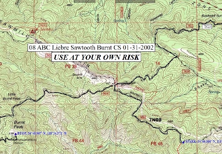
- Go 4.7 miles to Bushnell summit with a junction with 7N23 on the left. Turn left. Note your odometer and go as follows:
- At 2.0 miles, fork. Go right.
- At 3.2 miles, junction. Go right (west) on 7N23.
- At 4.6 miles, Sawmill Campground.
- At 6.5 miles, fork. Keep straight.
- At 9.7 miles, Bear Campground. Keep straight.
- At 11.2 miles, a wide spot in the road. Park here.
A shorter driving route on the return is as follows:
- From the parking area, go west on 7N23.
- At 6.6 miles, intersect 7N22. Continue straight on 7N23.
- At 7.2 miles turn right (north) on 8N04.
- 8N04 turns into N2. This portion of N2 is called the Old Ridge Route.
- At 12.6 miles turn left (west) onto SR 138.
- Continue west on SR 138 and meet I-5 at 16.8 miles.
HIKING ROUTE 2
- From the parking area (5760'), walk 250' north-northwest to a cairn.
ROUTE 3
(USFS Adventure Pass may be required)- Distance: 12 miles round trip
- Gain: 1900' total, 1850' out plus 250' on return
- Time: 6 hours round trip
- Rating: Class 1, moderate
- Navigation: Easy
- Leader Rating: "O", normal conditions
Original: Catherine Rossbach, Sunny Yi, and Jason Park, 2025
DRIVING ROUTE 3
- Take I-5 north to exit for Quail Lake Road/SR 138.
- Go 4 miles east on SR 138 to a paved road signed as Old Ridge Route Road, which is the beginning of Los Angeles County Road N2. Turn right.
- Go 2.2 miles east to Pine Canyon Road (which is a continuation of N2).
- Continue straight on Old Ridge Route Road (8N04) for another .7 mile, approximately 1000 feet past the ruins of the Sandberg Hotel on the right side of Old Ridge Road. The road deteriorates. It is at times paved and at times gravel with some washouts. High clearance vehicle is not required.
- Park in a very wide section of the road and climb left off the road over a low berm onto the "Sandberg Trail."
HIKING ROUTE 3
- Follow the Sandberg Trail to the right. It is at times deeply rutted from bike traffic as it winds its way up to the base of Sandberg Peak (5345').
- From this point, the Sandberg Trail roughly parallels the dirt road (7N23) that goes all the way to the broad, flat area of the HPS summit of Liebre Mountain.
- Note that roughly a half mile before you reach the HPS summit, you will pass the USGS summit of Liebre Mountain on the right. A register is located in a small rocky formation just above a wide, circular parking area. This is not the HPS summit register.
- The summit cairn of the HPS summit is in a grove of trees to the left (north) of the road. This summit has very little prominence and is somewhat difficult to discern. If you reach a circular turnaround area in the road where the PCT emerges from the north, you have gone too far.
- Returning to the trailhead on 7N23 until it diverges from the Sandberg Trail is somewhat easier walking and saves a mile, but it isn't as pretty as the trail.
History of Summit Signature
Climbing Archives
Please report any corrections or changes to the Mountain Records Chair.