Marion Mountain

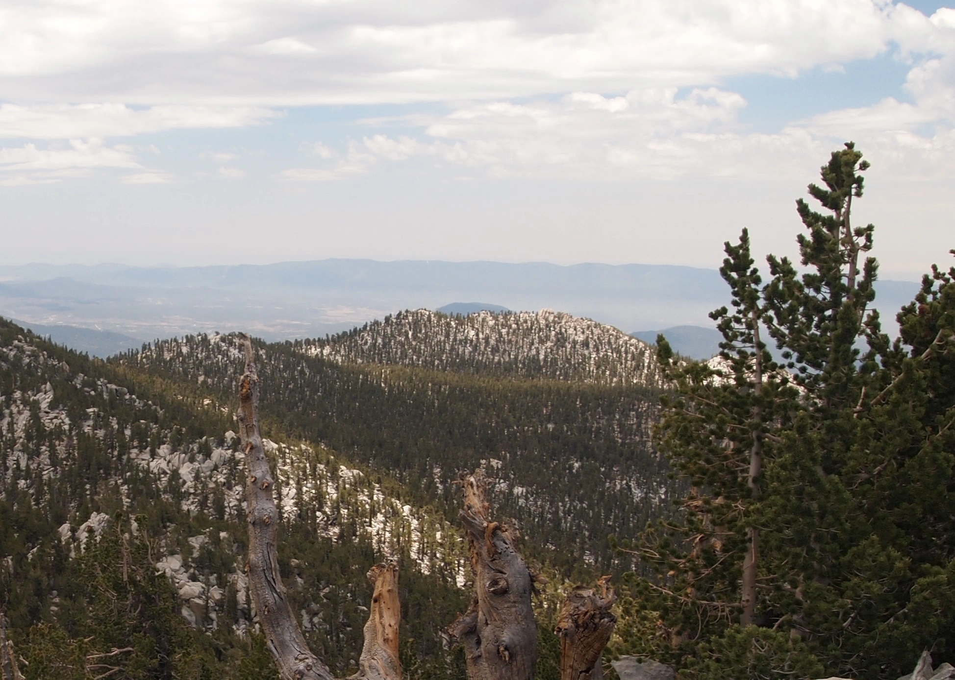
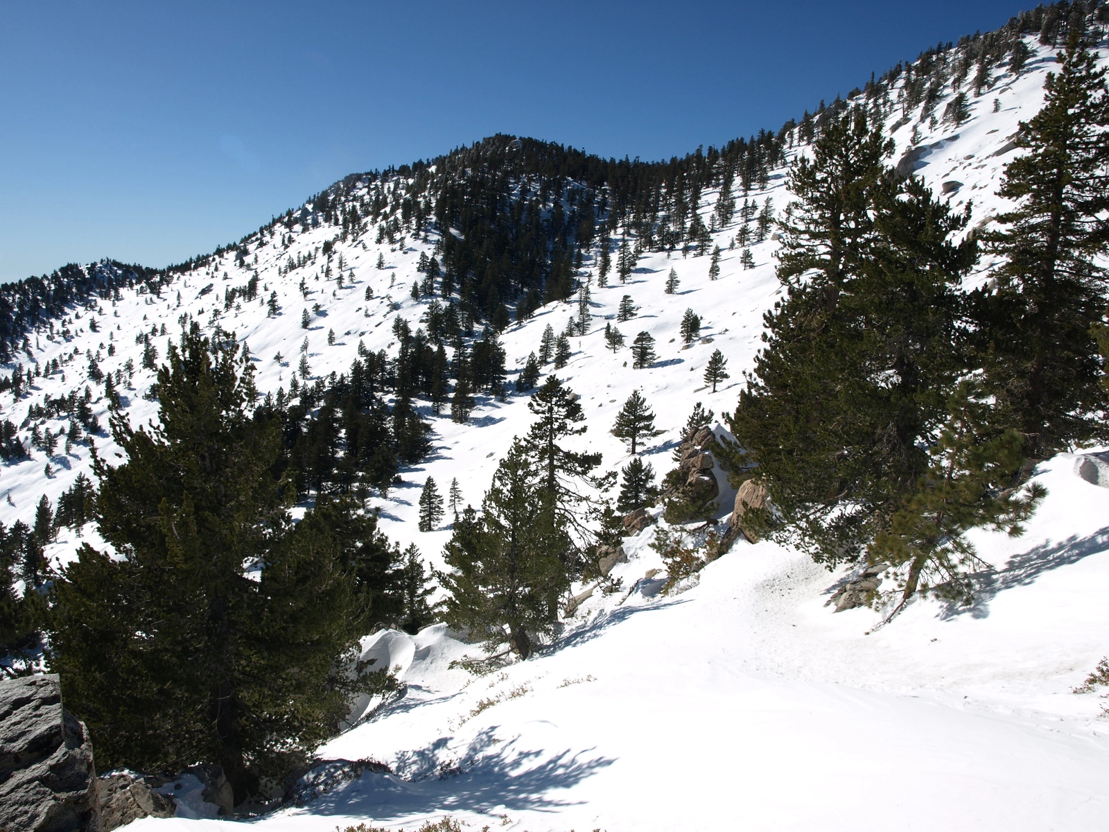
Marion Mountain from Long Valley, Photo by Kathy Wing.

Peak Name

Marion Mountain
27I

Elevation

10320

 feet

Status

active

Region

San Jacinto Area

Range

San Jacinto Mountains

Location

33.7958525,-116.6866838

Description

Though the surveyor who named this peak rejected its namesake for another, for whom Jean Peak was named, most of us find Marion to be a more interesting and challenging peak than its neighbor Jean. Its rocky summit overlooks Idyllwild below and Lily Rock and Tahquitz Peak directly across the canyon. Note that Marion is is one of several HPS peaks where the location of the HPS summit (the western bump) is different from the USGS summit.

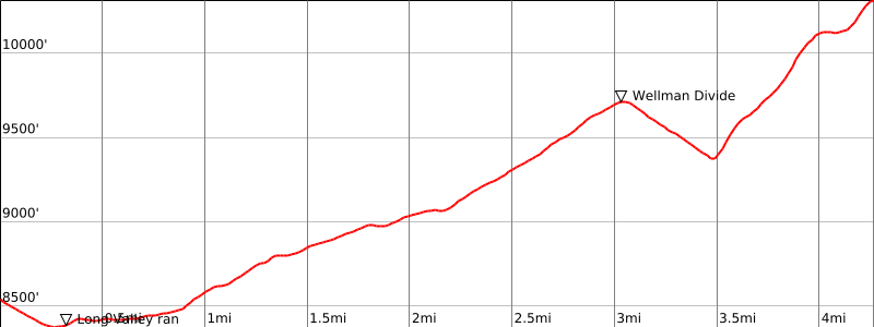
Route 1 starts from the tram and passes through Round Valley like San Jacinto Route 1, but turns south at Wellman Divide for a short distance before climbing a gully on use trail to the rocky summit. Route 2 describes the route from Idyllwild via the Devil’s Slide Trail, joining Route 1 for the final climb. Route 3 describes the route between Jean and Marion, which follows the ridge over an intermediate bump (Shirley Peak, perhaps named after the surveyors third girlfriend). Route finding on this route can be difficult. There are other less common cross country routes, which can be very brushy.

Maps generated from CalTopo.com, reproduced with permission

Route 1- From Palm Springs Tramway
Elevation Gain
2000′
Navigation Difficulty
Difficult
Distance
9 miles round trip on trail and cross-country
Estimated time
6-7 hours round trip
Route Rating
Class 3, moderate
Leader Rating Required
“I”, normal conditions

Driving route

Take I-10 east past Banning to the junction with SR 111.
Take SR 111 southeast 8.5 miles to the Palm Springs Tramway Road. Turn right.
Go up this road 3.7 miles to its end at the tramway terminal. Park where indicated by the signs in this area.

Hiking route

Take the tram (fee required) to the upper station at 8560′.
Go downstairs and exit the building. Follow the concrete sidewalk as it descends to the valley below.
Continue straight ahead to a ranger station.
Continue about 1/4 mile to a trail junction with a sign “Round Valley – 2”.
Keep right and continue to Round Valley Campground.
Keep left here at a junction and continue up to Wellman Divide (9700′).
Keep left at this junction and follow the trail southwest (downhill) through some switchbacks about 1/2 mile to Wellman Cienega.
Leave the trail on the right and hike cross-country up to the saddle northeast of Marion Mountain.
Turn left (south) and go up to the summit block. This is on the west end of the ridge.
To climb the summit block, start at an upright dead tree on the northeast side. Go up a crack for about 10′. Turn right for another 10′. Turn left into another crack that leads to the summit.

Route Notes

Note: Trailhead is at top of Palm Springs Tramway; fee required.

Printable Route

Road Type

None

Google Maps Link to Trailhead 

Route 2- From Devils Slide Trail
Elevation Gain
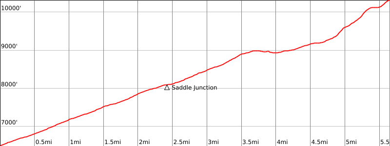
4100′
Navigation Difficulty
Difficult
Distance
16 miles round trip on trail
Estimated time
9-10 hours round trip
Route Rating
Class 3, strenuous
Leader Rating Required
“I”, normal conditions

Driving route

From the Chevron Station in Idyllwild, go northeast on North Circle Drive for 0.8 mile to South Circle Drive. Turn right.
Go 0.1 mile to Fern Valley Road. Turn left.
Go 1.8 miles to the loop at the end of the road in Humber Park. Park here.

Hiking route

From Humber Park (6480′), hike up the Devils Slide Trail to Saddle Junction at 8080′. This is a multiple trail junction.
Take the far left trail and continue up to Wellman Cienega.
Leave the trail on the left and hike cross-country up to the saddle northeast of Marion Mountain.
Turn left (south) and go up to the summit block. This is on the west end of the ridge.
To climb the summit block, start at an upright dead tree on the northeast side. Go up a crack for about 10′. Turn right for another 10′. Turn left into another crack that leads to the summit.

Route Notes

Printable Route

Road Type

Paved

Google Maps Link to Trailhead 

Route 3- From Jean Peak
Elevation Gain
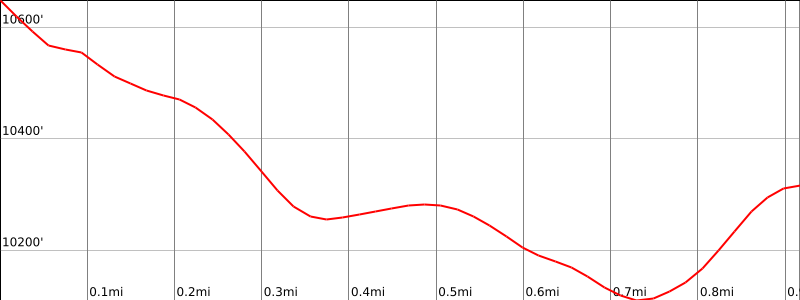
300′
Navigation Difficulty
Moderate with Jean Peak
Distance
1.5 miles one way cross-country
Estimated time
1 hour one way
Route Rating
Class 3, strenuous with Jean Peak
Leader Rating Required
“I”, normal conditions

Driving route

See the driving instructions for Routes 1 or 2 depending on your trailhead selection.

Hiking route

See the hiking instructions for Jean Peak.
From the summit of Jean Peak, hike south along the ridge passing a bump on its right side until you come to the saddle just north of Marion Mountain.
Go south up to the ridge.
Turn right and follow the ridge to its western end.
To climb the summit block, start at an upright dead tree on the northeast side. Go up a crack for about 10′. Turn right for another 10′. Turn left into another crack that leads to the summit.

Route Notes

From Jean Peak.

Printable Route

Road Type

None

Google Maps Link to Trailhead 

Additional Peak Information

Special conditions: Wilderness permits are required under all circumstances. Permits for day hikes can be obtained from the Long Valley ranger station (near the tram) for Route 1. For Route 2, they may be obtained at Idyllwild Ranger Station, as can permits for backpacking. Permits are limited to 12 hikers. The Idyllwild Ranger Station is just off SR 243 at 54270 Pine Crest Road. There is a self-issue permit stand outside of the ranger station. Permits may be obtained in advance from:
San Jacinto Ranger District
54270 Pinecrest
P.O. Box 518
Idyllwild, CA 92549
Voice: (909) 382-2921
Fax: (951) 659-2107

Historical note: The area was designated a state park in 1937.

Note: Temperatures are 30 to 40 degrees cooler on the peak than on the valley floor. Please dress accordingly.

Nearby Peaks

Backus Peak
Owens Peak
Black Mountain #5
Morris Peak

External Links

mountain 1

Peakbagger.com

Click Here

ranger-tower 1

Nearest ranger station

Click Here

g311

NOAA Forecast

Click Here

worldwide 1

Google Earth

Click Here

Photo Gallery