Grouse Mountain

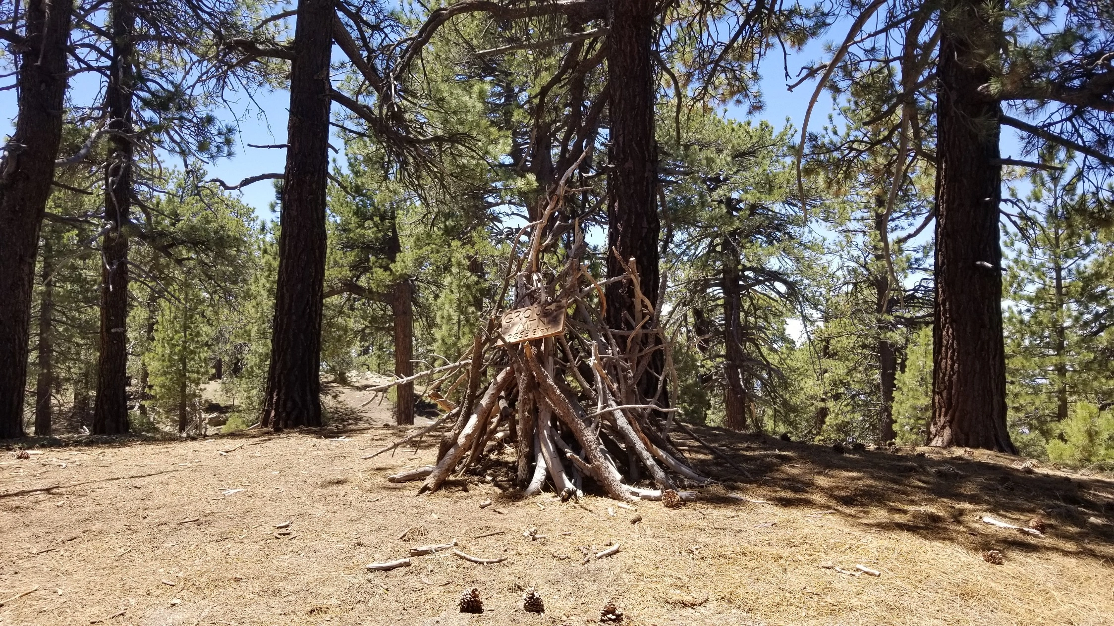
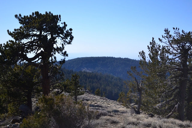
Grouse Mountain, Photo by Valerie Norton.

Peak Name

Grouse Mountain
04G

Elevation

8650

 feet

Status

active

Region

Southern Kern County West Of Hwy 5

Range

San Emigdio Mountains

Location

34.8149782,-119.1831651

Description

Grouse Mountain in the Chumash Wilderness and HPS’s first 100th peak (Weldon Heald; June 30, 1946), offers a hike through pine forest with a sense of solitude and a beautiful south-facing view from the summit. It is usually hiked in conjunction with the other peaks in the Pinos area.

Maps generated from CalTopo.com, reproduced with permission

Route 1
Elevation Gain
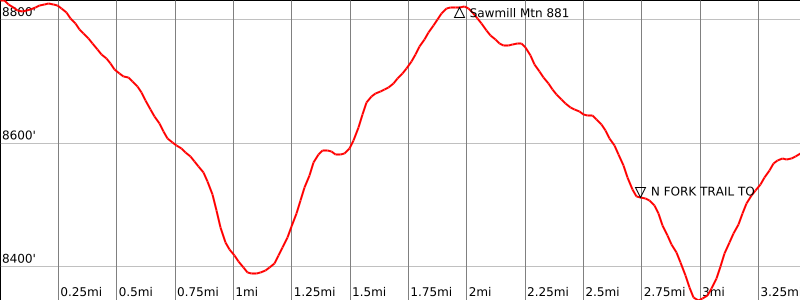
2200 total, 1400′ out plus 800′ on return
Navigation Difficulty
Moderate
Distance
9 1/2 miles round trip on trail and cross-country
Estimated time
4-5 hours round trip
Route Rating
Class 1, moderate
Leader Rating Required
“I”, normal conditions

Driving route

Drive north on I-5 to the Frazier Park exit. Turn left (west). Note your odometer and go as follows:
At 7.2 miles, Lake of the Woods. Here, the Lockwood Valley Road forks left and the Cuddy Valley Road goes straight. Keep straight.
At 5.3 miles, junction with Mount Pinos Road (straight) and the Mil Potrero Road (right). Go straight on the Mount Pinos Road.
At 13.9 miles, a large paved parking area and a road with a gate continuing farther on the left side. If the gate is open, continue 1 1/2 miles farther to the summit of Mount Pinos. If the gate is locked, park here and hike up to the summit of Mount Pinos.

Hiking route

From the summit of Mount Pinos, take the ridge trail 21W03 down into the saddle to the west.
From the saddle, the trail goes up the east side of Sawmill and along the south side of the summit ridge. Where the trail begins to go downhill is the turnoff for Sawmill Mountain.
Continue west on the ridge trail 21W03 to a junction in a shallow saddle 1/4 mile farther, where there is a sign ‘Sheep Camp 1/2’.
Keep to the right and continue to a saddle 1/4 mile farther; then ascend due west to the top of a low ridge, turn left (south) and follow the ridge to the summit, which is the southern bump.

Route Notes

Printable Route

Road Type

None

Google Maps Link to Trailhead 

Route 2
Elevation Gain
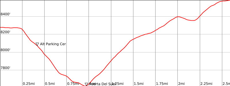
1700′ total, 1000′ out plus 700′ on return
Navigation Difficulty
Easy
Distance
5 miles round trip on trail and cross-country from Cerro Noroeste
Estimated time
2-3 hours round trip
Route Rating
Class 1, moderate
Leader Rating Required
“I”, normal conditions

Driving route

Go north on I-5 to the Frazier Park exit.
Go west 7.2 miles past Frazier Park and on to Lake of the Woods.
Keep straight here and go 5.3 miles farther to the junction with Mil Potrero Road. Turn right. Note odometer and go as follows:
At 8.3 miles, highway junction and a ranger station at Apache Saddle. Turn left.
At 16 miles, a circle road at the campground on the summit. Park at the south end of the circle near a restroom.

Hiking route

From the parking area (8280′), hike back down the road to trail 21W03 on the left side. (It may be possible to park here.)
Take the trail east down to a saddle marked Puerta Del Suelo (7618′) on the topo.
Continue southeast up the ridge to its high point at 8500’+.
Turn south and follow the ridge up to the summit.

Route Notes

Printable Route

Road Type

Paved

Google Maps Link to Trailhead 

Additional Peak Information

Alternate routes: This peak can be climbed from the Three Falls Boy Scout Camp via the Lockwood Valley Trail. Mount Pinos, Sawmill Mountain, Grouse Mountain and Cerro Noroeste (Mt. Abel) are often combined as an out and back trip from either end point. They are also hiked via car shuttle trip from Mount Pinos to Cerro Noroeste or the reverse (25 miles driving between trailheads in each direction).

Grouse Mountain and Sawmill Mountain are in the Chumash Wilderness. Permits are not required.

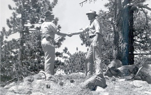
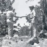
History notes: The First 100th Peak, June 1946. One of the most famous photographs in the Hundred Peaks Section’s archives shows Jack Bascom congratulating Weldon Heald on becoming the first person to ascend one hundred Southern California mountain summits of more than 5000′ elevation. The great event occurred on Grouse Mountain. Of this first 100 Peaks celebration, Jack Bascom recalls: “It was a beautiful June day when Weldon Heald and I hiked to Grouse Mtn. He was excited over the prospects of finishing his 100 Peaks. Although I had been with him in climbing a dozen other peaks on his list, I hadn’t as yet become afflicted with the 100 Peaks ‘bug.’ In 1946 there was no paved road to Mt. Pinos from Cuddy Valley and it was necessary to go on a one-way road from Lockwood Valley. We left the car at the highest point on the road and in less than an hour of cross-country travel reached the top of Mt. Pinos. From there, we followed the present trail over Sawmill to Grouse. We had no champagne (its use in HPS celebrations hadn’t been discovered), and to record my congratulations, Weldon set up his camera for a picture. I remember his enthusiasm and excitement, while my thoughts were, ‘Poor fellow, he must think that someday others will be doing this’. I always enjoyed my trips with Weldon, for besides his fine personality, he was one with many new ideas and he had an abundance of mountain knowledge.”

Nearby Peaks

Backus Peak
Owens Peak
Black Mountain #5
Morris Peak

External Links

mountain 1

Peakbagger.com

Click Here

ranger-tower 1

Nearest ranger station

Click Here

g311

NOAA Forecast

Click Here

worldwide 1

Google Earth

Click Here

Photo Gallery