Peak Name
Elevation
feet
Status
Region
Range
Nearby peaks
Location
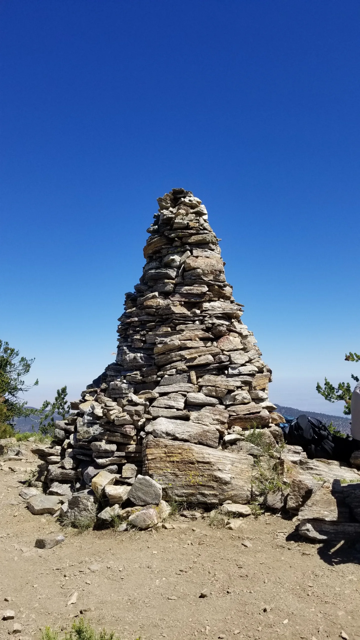
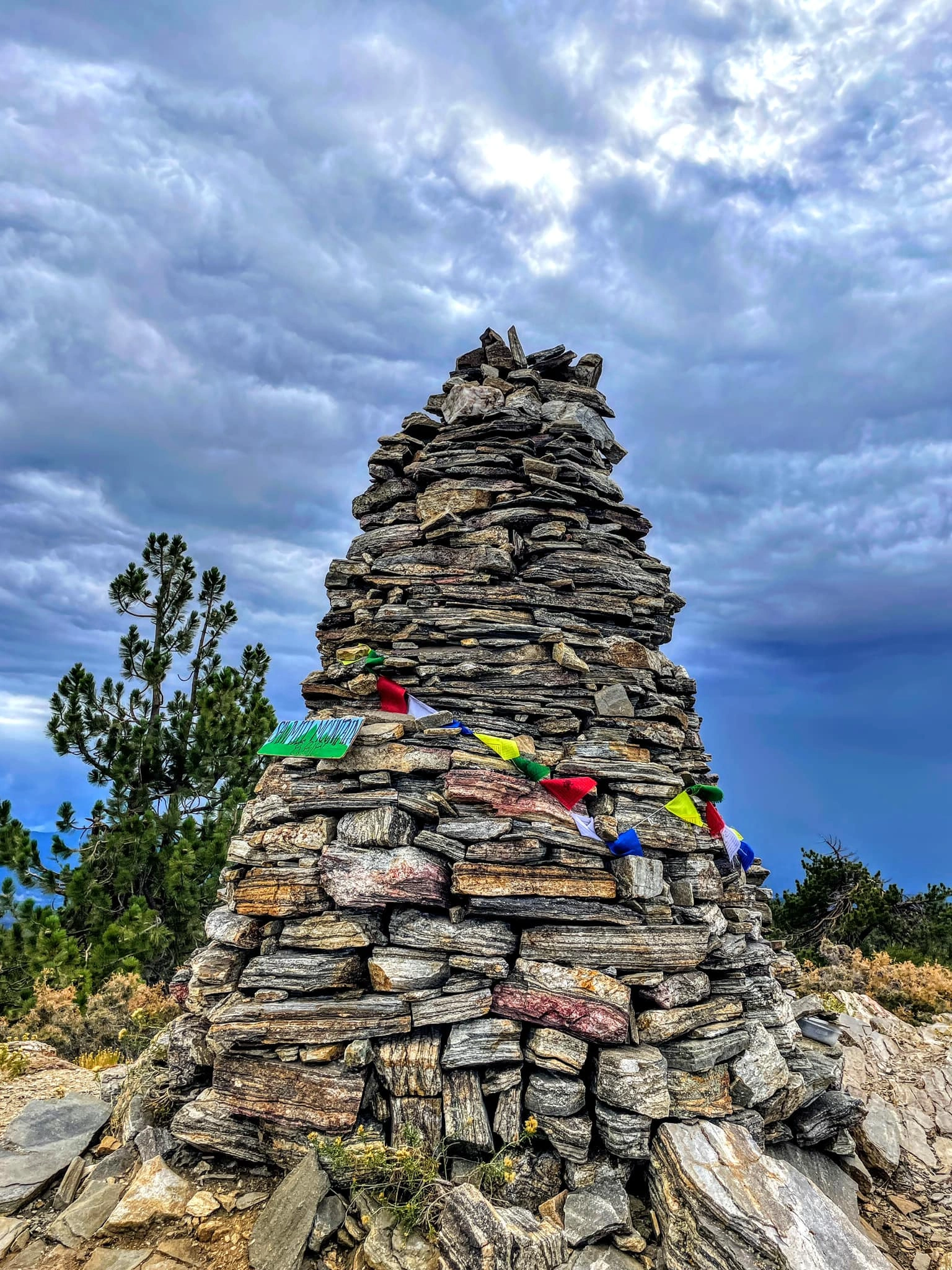
Sawmill Mountain is the high point of the Chumash Wilderness and possible high point of Kern County. It’s summit has an enormous and iconic rock cairn and excellent north-facing views of the San Andreas Fault as it travels northwest towards the Carrizo Plain.
Maps generated from CalTopo.com, reproduced with permission
Driving route
Drive north on I-5 to the Frazier Park exit. Turn left (west). Note your odometer and go as follows:
At 7.2 miles Lockwood Valley Road forks left and the Cuddy Valley Road goes straight. Keep straight.
At 12.4 miles, junction with Mount Pinos Road (straight) and the Mil Potrero Road (right). Go straight on the Mount Pinos Road.
At 22.5 miles, a large paved parking area and a dirt road with a gate on the west (left) side. Park here (8340′).
Hiking route
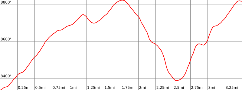
Hike to the summit of Mount Pinos (8831′). Sometimes the gate at the parking lot is open and high clearance vehicles can drive to this summit, saving 1.5 miles each way and 600′ of gain to Sawmill Mountain when done as a round trip.
From the summit of Mount Pinos, walk about 0.2 mile west to the Condor Observation Site at a Chumash Wilderness sign, which marks the beginning of trail 21W03.
Proceed west on this trail. The beginning of this trail takes some puzzling meanders while descending 300′ to the next saddle, but was carefully routed to bypass rare plants found only in the Mt Pinos Summit Botanical Area.
From the saddle (8560+), continue west toward Sawmill on the trail, which ascends steeply at first and then traverses rolling slopes on the summit plateau just south of the peak.
At the point where the trail starts definitely downhill, leave the trail to the right (north) and follow the ridge west to the summit. There is a very large rock pile on the summit that contains the register.
Driving route
Drive north on I-5 to the Frazier Park exit. Turn left (west). Note your odometer and go as follows:
At 7.2 miles the Lockwood Valley Road forks left and the Cuddy Valley Road goes straight. Turn left.
At 18.2 miles, junction with Boy Scout Camp Road. Turn right.
At 21 miles, a locked gate at the Three Falls Boy Scout Camp, with a sign that gives mileages (1 mile too short) to Sheep Camp and the junction with trail 21W03. Park here.
Hiking route
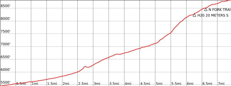
From the gate (5500′), hike up the road past the Boy Scout camp.
Where the pavement ends, continue straight ahead past more trail signs on the main trail. Continue on this trail for about 7 miles to the signed junction with trail 21W03 on the western slopes of Sawmill Mountain.
Turn right (east) on trail 21W03, ascending 250′ to rolling slopes on the summit plateau just south of the peak.
Leave the trail to the left (north) and follow the ridge to the summit.
Route Notes
Additional Peak Information
Alternate route: Mount Pinos, Sawmill Mountain, Grouse Mountain, and Cerro Noroeste (Mt. Abel) are often combined as a car shuttle trip (25 miles driving between trailheads in each direction). By reversing the climbing instructions, these peaks can be done from west to east.
Notes: The peak is the high point of Kern County. It is located in the Chumash Wilderness, but no permits are required at this time.


You must be logged in to upload images.