Peak Name
Elevation
feet
Status
Region
Range
Nearby peaks
Location
The name Mount Minerva Hoyt was given to this peak in 2013 and it was added to the HPS list in 2014. It honors an extraordinary woman whose love of desert plants led her to travel the country giving huge exhibits of desert plants and to advocate for desert preservation. Her efforts led directly to the formation of Joshua Tree National Monument as well as for protections for the Anza Borrego and Death Valley areas.
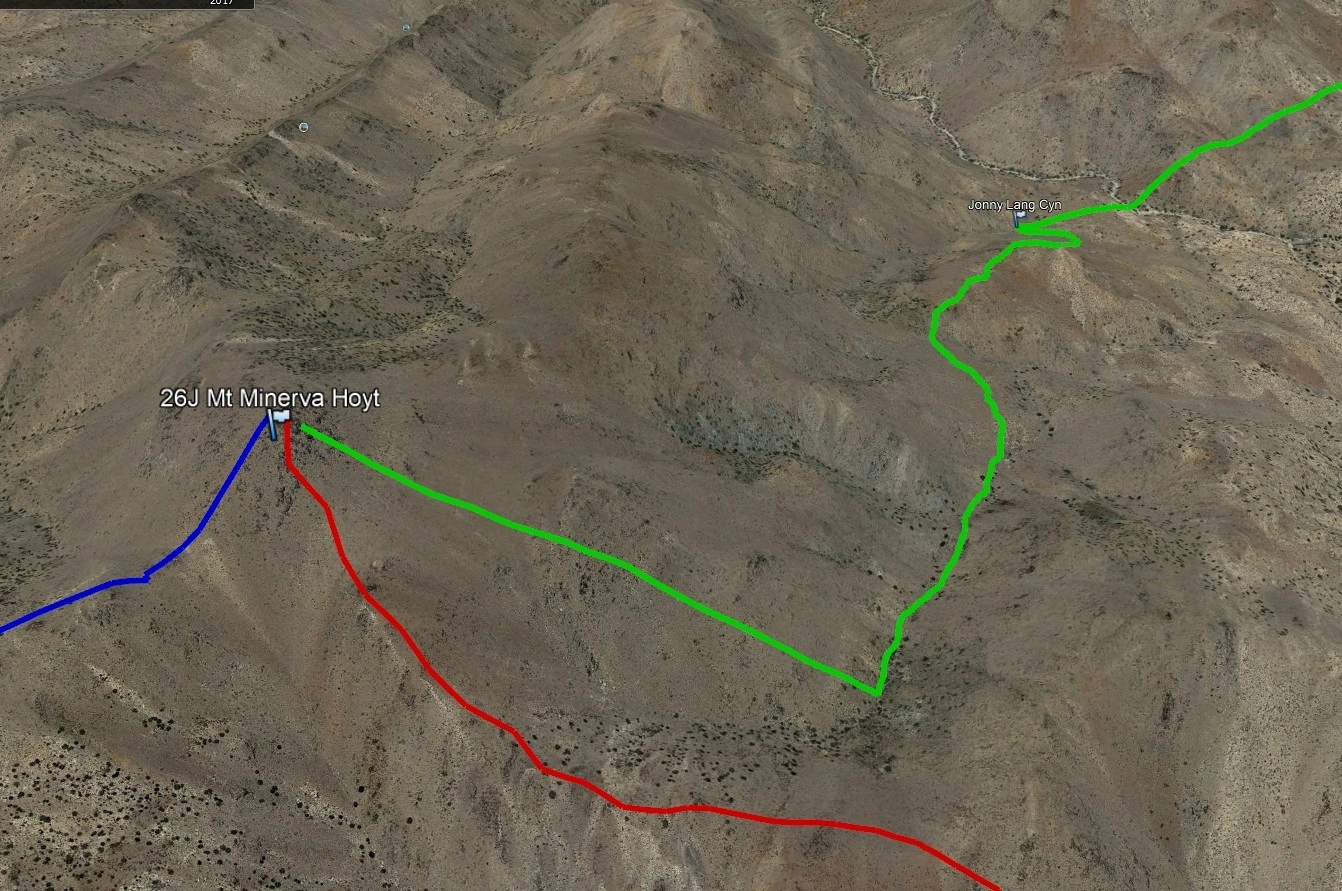
With its proximity to Quail Mountain, Minerva Hoyt can be added on to a hike to Quail by any route. HPS Route 1 follows Quail Route 4 from the east, departing toward the peak once it is in view. Route 2 starts from the northeast from the Quail Springs picnic area and is nearly identical to Quail Route 2.
Depending on which route you chose, consider a visit to the ruins of the historic Lang Mine or to Samuelson’s Rocks, where you can read the philosophical musings of the colorful depression-era homesteader John Samuelson.
Maps generated from CalTopo.com, reproduced with permission
Driving route
Take I-10 east past Banning to the intersection with SR 62.
Go north on SR 62 to Park Road in the town of Joshua Tree with a sign “Joshua Tree National Park”. Set odometer and turn right.
Drive 14.2 miles to the intersection with the Hidden Valley Campground road entrance.
Reset odometer and keep straight on the Loop Road.
Drive another 1.1 miles to a turnout on the right (west side of the road). Park here.
Hiking route
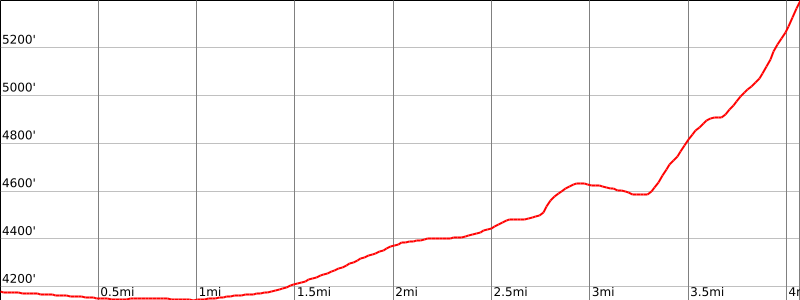
From the parking area (4200′), hike west about 3 miles (aiming for a gully that is just south of bump 4859′).
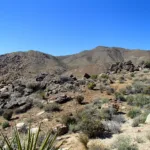
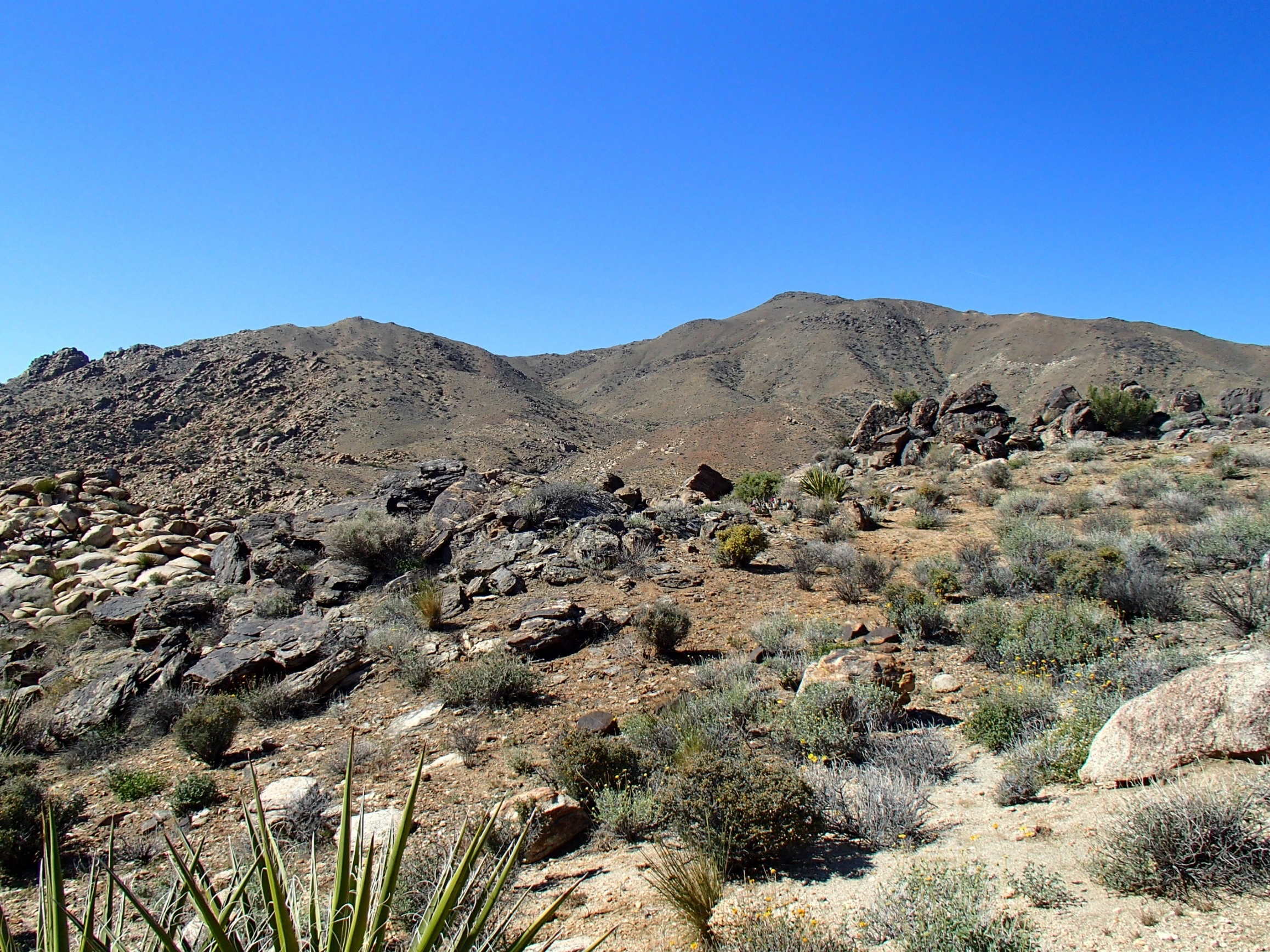
Go up his gully to a flat area about 4620′. From here, to the northwest, one can see the black-spotted summit of Minerva Hoyt and the ridge leading to the top.
Turn right (north), go about ¼ mile staying mostly in the wash.
Leave the gully before the gully makes a sharp S-turn to the right (east).
Head northwest, climbing over a low fold and then onto the ridge that bears mostly northwest.
Follow this ridge all the way to the black-spotted summit.
National Park Service entrance fee is required.
Driving route
Take I-10 east past Banning to the intersection with SR 62.
Go north on SR 62 to Park Road in the town of Joshua Tree with a sign “Joshua Tree National Park”. Turn right.
Drive 10.9 miles on this road to the Quail Springs Picnic Area on the right. Park here.
Hiking route
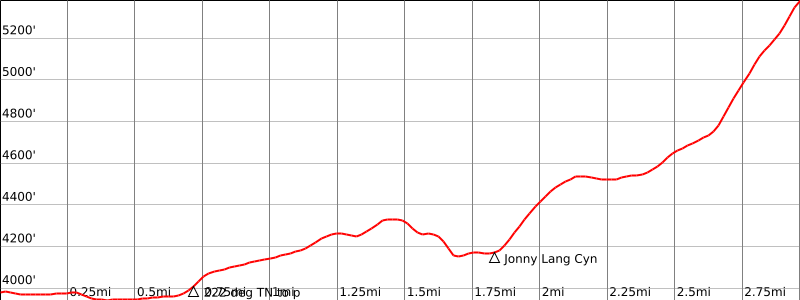
From the parking area (3979′), hike across the desert floor to a prominent wash directly southwest.
Ascend the wash. At its head, turn south for 0.5 mile to reach a broad saddle at 4240’+.
Descend southwest from the saddle into Johnny Lang Canyon, reaching the canyon bottom at about 4150′.
From here, leave the canyon and hike south up the slope passing bump 5041′ on its west side.
Continue down into saddle 4900′ (UTM 720635).
Go west up the ridge, staying to the right of the rock outcroppings.
Contour left to the saddle south of bump 5405′ (Mount Minerva Hoyt).
From here, turn right (north) and hike 100 yards to the summit.
Route Notes
National Park Service entrance fee is required.
Additional Peak Information
Notes: Mount Minerva Hoyt can be combined with Quail Mountain which is 1 mile to the southwest and accessible from Minerva Hoyt’s summit via a good use trail.


You must be logged in to upload images.