Quail Mountain

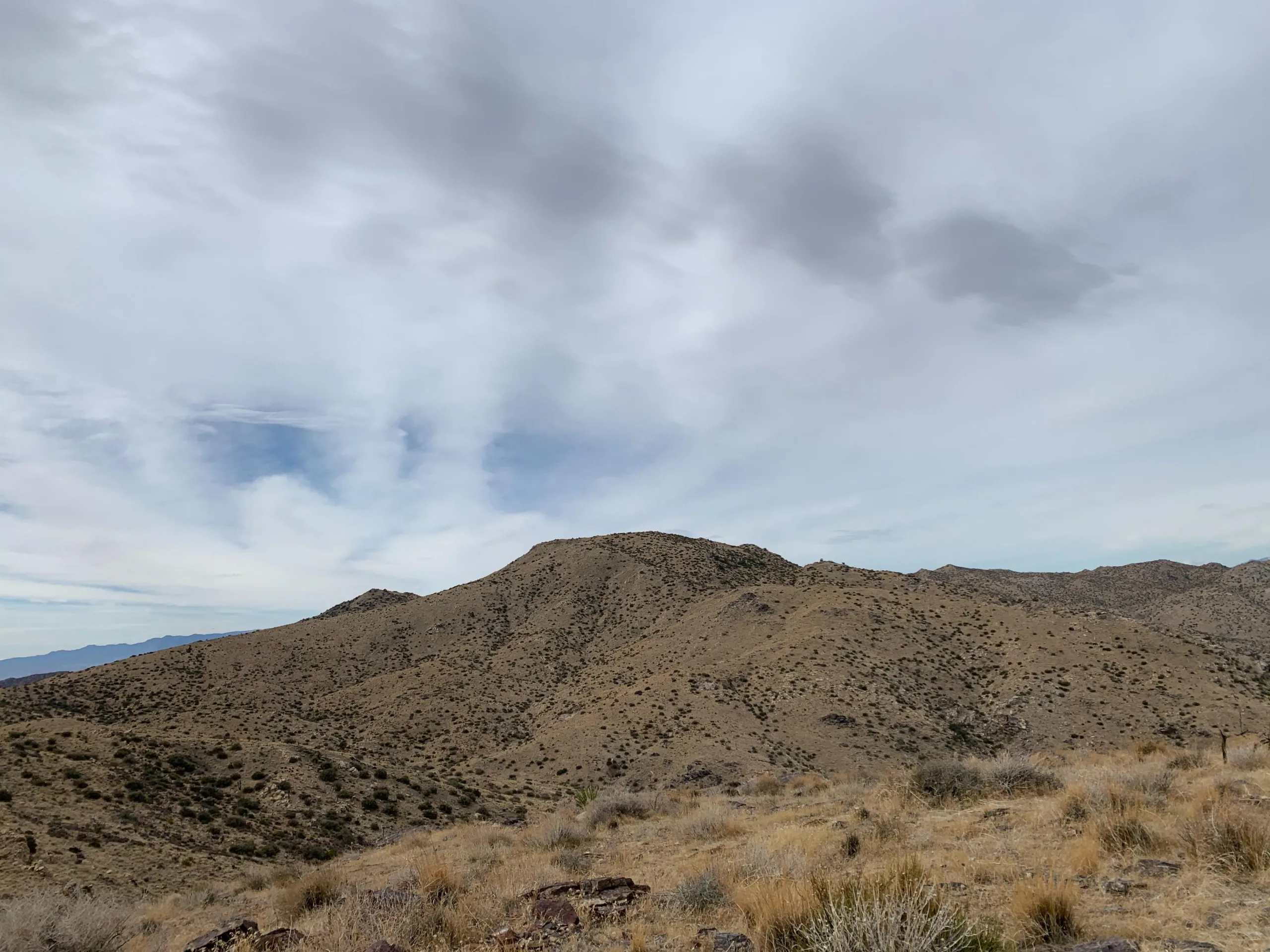
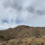
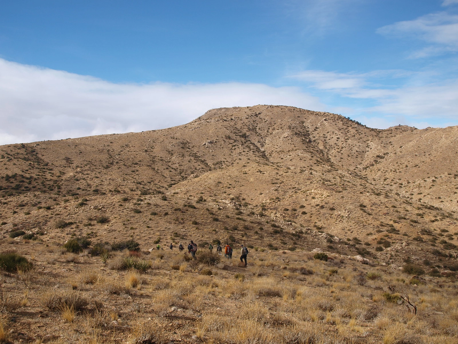
Quail Mountain, taken from Route #2, Photo by Kathy Wing.

Peak Name

Quail Mountain
26B

Elevation

5800

 feet

Status

active

Region

Little San Bernardino Mountains

Range

Joshua Tree Ranges

Nearby peaks

Location

34.007231,-116.2413963

Description

Named for the Desert Quail which can be found there, Quail Mountain is a perennial favorite of Joshua Tree and HPS hikers and backpackers. The highest point in the park, it has lovely 360 degree views. It is commonly hiked in combination with Mount Minerva Hoyt, its smaller sibling and more recent HPS addition to the northeast.

Quail can be hiked from almost any direction. Route 1 starts from Park Boulevard at Juniper Flats in the east and follows the California Hiking and Riding Trail to ascend the southeast ridge with other routes. Route 2 starts from the northeast from the Quail Springs picnic area. Route 3 starts from Yucca Valley by driving to Covington Flat and following a sandy wash to gain southwest ridges to the peak. Route 4 heads due west from the road to climb the southeast ridge. Route 2 and 3 have somewhat difficult navigation.

Depending on which route you chose, consider a visit to the ruins of the historic Lang Mine or to Samuelson’s Rocks, where you can read the philosophical musings of the colorful depression-era homesteader John Samuelson.

Maps generated from CalTopo.com, reproduced with permission

Route 1
Elevation Gain
1500′
Navigation Difficulty
Moderate
Distance
14 miles round trip cross-country
Estimated time
7 hours round trip
Route Rating
Class 1, moderate
Leader Rating Required
“I”, normal conditions

Driving route

Take I-10 east past Banning to the intersection with SR 62.
Go north on SR 62 to Park Boulevard in the town of Joshua Tree with a sign “Joshua Tree National Park”. Turn right.
Drive 16 miles on this road to the intersection with the Keys View Road. Turn right.
Continue 1.1 miles farther to a gated dirt road on the right. Park here.

Hiking route

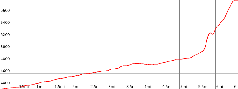
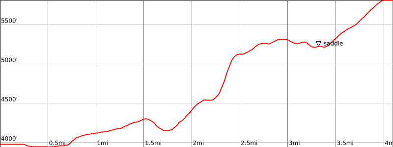
From the parking area (4342′), hike west on the sandy road 5.5 miles. It eventually turns north. Hike to its end at a turn-around southeast of the peak.
Hike northwest to the second gully.
Then ascend the ridge on your right (east) about 1.5 miles to the peak. The summit is at the north end of the ridge near the bench mark.

Route Notes

National Park Service entrance fee is required.

Printable Route

Road Type

Paved

Google Maps Link to Trailhead 

Route 2- From Quail Springs
Elevation Gain
3000′ total, 2400′ out plus 600′ on return
Navigation Difficulty
Difficult
Distance
12 miles round trip cross-country
Estimated time
7-9 hours round trip
Route Rating
Class 1, strenuous
Leader Rating Required
“I”, normal conditions

Driving route

Take I-10 east past Banning to the intersection with SR 62.
Go north on SR 62 to Park Boulevard in the town of Joshua Tree with a sign “Joshua Tree National Park”. Turn right.
Drive 10.9 miles on this road to the Quail Springs Picnic Area on the right. Park here.

Hiking route

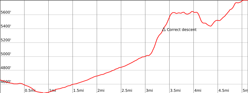
From the parking area (3979′), hike across the desert floor to a prominent wash directly southwest.
Ascend the wash. At its head, turn south for 0.5 mile to reach a broad saddle at 4240’+.
Descend southwest from the saddle into Johnny Lang Canyon, reaching the canyon bottom at about 4150′.
From here, leave the canyon and hike south up the slope passing bump 5041′ on its west side.
Continue down into saddle 4900′ (UTM 720635).
Go west up the ridge, staying to the right of the rock outcroppings.
Contour left to the saddle south of bump 5405′.
Then hike southwest along the right side of the ridge to saddle 5160’+ due east of the peak.
Continue southwest until you intersect the ridge coming east-southeast down from the summit.
Climb this ridge to the peak. The summit is at the north end of the ridge near the bench mark.

Route Notes

National Park Service entrance fee is required.

Printable Route

Road Type

Paved

Google Maps Link to Trailhead 

Route 3- From Lower Covington Flat
Elevation Gain
1750′ total, 1350′ out plus 400′ on return
Navigation Difficulty
Moderate
Distance
10 miles round trip on trail and cross-country
Estimated time
6-7 hours round trip
Route Rating
Class 1, moderate
Leader Rating Required
“I”, normal conditions

Driving route

Take I-10 east through Banning to SR 62.
Go north on SR 62 to SR 247 (Old Woman Springs Road) in Yucca Valley.
Continue about 2.8 miles east on SR 62 to La Contenta Road (traffic signal). Turn right (south) onto La Contenta Road. Note odometer and go as follows:
Drive south on La Contenta Road (pavement ends at 1.0 mile) to a junction at 2.8 miles. Make a half left turn.
Continue on La Contenta Road to Joshua Tree National Park boundary at 4.5 miles. There is a road junction to the left near the boundary. Disregard junction and continue straight.
Road junction at 5.8 miles. Go to the right. The road straight ahead goes to Nolina Cove.
Road junction at 8.8 miles. Continue straight. The road to the right goes to Upper Covington Flat.
Road ends at 9.4 miles. Park here in Lower Covington Flat.
Contact the National Park Service at (760) 367-5525 for road conditions.

Hiking route

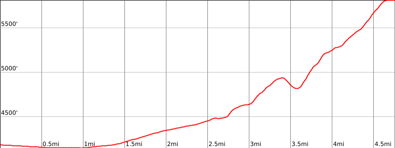
From the parking area (4600′), head east on the California Riding and Hiking Trail for about 3.0 miles, until you reach the small gullies draining to the southwest. This is right before the trail makes a sharp turn to the south.
At the second gully crossing (5000′), leave the trail and hike up the nose of the ridge in a generally east-southeast direction to the top of the ridge (5640′). Be sure to note your location as this ridge is hard to see on the return.
Continue on the ridgeline in an easterly and then northeasterly direction, crossing over several bumps.
Contour around bump 5787′ on the left and into the saddle southwest of the summit of Quail Mountain.
Continue to the northeast up the slope to the summit of Quail Mountain.

Route Notes

Note: Contact the National Park Service at (760) 367-5525 for road conditions. National Park Service entrance fee is required.

Printable Route

Road Type

Dirt

Google Maps Link to Trailhead 

Route 4
Elevation Gain
1800′
Navigation Difficulty
Moderate
Distance
10 miles round trip
Estimated time
5-6 hours round trip
Route Rating
Moderate
Leader Rating Required
“I”, normal conditions

Driving route

Take I-10 east past Banning to the intersection with SR 62.
Go north on SR 62 to Park Boulevard in the town of Joshua Tree with a sign “Joshua Tree National Park”. Turn right.
Drive 10.9 miles on this road to the Quail Springs Picnic Area on the right. Continue straight.
Drive about 3 miles to Hidden Valley Campground.
Continue another 0.9 mile. Park in the nearest legal pullout. Limited parking.

Hiking route

Hike west about 2.75 miles aiming for the gully just south of bump 4859′.
Go up this gully and down on the other side to a flat area.
Cross this flat area going generally west over a low lying ridge and down into a large gully. The low lying ridge is about 1/3 mile south of bump 5215′.
You will see a ridge in front of you that runs generally northwest. Hike up this ridge to Quail.
Note: Make sure you note where your car is for your return trip.

Route Notes

National Park Service entrance fee.

Printable Route

Road Type

Paved

Google Maps Link to Trailhead 

Additional Peak Information

Alternate routes: Another route, long and easier to follow but not so challenging, is from the backcountry board on Key’s View Road. Hike the California Riding and Hiking trail to Juniper Flats, then hike cross-country northwest up a convenient gully or ridge to the summit.

Note: Quail Mountain is the high point of Joshua Tree National Park.

Nearby Peaks

Backus Peak
Owens Peak
Black Mountain #5
Morris Peak

External Links

mountain 1

Peakbagger.com

Click Here

ranger-tower 1

Nearest ranger station

Click Here

g311

NOAA Forecast

Click Here

worldwide 1

Google Earth

Click Here

Photo Gallery