Meeks Mountain and its neighbor Bighorn Mountains lie in the Bighorn Mountains Wilderness, a wild and remote area where the mountains of the San Bernardino National Forest give way to the desert and Joshua Tree National Park. Shouldered by the grand San Bernardino Mountains on one side, and the vast high desert on the other, this was once the realm of large bands of mountain sheep and home to one S.H.Meek, a locally famous 1880s desperado. The sense of remoteness and isolation on all these routes is refreshing. It is commonly paired with Bighorn Mountains Route 1, a short drive further up the same road.
Route 1 starts after a rough dirt road drive from Landers in the east and follows a remnant of old road, then use trail, to the peak. Use only that route, all other possible routes pass through private property.
Maps generated from CalTopo.com, reproduced with permission
Take I-10 east through Banning to SR 62.
Go north and east on SR 62 to SR 247 in Yucca Valley. Go left (north).
Drive 11.5 miles to the New Dixie Mine Road. Turn left. Note your odometer and go as follows:
At 8.0 miles, fork. Go either way as the roads rejoin after 1/4 mile.
At 8.6 miles, fork. Go straight.
At 9.2 miles, fork. Park here.
Hiking route
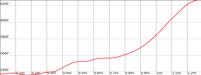
From the parking area (5320′), hike southwest up the road about 500′ to a fork.
Go right at this fork and hike about 1/2 mile, going through a junction to the end of the road at a burned out cabin site.
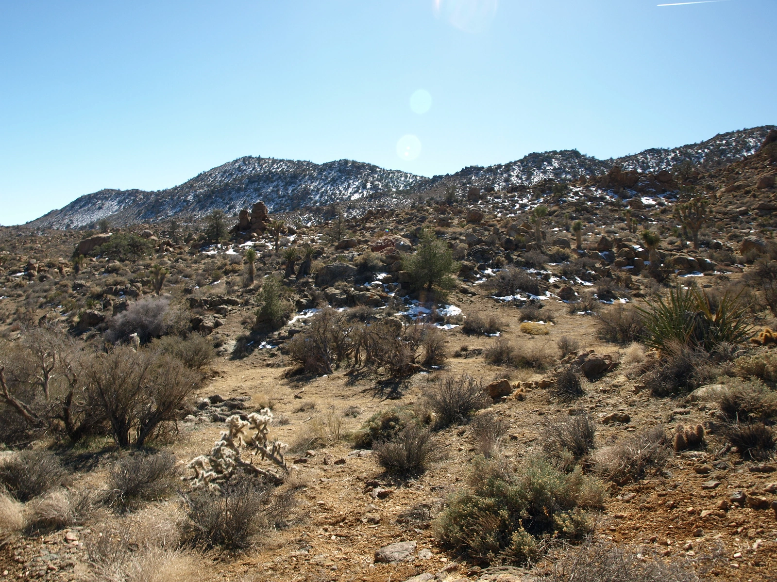
Continue up the jeep road southwest towards the peak. The peak is in view as a rounded summit with a smaller one to its left (south).
Leave the road wherever convenient and hike directly up to the summit.
Note: Meeks Mountain and the land surrounding it is private property and the owners request that their privacy be respected by using only the existing published route coming in from the North side and to please not enter or exit from the South, West, or East sides.