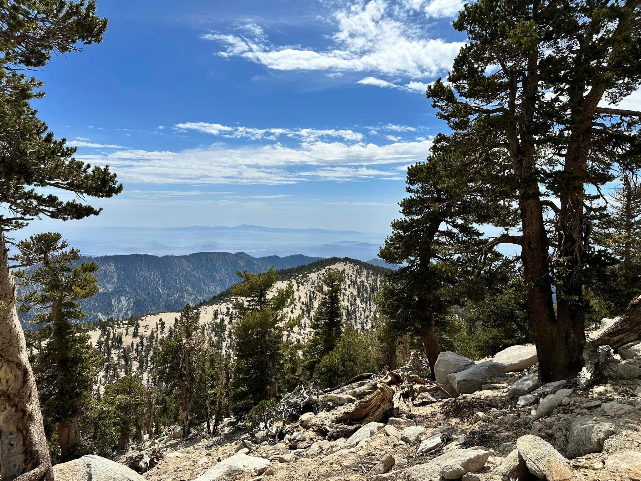
Dobbs Peak, photo by Sunny Yi
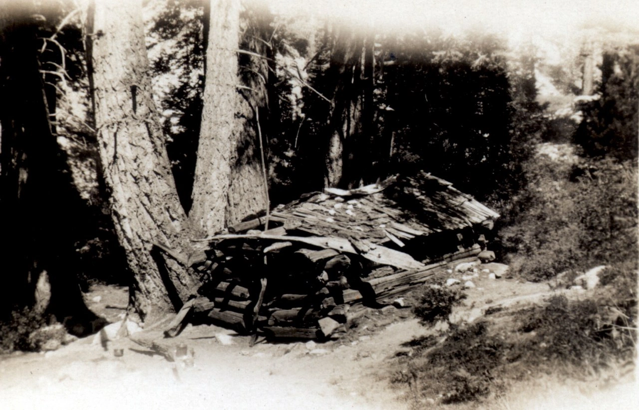
Dobbs Cabin in 1930, by Glen Dawson, photo by Angeles Chapter Sierra Club Archives
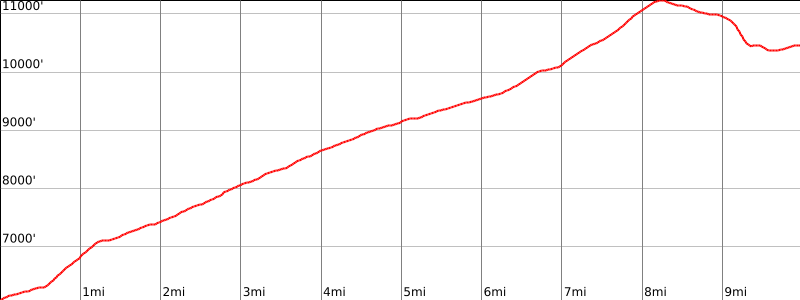

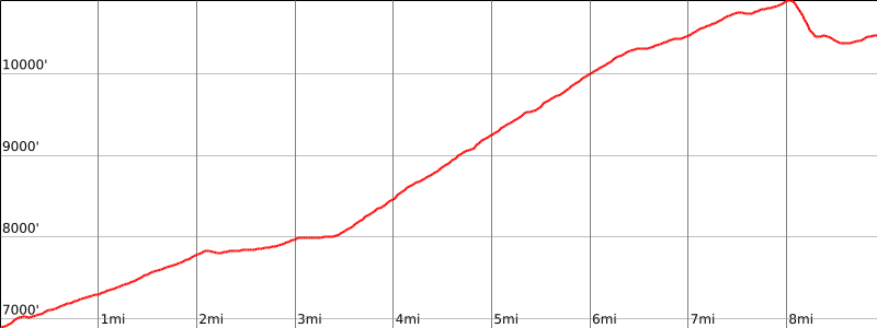
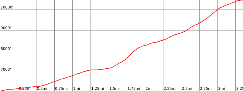

Peakbagger.com

Nearest ranger station

NOAA Forecast

Google Earth


