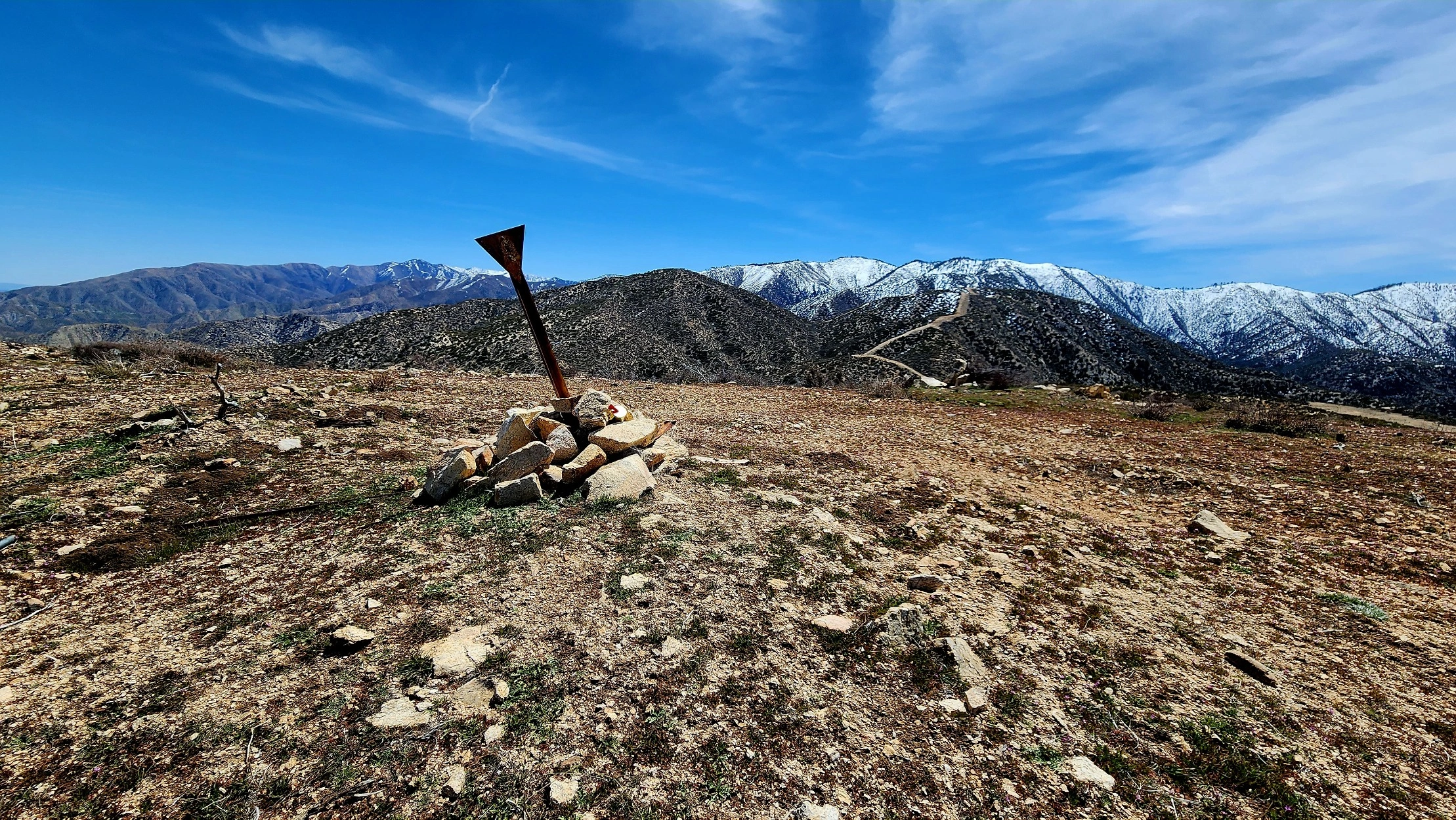
Cole Point

Cole Point, Photo by Tao Zhang.

Peak Name

Cole Point
10J

Elevation

5604

 feet

Status

active

Region

Pacifico Mountain Area

Range

San Gabriel Mountains

Nearby peaks

Location

34.421672,-118.072064

Description

Cole Point resides in the transition where the San Gabriel Mountains give way to the high desert. You will enjoy expansive views of the desert to the north and the surrounding mountains, including those of the beautiful Angeles National Forest.

Route 1 traverses the northwest ridge cross country then on firebreak over a series of bumps. Route 3 starts on old road then takes the west ridge to the peak. Cole can also be hiked from Mill Creek Summit on trail and firebreak, or from Mount Emma on ridges.

Maps generated from CalTopo.com, reproduced with permission

Route 1- Northwest ridge
Elevation Gain
1700′
Navigation Difficulty
Moderate
Distance
4 miles round trip on steep use-trail along open ridges in scrub brush
Estimated time
3 hours round trip
Route Rating
Class 1, easy
Leader Rating Required
“I”, normal conditions

Driving route

From I-210 in La Cañada drive north on Angeles Crest Highway 9.5 miles to Angeles Forest Highway. Turn left (north).
Go 14.2 miles to Mill Creek Summit.
Continue on Angeles Forest Highway about 4.3 miles to where the road crosses a low saddle and the highway begins to curve into a long, straight northwest run. Park at the large parking area on the right (east) side of the road.
Alternate: The parking area can also be reached by exiting the 14 Freeway at Angeles Forest Highway, then heading south 5 miles to the curve at the end of the long straightaway.

Hiking route

From the parking area (4100′), cross the embankment to the east and follow tracks into the canyon, meeting and following a use-trail that heads upstream.
At some convenient spot, leave the canyon and carefully ascend the steep slope on the north to gain the main ridgeline. Proceed along this ridge southeast and south as it goes steeply over bumps 4720′ and 5000′ to the summit.
Follow the trail to the top of the ridge, then turn right (south) and follow the ridge up to a firebreak, down into a saddle (4640’+) and up a steep slope to 5000’+, then south along the ridge to the summit.

Route Notes

Printable Route

Road Type

Paved

Google Maps Link to Trailhead 

Route 3- West Ridge Direct
Elevation Gain
1500′
Navigation Difficulty
Moderate
Distance
2.6 miles round trip, steep cross-country on open ridge in easy scrub brush
Estimated time
2 hours round trip
Route Rating
Class 1, easy
Leader Rating Required
“I”, normal conditions

Driving route

From the intersection of I-210 and Angeles Crest Highway (SR 2), drive north on Angeles Crest Highway 9.5 miles to Angeles Forest Highway (N3). Turn left (north).
Go 14.2 miles to Mill Creek Summit.
Continue another 3 miles on Angeles Forest Highway, passing the junction with paved Aliso Canyon Road that comes in from the left (west). Continue straight.
About 200 yards from the junction park near Mileage Marker 7.10.

Hiking route

From the parking area (4100′), follow the power line service road that wraps around the north side of the hill to a saddle on the east side at 4320′.
From the saddle turn east and follow the steep ridgeline generally eastward directly to the summit.

Route Notes

Printable Route

Road Type

Paved

Google Maps Link to Trailhead 

Additional Peak Information

Other routes: A former Route 2 that followed the ridgeline from the north/northeast has been withdrawn due to a private shooting range and permanent road closure.

Nearby Peaks

Backus Peak
Owens Peak
Black Mountain #5
Morris Peak

External Links

mountain 1

Peakbagger.com

Click Here

ranger-tower 1

Nearest ranger station

Click Here

g311

NOAA Forecast

Click Here

worldwide 1

Google Earth

Click Here

Photo Gallery