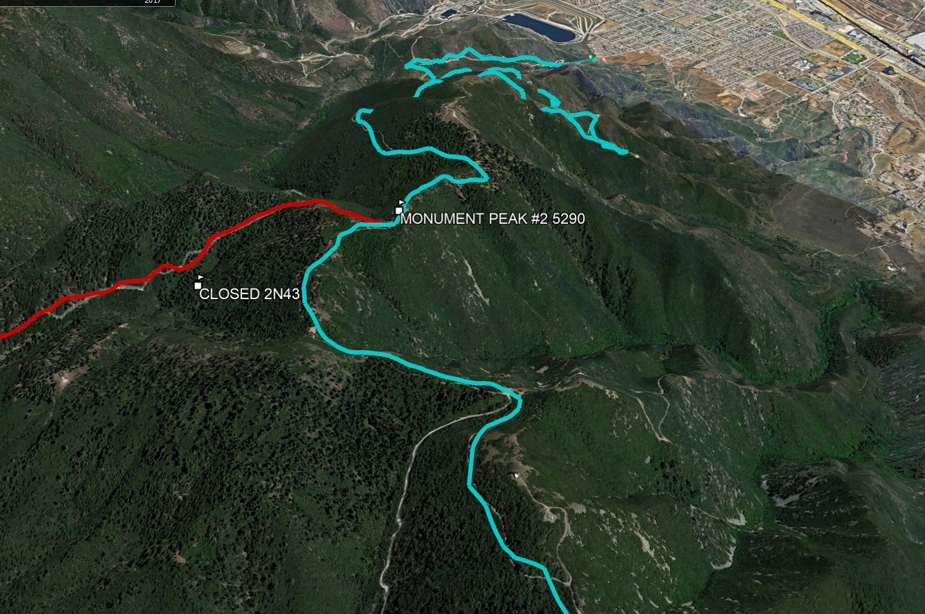
Monument Peak #2, photo by Google Earth
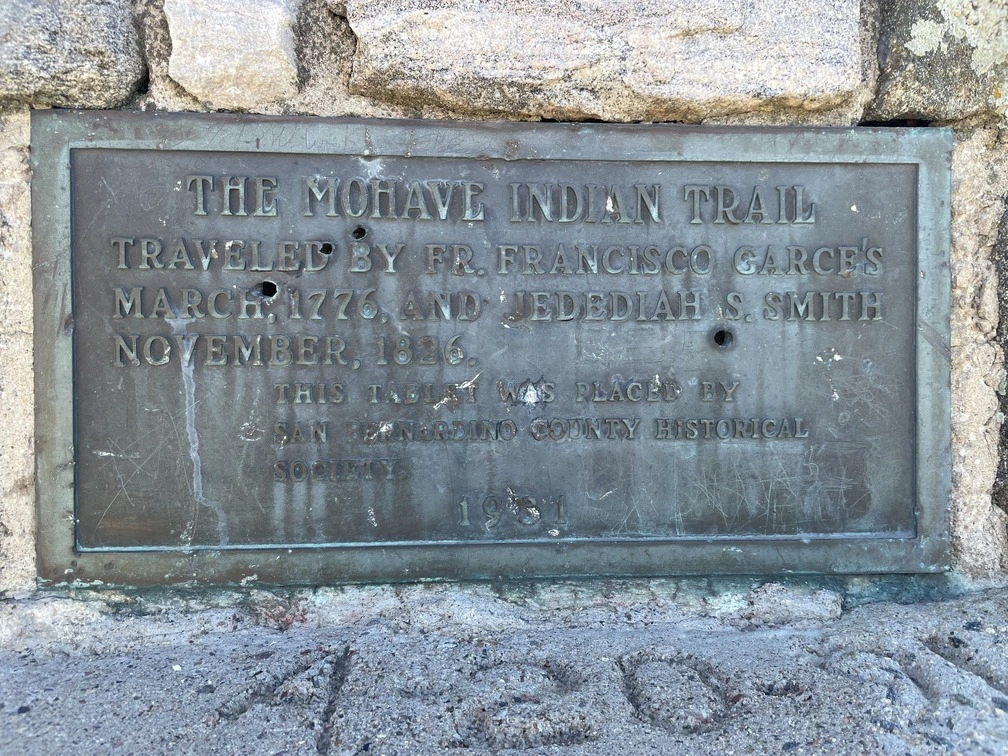
Plaque on the summit of Monument #2 recognizing the Anza Expedition and indigenous trade routes, photo by Jim Hagar


Peakbagger.com

Nearest ranger station

NOAA Forecast

Google Earth


