Tahquitz Peak (Lookout)

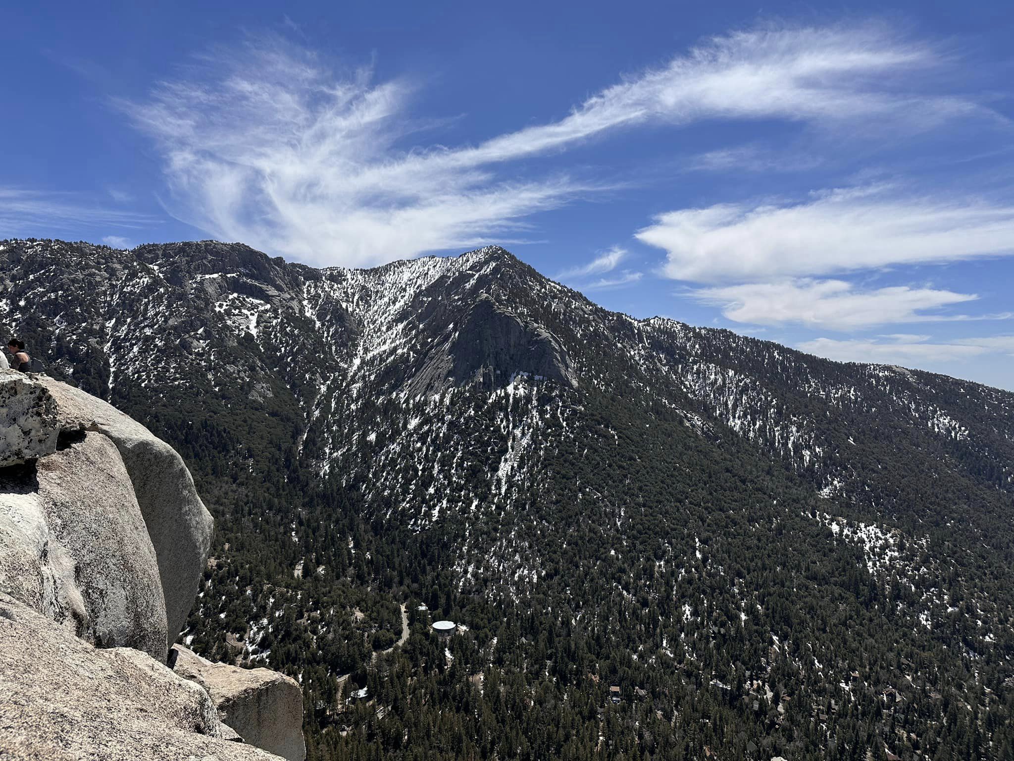
Tahquitz Peak with Lily Rock, Photo by Sunny Yi.

Peak Name

Tahquitz Peak (Lookout)
28B

Elevation

8846

 feet

Status

active

Region

Desert Divide

Range

San Jacinto Mountains

Nearby peaks

Location

33.7552984,-116.6769621

Description

Tahquitz Peak is named for the Cahuilla Indian demon that is said to reside in the area, described at length in the summit history. It has had various spellings and is pronounced different ways by different people, apparently depending on whether you are a climber, a local, or a tourist. It has unique views of the Desert Divide stretching southward beneath it, as well as the San Jacinto area to the north and the town of Idyllwild below.

There has been a fire lookout on its summit since 1937 and remains one of six active fire lookouts operated and staffed by the Southern California Mountains Foundation during fire season. It is open to the public when staffed.

Route 1 starts from the upper parking area of Humber Park and follows the Devil’s Slide Trail, then follows the PCT south from Saddle Junction until reaching the side trail that leads to the lookout. Route 2 follows the South Ridge Trail from the town of Idyllwild.

Maps generated from CalTopo.com, reproduced with permission

Route 1- From Humber Park
Elevation Gain
2200′
Navigation Difficulty
Easy
Distance
9 miles round trip on trail
Estimated time
4-5 hours round trip
Route Rating
Class 1, moderate
Leader Rating Required
“O”, normal conditions

Driving route

Drive I-10 to Banning. Exit at 8th Street (SR 243). Note your odometer and go as follows:
At 0.2 mile, turn left.
At 0.7 mile, turn right on San Gorgonio Avenue.
At 1.4 miles, keep left on SR 243.
At 25.0 miles, Idyllwild Ranger Station (San Bernardino National Forest) on the left. Turn left on Pine Crest Avenue. Note your odometer and go as follows:
At 0.6 mile, intersection. Make a half right on South Circle Drive.
At 0.7 mile, Fern Valley Drive on the left with a sign “Humber Park”. Turn left.
At 1.2 miles, fork. Keep left.
At 2.2 miles, trailhead on the left. This is the climber’s trail for Suicide Rock. Keep straight.
At. 2.6 miles, Humber Park. Park here.

Hiking route

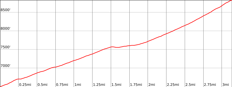
The Devils Slide Trail begins at the upper right corner of the parking lot. From this trailhead (6440′), hike up the trail 2.5 miles to Saddle Junction (8040′). At this point there are four trail choices.
Take the extreme right trail with a sign “Tahquitz Peak”.
Follow this trail up to the summit.

Route Notes

Printable Route

Road Type

Paved

Google Maps Link to Trailhead 

Route 2- South Ridge Trail
Elevation Gain
2400′
Navigation Difficulty
Easy
Distance
6 miles round trip on trail
Estimated time
3-4 hours round trip
Route Rating
Class 1, moderate
Leader Rating Required
O

Driving route

See the driving instructions for Route 1. From the Idyllwild Ranger Station, go south 0.7 mile on SR 243 to Saunders Meadow Road on the left just north of the Idyllwild Elementary School.
Turn left (southwest). Note your odometer and go as follows:
At 0.9 mile, Pine Avenue. Turn left.
At 1.0 mile, Tahquitz View Road. Turn right.
At 1.2 miles, a dirt road with a sign “South Ridge Trail – 2”. Turn right. A high clearance vehicle may be necessary.
At 2.2 miles, fork. Keep left.
Go to the turn-around at the end of the road. Park here. Ample parking.

Hiking route

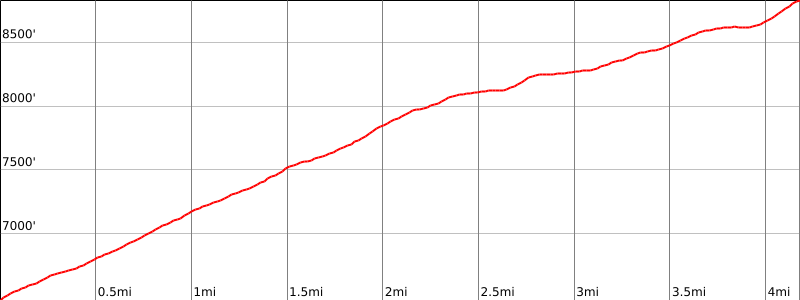
From the parking area (6480′), hike up the South Ridge Trail to where it meets Route 1 just below the summit.
Turn right and hike about 100′ up to the lookout.

Route Notes

Printable Route

Road Type

High-clearance

Google Maps Link to Trailhead 

Additional Peak Information

Special conditions: Wilderness permits are required under all circumstances. Permits are limited to 12 hikers. Permits may be obtained from the Idyllwild Ranger Station just off SR 243 at 54270 Pine Crest Road. There is a self-issue permit stand outside of the ranger station. The weekend quota for the Devil’s Slide Trail is usually filled in advance during the summer months. Permits for the South Ridge Trail are much easier to obtain. Permits may be obtained in advance from:
San Jacinto Ranger District
54270 Pinecrest
P.O. Box 518
Idyllwild, CA 92549
Voice: (909) 382-2921
Fax: (951) 659-2107

Historical notes: Tahquitz Peak is named for a leader of the Soboba Indians, Chief Tahquitz, about whom there are various legends. In one story, after changing from a loved to a hated chief as a result of evil spirits, Tahquitz’ body was destroyed by his tribe, but his spirit escaped to the present Tahquitz Peak. Thunderstorms in the area are evidence of his presence. Legend has it that his spirit still lives there with a rattlesnake and a condor, although the watchful fire lookout cannot corroborate this.
The Lookout is open from 9:00 am to 5:00 pm Memorial Day through early October. To find out if Lookout will be open call, Mr. Doug Wood at 909-659-8553.

Nearby Peaks

Backus Peak
Owens Peak
Black Mountain #5
Morris Peak

External Links

mountain 1

Peakbagger.com

Click Here

ranger-tower 1

Nearest ranger station

Click Here

g311

NOAA Forecast

Click Here

worldwide 1

Google Earth

Click Here

Photo Gallery