Lily Rock

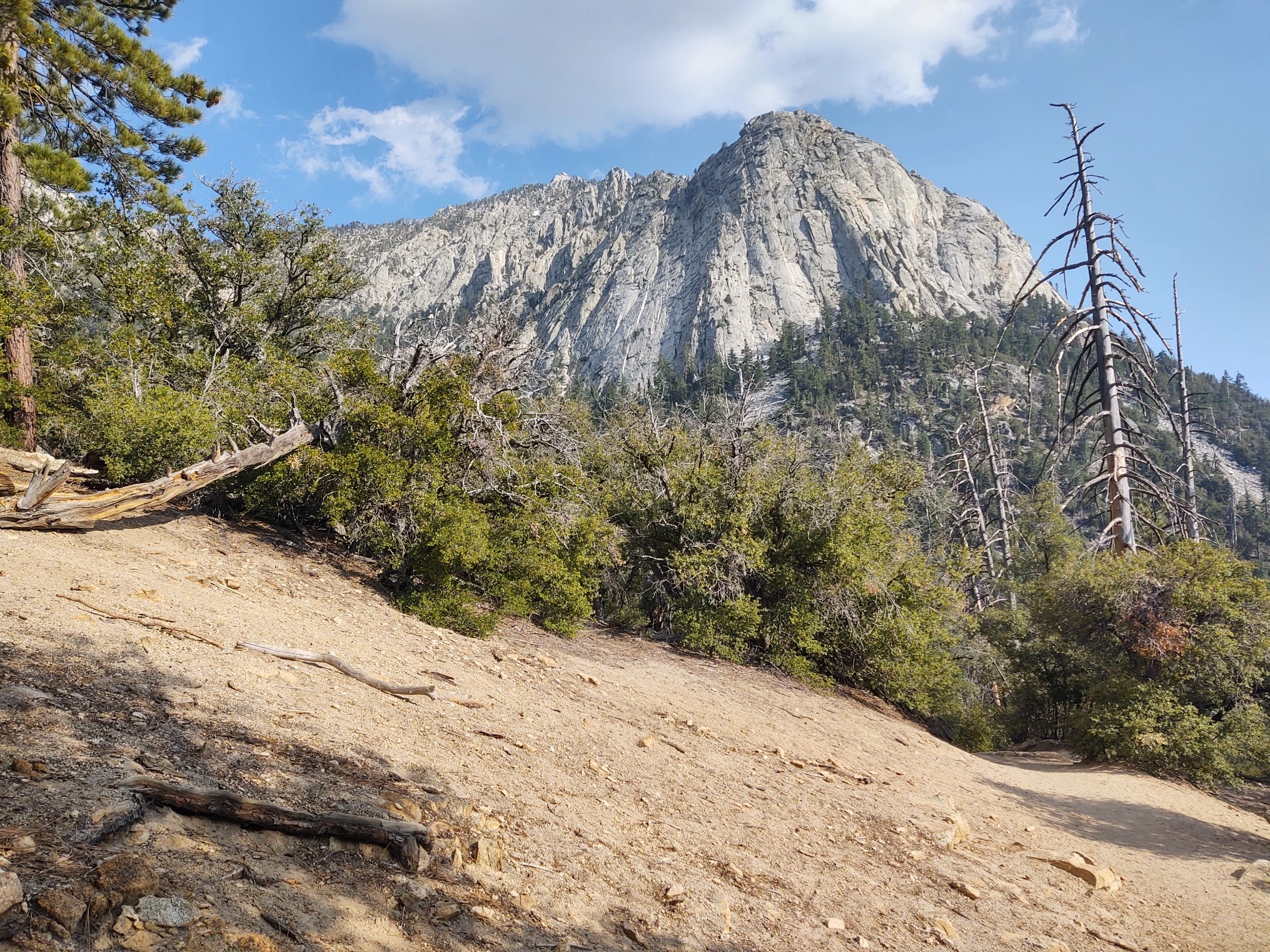
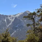
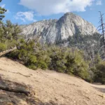
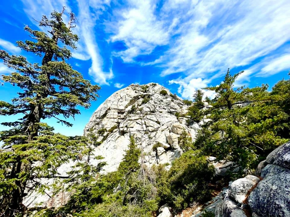
Lily Rock Summit Block, Photo by Sunny Yi.

Peak Name

Lily Rock
28A

Elevation

8000

 feet

Status

active

Region

Desert Divide

Range

San Jacinto Mountains

Location

33.7600204,-116.6830733

Description

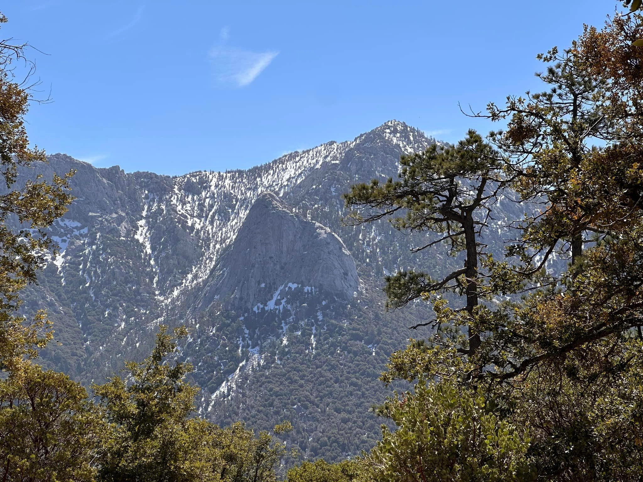
Lily Rock, whether named for its white appearance, a local beauty, or the much admired lemon lilies that are found in the area, is not to be missed. Lily is a dramatic granite outcropping arising from the side of Tahquitz Peak and has been a climber’s mecca since the 1940s (the formation is known to climbers as “Tahquitz”, not the peak). It has a lot to offer hikers too, and the numerous routes (all of which converge on a short third class segment) are all interesting and challenging. A climbing helmet is recommended, and required on official outings, on the third class sections. Permits are not required.

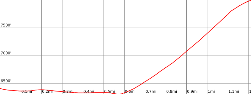
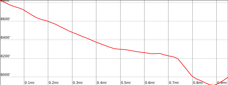
Route 1 starts from lower parking area at Humber Park and follows the Ernie Maxwell Trail 0.6 miles to ascend a steep rocky gully to the peak. Route 2 describes the route to and from Tahquitz Peak. Route 3 starts from the Devil’s Slide trailhead at the upper Humber Park parking area but immediately departs southeast on use trail to ascend the large northwest gully with some boulder hopping and slab climbing to reach the final third class section. Route 4 follows the climbers trail which starts as Route 1 but departs at 0.2 miles up a very steep use trail that goes to the base of the rock and traverses around to join Route 1. The final section involves a third class step around that can be avoided by crawling through a fun “wormhole”.

Maps generated from CalTopo.com, reproduced with permission

Route 1- From Humber Park
Elevation Gain
1600′
Navigation Difficulty
Difficult
Distance
3 miles round trip on trail and cross-country
Estimated time
3-4 hours round trip
Route Rating
Class 3, moderate, climbing helmets required
Leader Rating Required
“M”, normal conditions

Driving route

Drive I-10 to Banning. Exit at 8th Street (SR 243). Note your odometer and go as follows:
At 0.2 mile, turn left.
At 0.7 mile, turn right on San Gorgonio Avenue.
At 1.4 miles, keep left on SR 243.
At 25.0 miles, Idyllwild Ranger Station (San Bernardino National Forest) on the left. Turn left on Pine Crest Avenue. Note your odometer and go as follows:
At 0.6 mile, intersection. Make a half right on South Circle Drive.
At 0.7 mile, Fern Valley Drive on the left with a sign “Humber Park”. Turn left.
At 1.2 miles, fork. Keep left.
At 2.2 miles, trailhead on the left. This is the climber’s trail for Suicide Rock. Keep straight.
At 2.6 miles, Humber Park. Park here.

Hiking route

At the southwest end of Humber Park, a trail starts near a green water tank. Follow it about 3/4 mile to where it crosses a gully.
Go east up this steep gully to the saddle just southeast of Lily Rock.
From here go northwest up easy class 3 rock to the summit.

Route Notes

Printable Route

Road Type

Paved

Google Maps Link to Trailhead 

Route 2- From Tahquitz Lookout
Elevation Gain
100′ gain, 1000′ loss one way
Navigation Difficulty
Difficult
Distance
1 mile one way from Tahquitz Peak (LO)
Estimated time
1 hour one way
Route Rating
Class 3, climbing helmets required
Leader Rating Required
“M”, normal conditions

Driving route

See the driving instructions for Tahquitz Peak.

Hiking route

From the summit of Tahquitz Peak (LO), descend on the trail about 50′ to a trail junction.
Turn left on the South Ridge Trail and follow it down to the tenth switchback.
Leave the trail here and descend west cross-country to about 8250′.
Turn right and follow ducks along the side of the ridge and down to the saddle southeast of Lily Rock. (The route is poorly ducked after the first 100 yards.)
From here go northwest up easy class 3 rock to the summit.

Route Notes

Special conditions: While going along the side of the ridge, be careful to stay on the route and stay below the cliffs. There are many cliffs in the area. The terrain is very steep, and it is easy to get into class 4 rock.

Printable Route

Road Type

None

Google Maps Link to Trailhead 

Route 3- Via North Gully
Elevation Gain
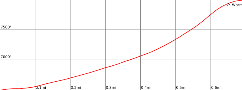
1500′
Navigation Difficulty
Moderate
Distance
2 miles round trip on trail and cross-country
Estimated time
2½-3½ hours round trip
Route Rating
Class 3, moderate, climbing helmets required
Leader Rating Required
“M”, normal conditions

Driving route

See driving instructions for Route One.

Hiking route

If possible, park in the upper corner of Humber Park (elevation 6500′) by the Devils Slide trailhead.
Do not start up the Devils Slide Trail; instead, cross past the wooden barriers and go east following a metal fence.
After about 100′ the fence turns down to the right.
Descend down to the right towards the brook. Turn left at the brook and follow a climber’s trail that is next to the brook on its left side.
After about 250′ cross the brook. Follow the trail that is now next to the brook on its right side for about ¼ miles.
The trail veers away from the brook and continues up a major southeast gully.
At about elevation 7100′, view of a large rectangular boulder angled atop a spire appears. Keep to the right of this spire as the route ascends next to a talus field. Do not follow the talus field on the gully to the left of this spire.
Around 7400′, a vertical climber’s wall (pitons may be visible) is reached; keep this to your left as you continue up the gully following an east to west switchback use-trail.
At about 7600′ a terraced rocky slab begins.
At about 7800′, the Northeast Gully reaches a high saddle.
Turn right (NW) and proceed to the summit.

Route Notes

Note: The ascent up this last segment above the 7800′ saddle includes a step on a bush growing out of a somewhat exposed rocky cliff. Most slender hikers can bypass this step. If one prefers to do so, stop short of the bush and climb down about 10′ veering to the left. There is a small cave on the right. The ceiling of the cave has a narrow 9″ slot. Hikers can continue up (or return) through this Worm Hole to bypass the bush step. The Worm Hole is around 7900′ elevation.

Printable Route

Road Type

Paved

Google Maps Link to Trailhead 

Route 4- Via Climbers Trail
Elevation Gain
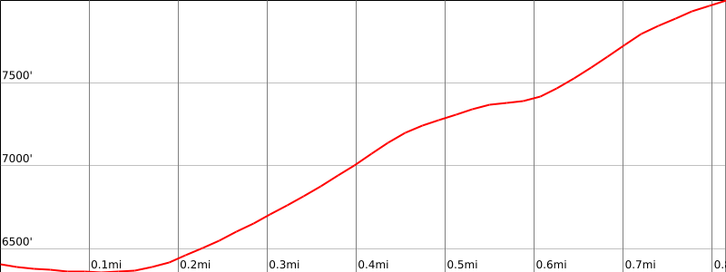
1900′
Navigation Difficulty
Moderate
Distance
2.2 miles round trip on use trail and cross-country
Estimated time
3 hours round trip
Route Rating
Class 3, moderate, climbing helmets required.
Leader Rating Required
“M”, normal conditions

Driving route

See driving instructions for Route One.

Hiking route

From the southwest end of the lower Humber Park lot, take the signed Ernie Maxwell Scenic Trail for 0.2 mile.
Turn left on the signed Climber’s Trail and ascend the steep trail 0.4 mile to the base of Lily Rock, trending right around the massive Lunch Rock.
Turn right and continue up the climber’s trail as it curves around the south and east side of the formation to reach the saddle just southeast and east of the summit, 0.5 mile.
From here, go northwest up easy class 3 rock to the summit.

Route Notes

Printable Route

Road Type

Paved

Google Maps Link to Trailhead 

Additional Peak Information

Note: HPS policy requires the possession and use of a climbing helmet on Class 3 terrain or where the hazard of rockfall is present.

Special conditions: Wilderness permits are required under all circumstances. Permits are limited to 12 hikers. Permits may be obtained from the Idyllwild Ranger Station just off SR 243 at 54270 Pine Crest Road. There is a self-issue permit stand outside of the ranger station. The weekend quota for the Devil’s Slide Trail is usually filled in advance during the summer months. Permits for the South Ridge Trail are much easier to obtain. Permits may be obtained in advance from:
San Jacinto Ranger District
54270 Pinecrest
P.O. Box 518
Idyllwild, CA 92549
Voice: (909) 382-2921
Fax: (951) 659-2107

Historical notes: Rock climbers usually call this peak Tahquitz Rock. However, the U.S. Board on Geographic Names has accepted the name Lily Rock. It has dozens of rock-climbing routes on it. It has been a favorite spot for years and from the parking lot at Humber Park you will often see climbers on its face.

Nearby Peaks

Backus Peak
Owens Peak
Black Mountain #5
Morris Peak

External Links

mountain 1

Peakbagger.com

Click Here

ranger-tower 1

Nearest ranger station

Click Here

g311

NOAA Forecast

Click Here

worldwide 1

Google Earth

Click Here

Photo Gallery