Suicide Rock

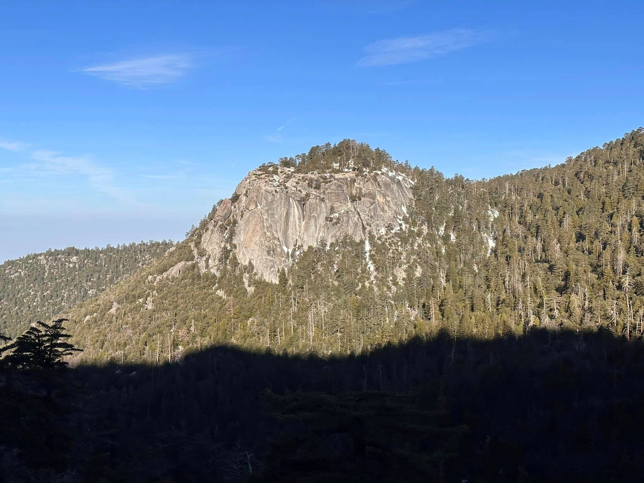
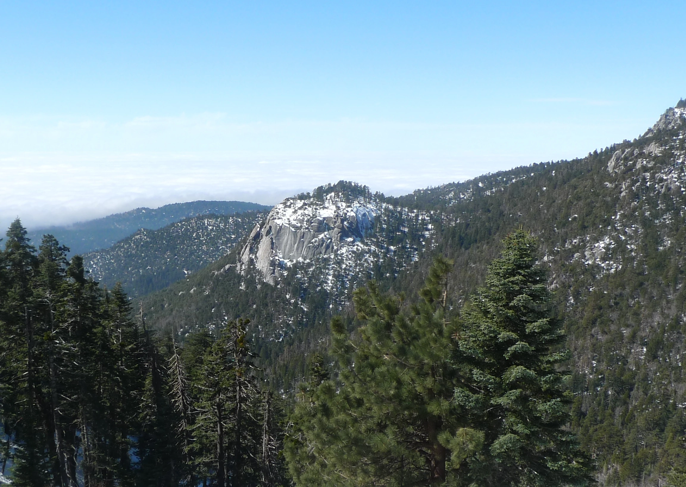
Suicide Rock, taken from the Devils Slide Trail, Photo by Kathy Wing.

Peak Name

Suicide Rock
27J

Elevation

7528

 feet

Status

active

Region

San Jacinto Area

Range

San Jacinto Mountains

Nearby peaks

Location

33.7708532,-116.69724

Description

Suicide Rock’s name is linked with efforts to boost late 19th century tourism by the telling of a story with elements of Ramona and Romeo & Juliet — an Indian princess and her lover jump to their death rather than live separated from one another. Although there is no actual dramatic story behind its name, Suicide Rock is a worthy moderate hike, and its views of the Idyllwild area and dramatic Lily rock are excellent.

Route 1 starts from a road junction on the way to Humber Park and follows a signed climbers trail to the summit. While the first part is maintained trail, the remainder is rocky and steep. Route 2 starts from Idyllwild on the Deer Springs Trail, leaving it to head off northeast on the Suicide Rock Trail to the peak.

Maps generated from CalTopo.com, reproduced with permission

Route 1- Climbers Trail
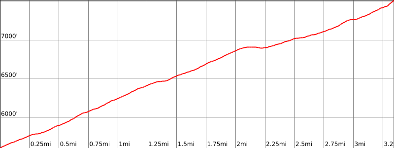
Elevation Gain
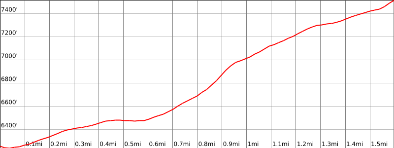
1300′
Navigation Difficulty
Easy
Distance
2 miles round trip on trail and cross-country
Estimated time
2-3 hours round trip
Route Rating
Class 1, easy
Leader Rating Required
“I”, normal conditions

Driving route

Take I-10 or SR 60 east to SR 79 in Beaumont. Take exit south to SR 79.
Go south on SR 79 to the Ramona Expressway. Turn left (east).
Go east and then southeast on the Ramona Expressway until it ends at SR 74. Turn left (east).
Go east on SR 74 to Mountain Center (junction with Idyllwild Highway SR 243). Turn left (north).
Go to Idyllwild Ranger Station (San Bernardino National Forest) on the right. Turn right on Pine Crest Avenue. Note your odometer and go as follows:
At 0.6 mile, intersection. Make a half right on South Circle Drive.
At 0.7 mile, Fern Valley Drive on the left with a sign “Humber Park”. Turn left.
At 1.2 miles, fork. Keep left.
At 2.2 miles, sign “Climber’s Route” on the left, at a junction with paved Forest Drive coming in from the right. This is the trailhead. Park on Forest Drive (unlimited parking).

Hiking route

From the parking area (6280′), a climber’s trail starts. Follow this trail as it crosses a creek and meets a paved road.
Turn right and continue straight on this road, ignoring all side junctions, to its end at a trail register. Sign in here. This is your Wilderness permit (day use only).
Continue to a sign “Trail not maintained past this point”.
Climb steeply northwest on a network of use trails to the foot of the cliffs.
Upon reaching the cliffs, turn right and follow along their base.
Past the final cliffs, ascend cross-country directly west to the main summit trail described in Route 2.
Turn left on this trail to the summit.

Route Notes

Printable Route

Road Type

Paved

Google Maps Link to Trailhead 

Route 2- Deer Springs Trail
Elevation Gain
1850′
Navigation Difficulty
Easy
Distance
6.6 miles round trip on trail and cross-country
Estimated time
4-5 hours round trip
Route Rating
Class 1, moderate
Leader Rating Required
“O”, normal conditions

Driving route

Take I-10 or SR 60 east to SR 79 in Beaumont. Take exit south to SR 79.
Go south on SR 79 to the Ramona Expressway. Turn left (east).
Go east and then southeast on the Ramona Expressway until it ends at SR 74. Turn left (east).
Go east on SR 74 to Mountain Center (junction with Idyllwild Highway SR 243). Turn left (north).
Go north on SR 243 through Idyllwild to the Idyllwild Nature Center on the left, near mile paddle 5.25. Park in the large dirt area on the right side of the highway. Plenty of parking.

Hiking route

From the parking area, hike up the Deer Springs Trail.
Follow it about 2 miles to its junction with the Suicide Rock Trail (3E33).
Go right and continue about 1 mile to the summit, which is the high point to your right just before the trail ends.

Route Notes

Printable Route

Road Type

Paved

Google Maps Link to Trailhead 

Additional Peak Information

Wilderness permits are required for Route 2. Permits are limited to 12 hikers. Permits may be obtained from the Idyllwild Ranger Station just off SR 243 at 54270 Pine Crest Road. There is a self-issue permit stand outside of the ranger station. Permits may be obtained in advance from:
San Jacinto Ranger District
54270 Pinecrest
P.O. Box 518
Idyllwild, CA 92549
Voice: (909) 382-2921
Fax: (951) 659-2107

Nearby Peaks

Backus Peak
Owens Peak
Black Mountain #5
Morris Peak

External Links

mountain 1

Peakbagger.com

Click Here

ranger-tower 1

Nearest ranger station

Click Here

g311

NOAA Forecast

Click Here

worldwide 1

Google Earth

Click Here

Photo Gallery