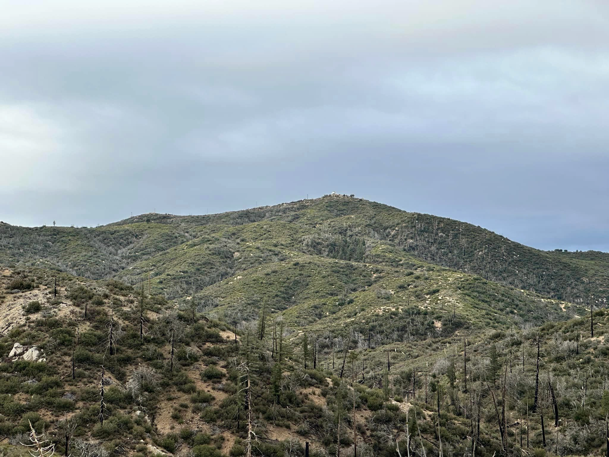
Vetter Mountain with lookout in the distance, photo by Sunny Yi
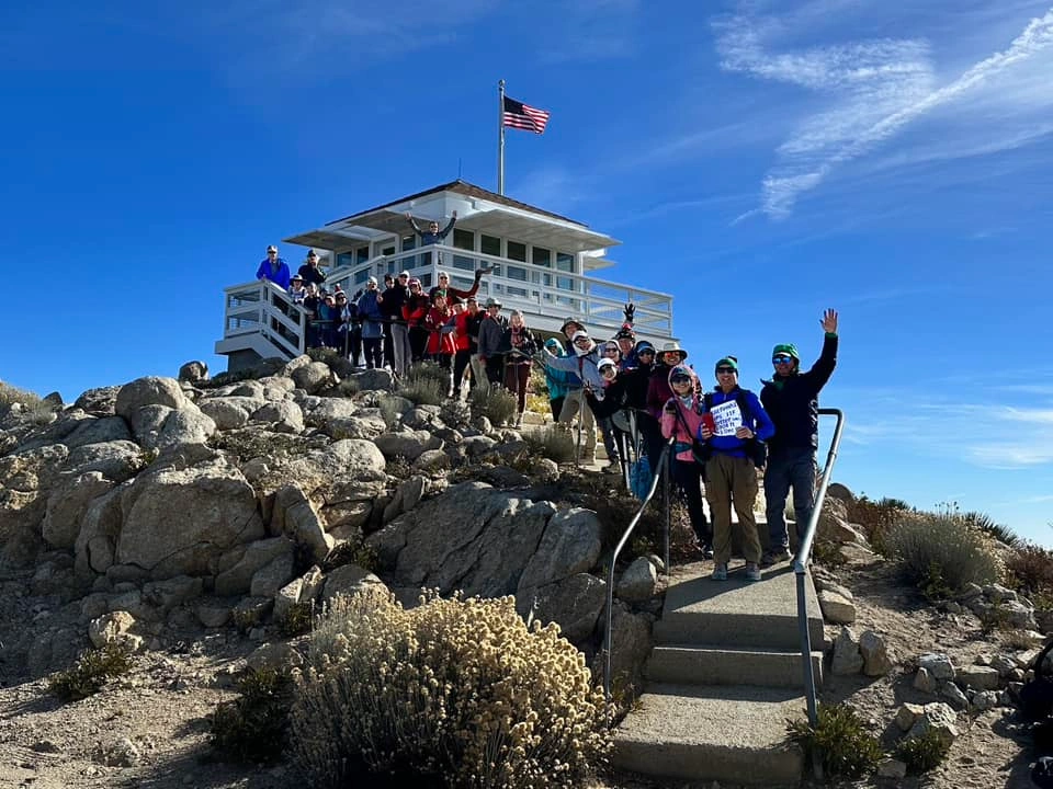
Vetter Mountain Lookout; Louie Rodriguez's list finish 12/9/2023, photo by Sunny Yi
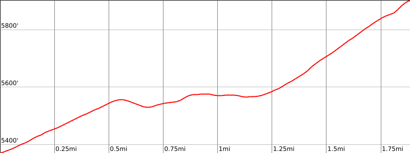

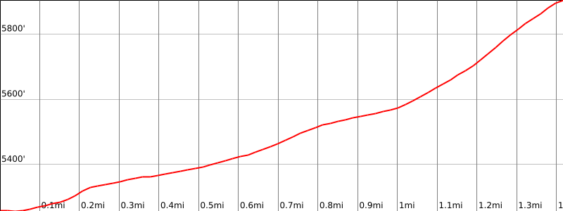

Peakbagger.com

Nearest ranger station

NOAA Forecast

Google Earth


