Toro Peak

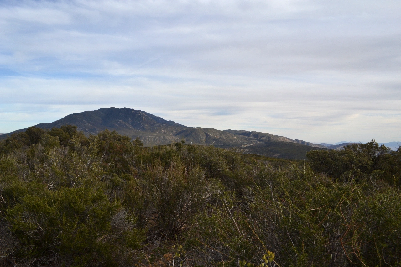
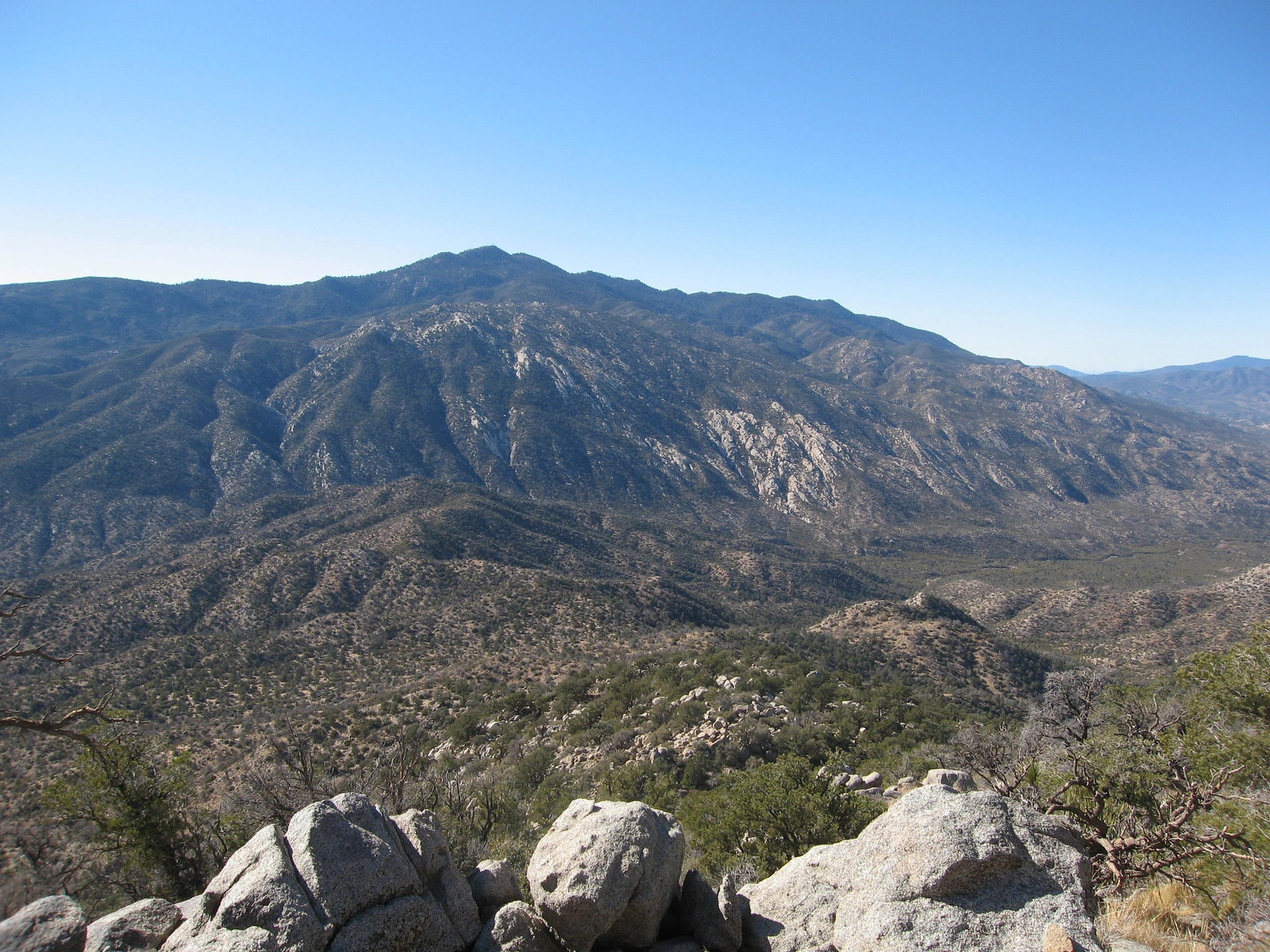
Toro Peak, taken from Martinez Mountain, Photo by Kathy Wing.

Peak Name

Toro Peak
30E

Elevation

8316

 feet

Status

active

Region

Santa Rosa Mountains

Range

San Jacinto Mountains

Nearby peaks

Location

33.5233623,-116.4255689

Description

Toro is the highest peak in the Santa Rosa range, which picks up after the desert divide ends into the desert. Toro and its neighbor Santa Rosa have commanding views of the Anza Borrego Desert and the Coachella Valley. Route 1 is a drive-up on high clearance road, passing nearly over the summit of Santa Rosa along the way. There are several nice campgrounds in the area.

Maps generated from CalTopo.com, reproduced with permission

Route 1
Elevation Gain
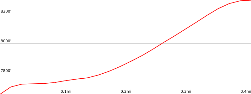
500′
Navigation Difficulty
Moderate
Distance
1 mile round trip cross-country in forest
Estimated time
1 hour round trip
Route Rating
Class 1, easy
Leader Rating Required
“I”, normal conditions.

Driving route

Take SR 60 east to I-215.
Go south on I-215 to the Ramona Expressway. Turn left (east).
Go east and then southeast on the Ramona Expressway until it ends at SR 74. Turn left (east).
Go east on SR 74 to Mountain Center.
Continue east on SR 74 for 12.5 miles to the intersection with SR 371 on the right.
Continue east on SR 74 about 5.2 miles to a dirt road 7S02 on the right signed “Santa Rosa Mtn.”. Turn right. Note your odometer and go as follows:
At 8.5 miles, fork to the left. Keep straight.
At 8.9 miles, fork to the left. Keep straight.
At 9.8 miles, fork. Turning sharply right leads to Santa Rosa Mountain. Continue straight.
At 11.5 miles, stop at the Y-junction and park near the junction.

Hiking route

From the parking area (7800′), hike up the right-hand road fork, which heads uphill to a nearby gate. The gate is often closed but sometimes open.
Leave the road at the gate and ascend a forested gully to the south.
Reach an obvious saddle after 400′ gain, then turn right (west) and climb adjacent bump 8316′.
This bump is Toro West Peak, the register location. The traditional summit of Toro Peak lies 0.6 miles to the southeast and should be avoided.

Route Notes

Printable Route

Road Type

High-clearance

Google Maps Link to Trailhead 

Additional Peak Information

Access note: The traditional (highest) summit of Toro Peak is located at an electronic site within the Santa Rosa Indian Reservation. Public access is currently restricted. The HPS register is on the west summit, elevation 8316′, which lies entirely within the National Forest.

Special conditions: Forest Road 7S02 may be closed during fire season or rainy season, and is treacherously icy in winter. For road condition, check with the Forest Service in Idyllwild, 909 382-2921.

Nearby Peaks

Backus Peak
Owens Peak
Black Mountain #5
Morris Peak

External Links

mountain 1

Peakbagger.com

Click Here

ranger-tower 1

Nearest ranger station

Click Here

g311

NOAA Forecast

Click Here

worldwide 1

Google Earth

Click Here

Photo Gallery