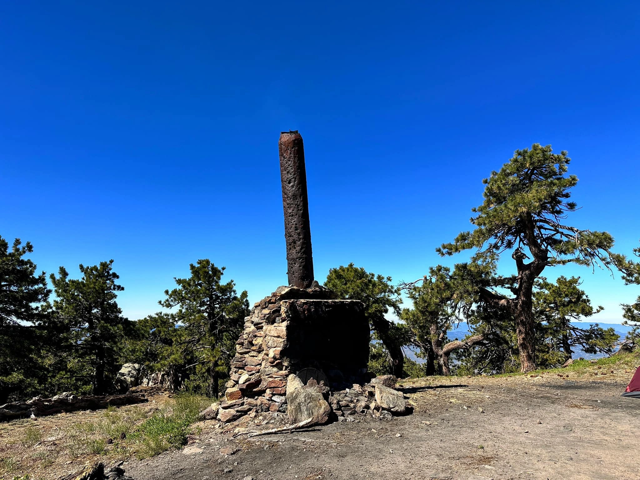
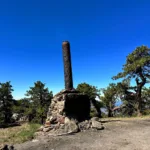
Santa Rosa Mountain

Cabin ruins on summit of Santa Rosa, Photo by Nahid Shirazi.

Peak Name

Santa Rosa Mountain
30D

Elevation

8070

 feet

Status

active

Region

Santa Rosa Mountains

Range

San Jacinto Mountains

Nearby peaks

Location

33.5378065,-116.4614033

Description

Named for the Santa Rosa band of Cahuilla Indians who once lived on the slopes of this peak, Santa Rosa and its neighbor Toro are the highest peaks in the area and have commanding views of the Anza Borrego Desert and the Coachella Valley. Route 1 is a drive-up on high clearance road, on which you can continue to Toro. There are several nice campgrounds in the area. There is also the Sawmill Trail from the north, for those inclined to hike, but is not an official route.

Maps generated from CalTopo.com, reproduced with permission

Route 1
Elevation Gain
None
Navigation Difficulty
Distance
None
Estimated time
None
Route Rating
Drive-up
Leader Rating Required
“O”, normal conditions

Driving route

Take SR 60 east to I-215.
Go south on I-215 to the Ramona Expressway. Turn left (east).
Go east and then southeast on the Ramona Expressway until it ends at SR 74. Turn left (east).
Go east on SR 74 to Mountain Center.
Continue east on SR 74 for 12.5 miles to the intersection with SR 371 on the right.
Continue east on SR 74 about 5.2 miles to a dirt road 7S02 on the right signed “Santa Rosa Mtn.”. Turn right. Note your odometer and go as follows:
At 8.3 miles, fork to a campground. Keep straight.
At 8.5 miles, fork to Santa Rosa Spring. Go right.
At 9.8 miles, fork. Turn sharp right.
At 10.5 miles, the end of the road at a log cabin. This is the summit.

Hiking route

None.

Route Notes

Printable Route

Road Type

High-clearance

Google Maps Link to Trailhead 

Additional Peak Information

Special conditions: Forest Road 7S02 may be closed during fire season or rainy season, and is treacherously icy in winter. For road condition, check with the Forest Service in Idyllwild, 909 382-2921.

Natural historical note: Note the rustic notices regarding forest fire hazards, which were originally placed by Desert Steve Ragsdale (colorful founder of Desert Center) when he worked as a seasonal ranger in the 1930’s and 40’s.

Nearby Peaks

Backus Peak
Owens Peak
Black Mountain #5
Morris Peak

External Links

mountain 1

Peakbagger.com

Click Here

ranger-tower 1

Nearest ranger station

Click Here

g311

NOAA Forecast

Click Here

worldwide 1

Google Earth

Click Here

Photo Gallery