Peak Name
Elevation
feet
Status
Region
Range
Nearby peaks
Location
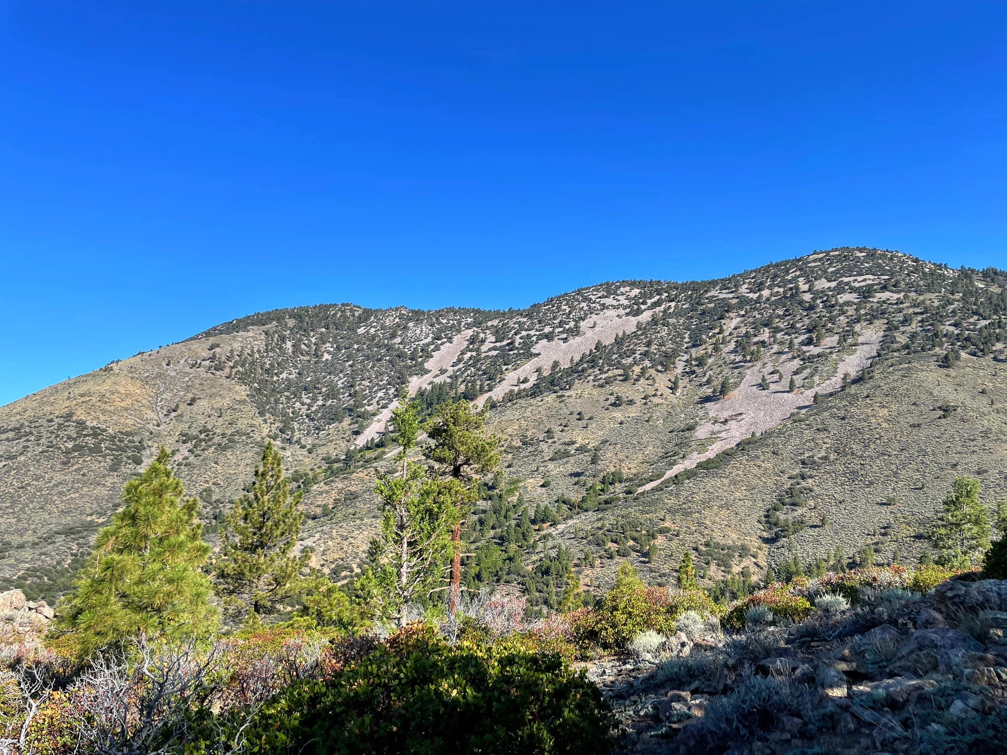
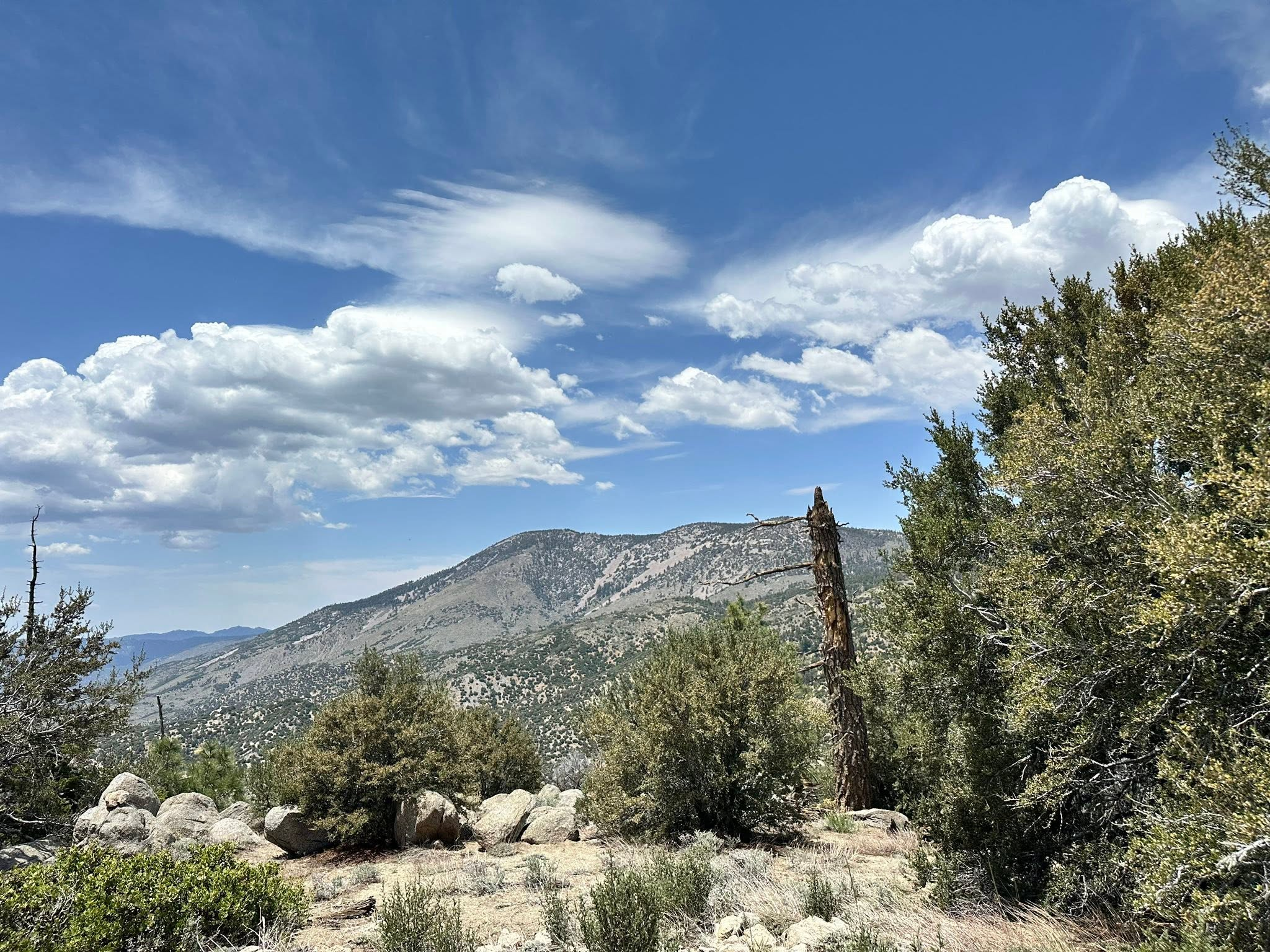
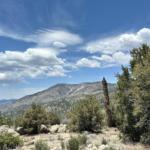
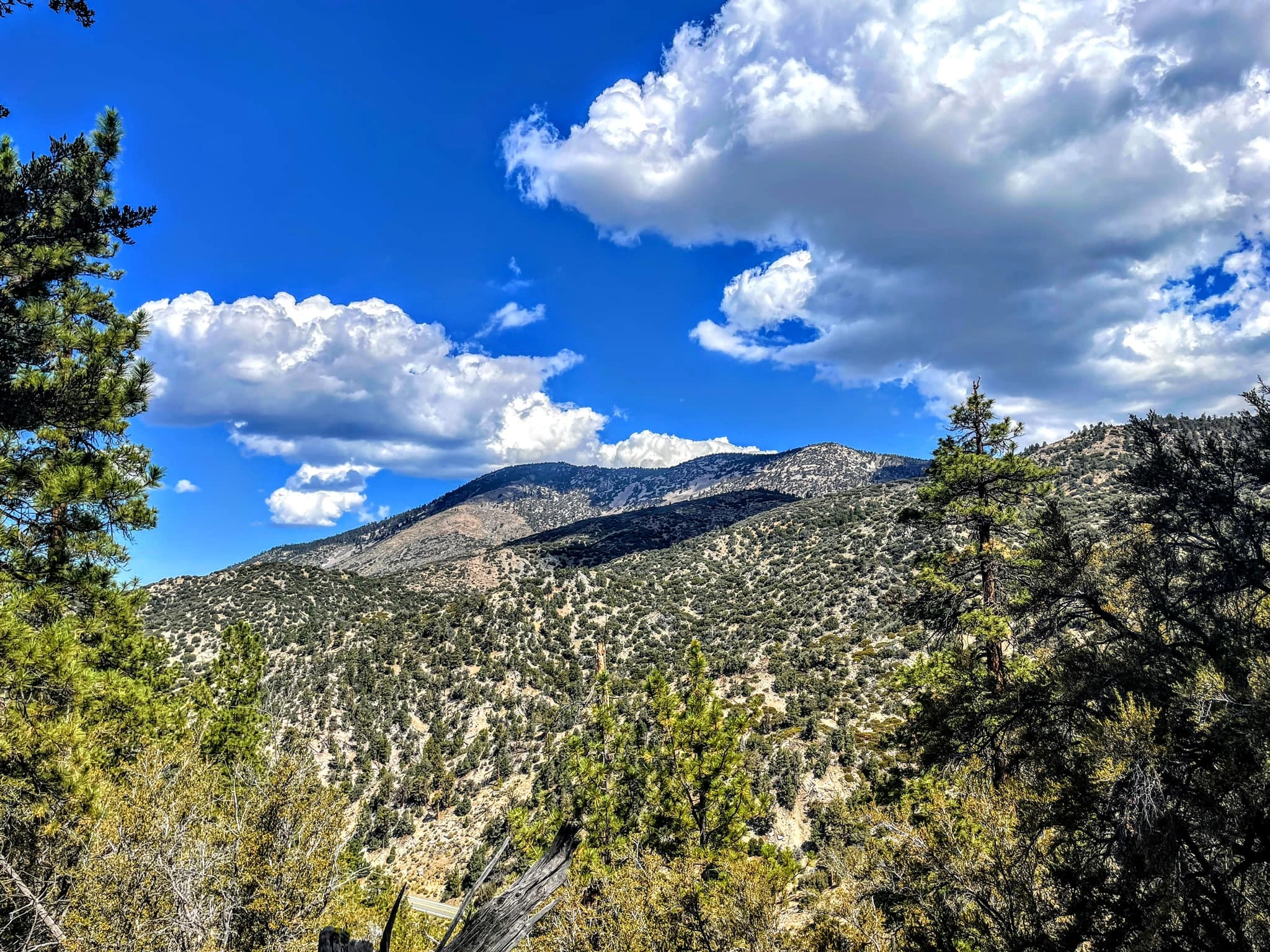
At nearly 10,000 feet, Sugarloaf mountain is the highest peak in the area outside of the San Gorgonio Wilderness. It has sweeping views of the Big Bear area and much of the San Bernardinos on beautifully forested trails. There are numerous routes to hike Sugarloaf, all of which are wonderful outings.
Route 1 starts with a drive on high-clearance dirt road from Highway 38 in the south to reach the beginning of the summit ridge. A use trail winds its way west through beautiful forest and across several bumps to the peak. Route 2, the Sugarloaf National Recreation Trail, starts from the Big Bear side and ascends Green Canyon to join Route 1. Route 3, the easiest route, follows the same ridge but from the west; it crosses a ski area and is not accessible when the ski area is in operation. Route 4 starts from Sand Canyon Road and ascends a narrow gully to meet Route 3. Route 5 is a longer endeavor, starting at Highway 38 from the south on the scenic Wildhorse Trail through meadow and forest. There is a campsite on the way at Wildhorse Creek. Any way you want to go, and you may want to try all of them, this peak is a gem.
Maps generated from CalTopo.com, reproduced with permission
Driving route
Take I-10 east past San Bernardino to the Orange Street exit (SR 38).
Go one block east, then go north (left) 0.5 mile to Lugonia Avenue. Turn right on SR 38 (east).
Continue east on SR 38 about 33 miles to 1N02, the road to Heart Bar Campground, on the right. Keep straight.
Go another 2.2 miles on SR 38 to a dirt road, 2N93, on the left (north). Turn left.
Follow 2N93 for 6.0 miles to Wildhorse Meadows. There is a fork to a gated dirt road on the left (west). Park on the right just before this fork.
Hiking route
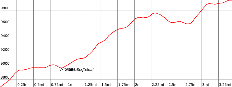
From the parking area (8700′), the trail begins on the left side of the road at a break in the fence. Hike west along the ridge over a broad plateau and down into a saddle with a sign “Sugarloaf Trail” at a trail junction (8972′).
Continue on the road, which becomes a trail (2E02A).
Follow the trail west along the ridge, down into a saddle (9600’+), and up to the summit where you will find a sign on a pile of rocks.
Special conditions: Dirt road 2N93 is seasonal.
Driving route
Take I-10 east past San Bernardino to the Orange Street exit (SR 38).
Go one block east, then go north (left) 0.5 mile to Lugonia Avenue. Turn right on SR 38 (east).
Continue east on SR 38 about 33 miles to 1N02, the road to Heart Bar Campground, on the right. Keep straight.
Go another 12.2 miles on SR 38 to Hatchery Drive. Turn left. Note your odometer and go as follows:
At 0.55 mile, a fork to the right. Keep straight.
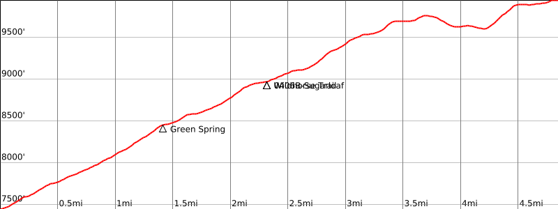
At 1.3 miles, Sugarloaf Trail on the right. Park here.
Hiking route
From the parking area (7560’+), hike up the Sugarloaf Trail to a trail junction on the ridge (8972′).
Turn right and follow the trail (2E02A) west along the ridge, down into a saddle (9600’+), and up to the summit where you will find a sign on a pile of rocks.
Route Notes
Driving route
Drive east on I-10 to I-215.
Go north on I-215 to SR 210.
Go east on SR 210 to SR 330.
Go north on SR 330 to Running Springs. Turn right on SR 18.
Continue on SR 18 to the junction of SR 18 and SR 38. Reset your odometer here.
Continue 6.0 miles on SR 18 to Moonridge Road. Turn right (south).
At 6.8 miles, turn right (south) on Club View.
At 8.1 miles, Club View becomes 2N10 (past the ski area). Continue on 2N10.
At 8.8 miles, continue straight at the junction of 2N10E (which crosses 2N10 from both your right and left).
At 9.3 miles, turn left (east) on 2N06.
At 10.0 miles, go straight on 2N21.
At 10.4 miles, park at the clearing before the gate.
Hiking route
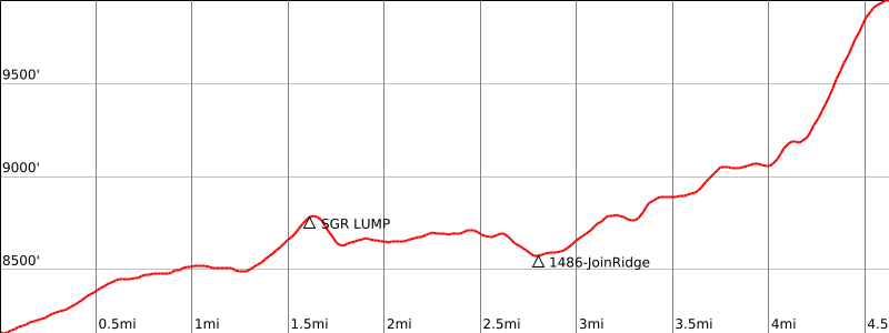
From the parking area, hike east along the road past the ski area over several bumps to the saddle at the base of Sugarloaf (about 3 miles). The road becomes a trail past the last ski lift on the bump named Sugarlump. The road and trail generally follow a long ridge that goes generally east toward the mountain from the parking area.
Hike up the slope to the top. Note your way for the return as the return to the saddle is not obvious.
Special conditions: Route 3 crosses the Bear Mountain Ski Area. Permission to hike across the ski area is required. Alternative routes are possible that by-pass the ski area, but they have not yet been explored and documented.
Driving route
Drive east on I-10 to I-215.
Go north on I-215 to SR 210.
Go east on SR 210 to SR 330.
Go north on SR 330 to Running Springs. Turn right on SR 18.
Continue on SR 18 to the junction of SR 18 and SR 38. Reset your odometer here.
Continue 6.0 miles on SR 18 to Moonridge Road. Turn right (south).
At 7.8 miles, turn left onto Sand Canyon Road. Follow Sand Canyon Road, making three left turns to stay on Sand Canyon.
At 8.9 miles, Sand Canyon Road turns to good dirt Forest Road 2N27.
At 9.7 miles, park at a turnout at a hairpin turn.
Hiking route
From the parking area, pick up a faint trail leading south through a gap in the fence.
At 0.2 mile, come to a T-junction. Turn right, and go 15 yards to a shallow draw that may be marked with a cairn.
Turn left and hike up the draw. For a while, you may be able to avoid brush in the draw by taking a very faint use path on the left side of the draw.
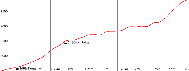
Continue up the draw to join Route 3 on the ridge at 8570′, 1.0 miles from the start.
Turn left and follow a trail along the ridge toward Sugarloaf Mountain.
A 9200′, 2.2 miles, the trail reaches the final slope of Sugarloaf Mountain and becomes too faint to follow.
Hike up the slope to the top. Note your way for the return as the return to the saddle is not obvious.
Route Notes
Driving route
From Redlands, drive east on SR 38 to the turnoff for the Wildhorse Creek Trail on the left, just before mile marker 038 SBD 34.30 and 0.2 mile before the Heart Bar Campground Road on the right.
Turn left (north) and drive about 20 yards up a dirt road to a signed parking area.
Hiking route
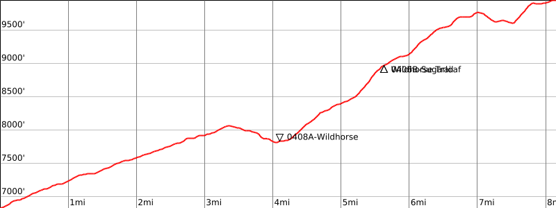
From the parking area, hike up the Wildhorse Trail 4 miles to Wildhorse Creek Trail Camp.
Cross the creek and continue up the Wildhorse Trail.
At 4.7 miles, merge onto a closed jeep track 2N93E along the west side of Wildhorse Meadow.
At 5 miles, leave the jeep track on a signed trail to Sugarloaf Mountain.
At 5.5 miles, reach the 4-way junction on the 8972′ saddle where you join routes 1 and 2.
Turn left and follow the trail west along the ridge, down into a saddle (9600’+), and up to the summit where you will find a sign on a pile of rocks.
Special conditions: Route 3 crosses the Bear Mountain Ski Area. Permission to hike across the ski area is required. Alternative routes are possible that by-pass the ski area, but they have not yet been explored and documented.
Additional Peak Information
Notes: You can combine Routes 2 and 4 into a 11-mile loop with 2600′ of elevation gain by walking back on 2N27 or 2N93. You can shorten it to 8 miles by setting up a car or bicycle shuttle between the trailheads.


You must be logged in to upload images.