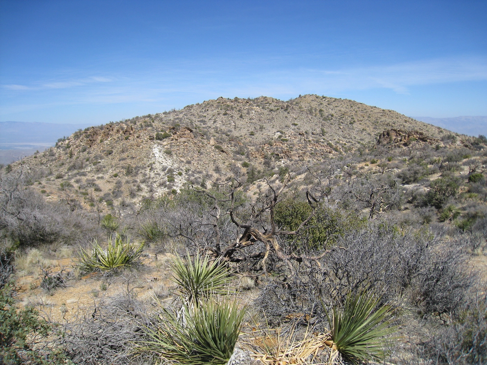
Sheep Mountain

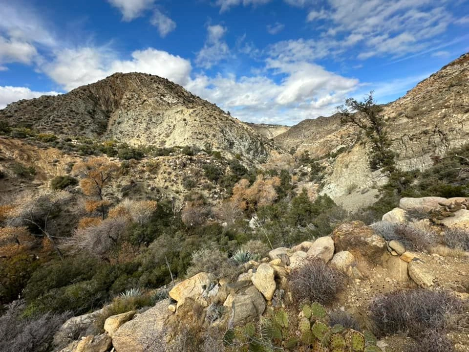
Sheep Mountain, Photo by Kathy Wing.

Peak Name

Sheep Mountain
30B

Elevation

5141

 feet

Status

active

Region

Santa Rosa Mountains

Range

San Jacinto Mountains

Nearby peaks

Location

33.5858601,-116.3761228

Description

Named for the Bighorn Sheep that roam here, Sheep and its neighbor Martinez Mountain are in the Santa Rosa Mountains, with Santa Rosa and often snow-capped Toro to the west, the Coachella Valley to the east, and the Salton Sea to the southeast. The desert setting is beautiful and peaceful and the sights along the trail and from the peak are excellent.

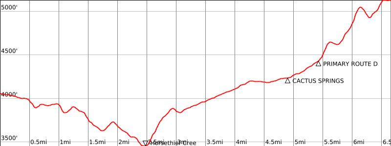
All routes to Sheep have difficult navigation. HPS Route 1 follows the Cactus Springs Trail, descending to Horsethief Creek, which almost always has year-around water and a few campsites, then crosses the desert floor to the dry Cactus Springs. From there a use trail continues north, becoming increasingly difficult to follow as it goes on. The map shows several common route variations. One can also ascend or return via the southwest ridge of the peak, which is less steep than Route 1, and is shown on our map.

Martinez and Sheep are often hiked together as one long strenuous day, and there are a variety of ways to do this, shown on the map. One way is to hike to Sheep then continue cross country to Martinez and ascend via the gully of Route 1 or vice versa.

Sheep Mountain and Martinez Mountain are subject to a voluntary seasonal closure to protect bighorn sheep habitat, except for the months of October, November, and December. This seasonal closure may become permanent at some time in the future.

Maps generated from CalTopo.com, reproduced with permission

Route 1- Cactus Spring Trail
Elevation Gain
2900′ total, 2100′ out plus 800′ on return
Navigation Difficulty
Difficult
Distance
13 miles round trip on trail and cross-country
Estimated time
6-7 hours round trip
Route Rating
Class 1, strenuous
Leader Rating Required
“I”, normal conditions

Driving route

From the west:
Take I-10 east to SR 79 in Beaumont.
Go south on SR 79 to the Ramona Expressway. Turn left (east).
Go east and then southeast on the Ramona Expressway until it ends at SR 74. Turn left (east).
Go east on SR 74 to Mountain Center (junction with Idyllwild Highway – SR 243).
Continue east on SR 74 for about 21.5 miles to a paved road (7S06) at a sign “Cactus Spring Trail”. This is just across from the entrance to Pinyon Flat Campground.
Go south 1/4 mile to the (paved) “Sawmill Trailhead” parking lot.

From the north:
Travel east on I-10 to its interchange with Monterey Avenue near Palm Desert. Exit right (south) on Monterey. Reset your odometer.
At 6.0 miles, Monterey crosses 111 in Palm Desert and becomes SR 74. Continue straight.
At 21.3 miles, turn left (southeast) on a paved road (7S06) at a sign “Cactus Spring Trail”. This is just across from the entrance to Pinyon Flat Campground.
Go south 1/4 mile to the (paved) “Sawmill Trailhead” parking lot.

Hiking route

From the parking area (4040′), hike east along the road to an intersection.
Continue straight ahead at the beginning of the Cactus Spring Trail. This is shown as a short road segment on the topo. Hike along the trail as it goes right at a fork and descends to a road near an old dolomite mine.
Turn left (east) on this road and follow it past the mine to where the trail leaves the road. This is the old trailhead. Continue east on the trail as it goes over several rises and then descends to Horse Thief Creek near BM 3492.
Follow it across the creek as it climbs over a hill to avoid a waterfall and then descends back into a wash.
Follow it east along this wash to Cactus Spring (usually dry). Leave the trail here and go north-northeast passing to the left of bump 4678′ and then across bump 5067′.
Descend through a saddle and then go north past a false summit to the peak.

Route Notes

Printable Route

Road Type

Paved

Google Maps Link to Trailhead 

Additional Peak Information

Alternate route: This peak is often combined with Martinez Mountain. From the summit of Martinez, descend either gully, just north or just south of the peak, to about 4800′ where they almost come together. From here hike northwest cross-country passing south of bump 5122′ and north of bump 5027′ and on to bump 5067′. From here turn right (north) and continue as above. The statistics for both peaks when done as a single hike are 18 miles and 5500′ gain (very strenuous).

Wilderness permits: Both Sheep Mountain and Martinez Mountain are in the Santa Rosa Wilderness, but your sign-in at a wilderness register box near the beginning of the Cactus Spring Trail currently replaces the usual wilderness permit process for both day hikes and overnight trips.

Note: There is water most of the year at Horsethief Creek and there are a few campsites there, allowing the peaks to be done as a pleasant and easier-paced overnight backpack. You should check on the water situation before going.

Nearby Peaks

Backus Peak
Owens Peak
Black Mountain #5
Morris Peak

External Links

mountain 1

Peakbagger.com

Click Here

ranger-tower 1

Nearest ranger station

Click Here

g311

NOAA Forecast

Click Here

worldwide 1

Google Earth

Click Here

Photo Gallery