San Rafael Peak

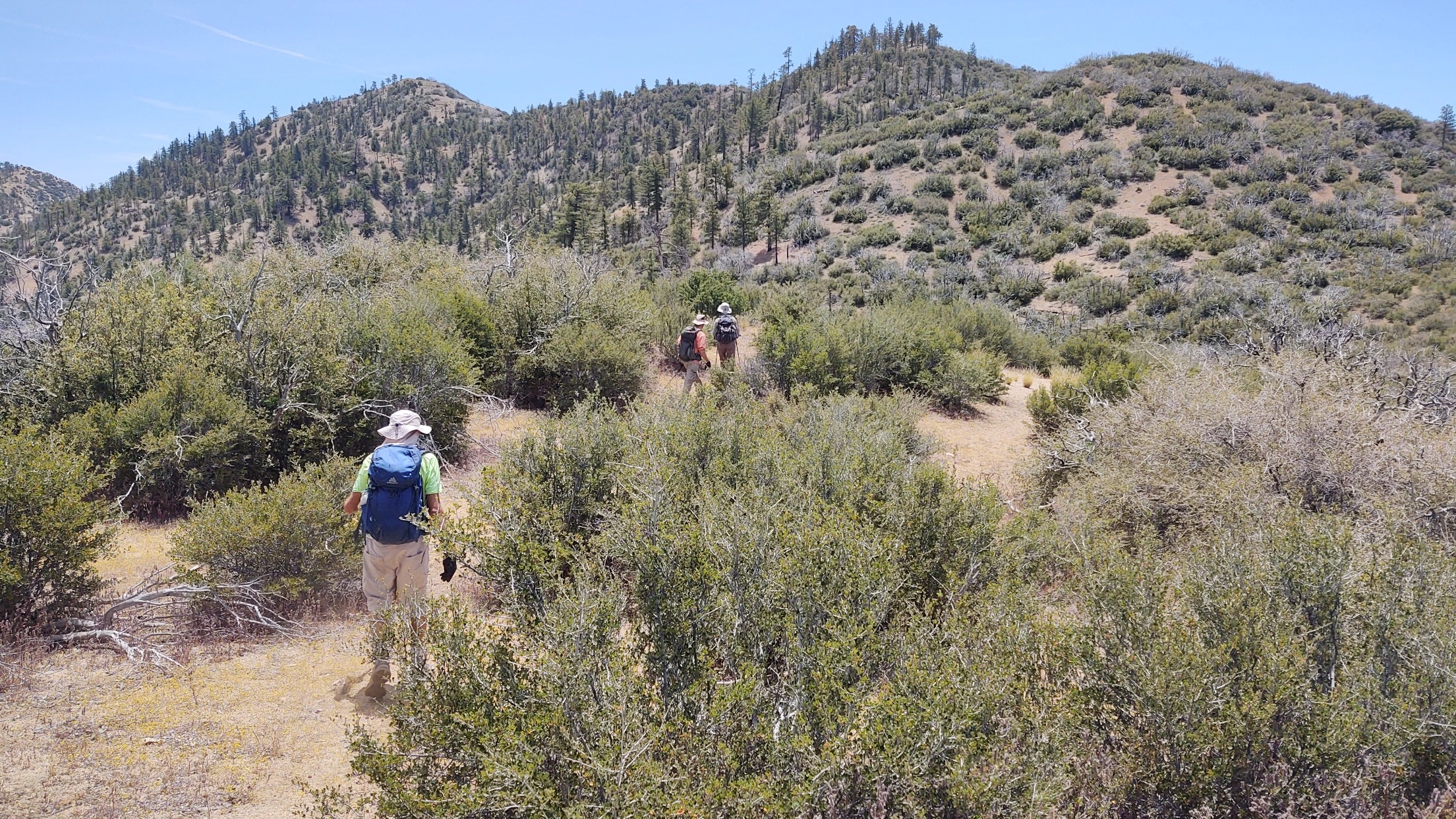
San Rafael Peak, Photo by Steve Russell.

Peak Name

San Rafael Peak
07F

Elevation

6666

 feet

Status

active

Region

Ventura County

Range

Ventura Ranges

Location

34.6238759,-119.0014907

Description

San Rafael Peak was once called Mission Pine Peak because it was the source of the beams used in the construction of Mission Santa Barbara. It overlooks Sespe Hot Springs and the valley of the Wild and Scenic Sespe Creek.

Route 1 is a strenuous but scenic route that follows the Little Mutau Trail which descends into Little Mutau Creek and follows it for several more miles, dropping 1700’ that will have to be regained on our return, before ascending to the peak on ridges. Route 2 takes the same trail but from the west, then approaches the peak over a series of bumps and ridges from the northwest, with little gain on the return. Both routes, especially Route 1, have complex navigation.

Maps generated from CalTopo.com, reproduced with permission

Route 1- Johnson Ridge Trail
Elevation Gain
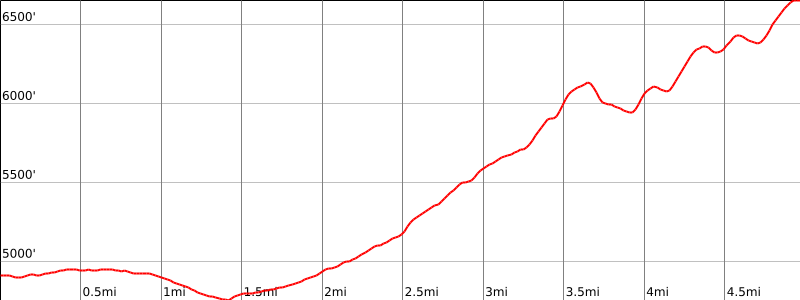
2400′ total, 2100′ out plus 300′ on return
Navigation Difficulty
Very difficult
Distance
10 miles round trip on trail and cross-country
Estimated time
6-7 hours round trip
Route Rating
Class 1, strenuous
Leader Rating Required
“I”, normal conditions

Driving route

Take I-5 north past Gorman to the Frazier Park turnoff.
Go west on Frazier Mountain Park Road for 7.1 miles to the junction with the Lockwood Valley Road in Lake of the Woods. Turn left.
Go 10.6 miles on the Lockwood Valley Road to the Mutau Road (7N03) on the left with a sign reading in part “Pine Springs 5”. Turn left. Note your odometer and go as follows:
At 2.1 miles, fork with Piano Box Loop Road on the left. This is the turnoff for Lockwood Peak. Keep straight on 7N03.
At 2.7 miles, fork with 7N03A on the right. This is the turnoff for San Guillermo Mountain. Keep straight on 7N03.
At 7.5 miles, fork to the left (east). Turn left. (The Thorn Point trailhead is on the right fork.) Note your odometer again and go as follows on the Mutau Road (7N03):
At 2.5 miles, a stream crossing and the entrance to Halfmoon Campground. Keep straight.
At 3.8 miles, a fork to the right. Turn left on 7N03 and immediately park in a small parking area at the road end.

Hiking route

From the parking area (4900′), hike down the Johnson Ridge Trail (20W12) 1.0 mile to a trail junction on the west bank of Mutau Creek (4800′).
At the trail junction with a sign reading “Johnson Ridge Trail and Little Mutau Creek Trail”, continue straight ahead, pass a sign reading “Sespe Wilderness” on the left and continue across Mutau Creek about 3/4 mile to a trail junction.
At the trail junction with a sign reading “Little Mutau Creek Trail”, continue straight on the Little Mutau Creek Trail over a motorcycle barrier about 1 1/2 miles to a saddle at 5729′. Do not turn right at this junction.
At the saddle (5729′), turn right (south), follow a faint use trail up and over the right shoulder of bump 6160’+ and descend the steep slope to the saddle at 5960’+. Do not try to contour around bump 6160′.
Hike across the saddle on a faint clipped use trail and turn left (southeast) to hike along the east trending ridge of San Rafael Peak.
Contour around the east side of bump 6120’+ on the east trending ridge to the saddle to the southeast of it.
From this saddle contour around the north side of bump 6408′ on the east trending ridge to a saddle to the east of it.
Continue up the ridgeline from this saddle over bump 6440’+ to the summit.

Route Notes

Note: Use a high degree of care to ensure that the contours around bumps 6120’+ and 6408′ take you to the appropriate saddle. It is possible to be misled high or low when contouring by the animal trails crossing the faint use trail. Since the saddles are higher going to the east, you should, when the animal/use trail you are using fades out, go up to the next animal/use trail. This strategy will generally take you to the next higher saddle. On the return, go down to the next animal/use trail when the one you are on fades out. This strategy will generally take you to the next lower saddle. It is very important that you not miss the saddle at 5960’+ on the return. The use trail through the brush on the saddle 5960’+ is reasonably well clipped. Carrying clippers to improve this portion of the route would be useful. Take care when descending from bump 6160’+ on the return to ensure that the faint use trail is followed to the saddle at 5729′ on the Little Mutau Trail. The ridge over bumps 6120’+ and 6408′ is brushy and involves additional elevation gain.
Mutau Road (7N03) is gated at the junction with Lockwood Valley Road. This gate may be closed due to the condition of the road in rainy season. Contact the Chuchupate Ranger Station of the Mount Pinos Ranger District at 661-245-3731 for information about the status of the gate.

Printable Route

Road Type

Paved

Google Maps Link to Trailhead 

Route 2- Little Mutau Trail
Elevation Gain
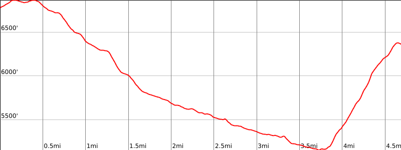
3200′ total, 1500′ out plus 1700′ on return
Navigation Difficulty
Very difficult
Distance
11 miles round trip on trail, and cross-country
Estimated time
6-7 hours round trip
Route Rating
Class 1, strenuous
Leader Rating Required
“I”, normal conditions

Driving route

Go north on I-5 to the town of Gorman. Get off on the signed Gorman exit.
Turn left at the bottom of the off-ramp and go under the freeway.
Go 0.1 mile to Peace Valley Road. Turn right.
Go 1 mile to the entrance to Hungry Valley Recreation Area on your left (paved). Turn left. Note your odometer and go as follows:
At 0.2 mile, entrance station. If manned, you can avoid payment of the fee by telling the State Park employee that you are passing through to Alamo Mountain.
At 5.2 miles, intersection. Turn right (west) toward “”Piru Creek””, signed.
At 11.2 miles, improved car camping area on right, with toilets. Often used as a meeting point.
At 11.4 miles, Piru Creek crossing. There is a seasonal gate just before this stream crossing.
At 13.4 miles, the pavement ends.
At 17.8 miles, fork to the left. Keep right.
At 17.9 miles, junction with the Alamo Mountain Road. Turn left. (To the right leads to Twin Pines Campground and Alamo Mountain Route 2.) Note your odometer again and go as follows:
At 3.3 miles, fork immediately beyond a small road cut through the ridge. (To the right leads to Alamo Mountain Route 1.) Turn left on 6S01.
At 4.0 miles the Little Mutau trailhead on the right. Park here.”

Hiking route

From the parking area (6750′), follow the obvious trail to the south steeply uphill for about 1/2 mile, where it fades into intermittent use trail. (Proceeding east along the ridge from this point leads to McDonald Peak.)
Continue down the southwest trending ridge for about 1 1/2 miles, reaching Little Mutau Creek at about the 5800′ contour, just north of point 5969′.
Follow Little Mutau Creek (can be very wet in the spring) for about 2 miles to about the 5200′ contour where a tributary creek enters from the south (UTM coordinates 165343). (Continuing west along the Little Mutau trail would lead, in about 3/4 mile, to Route 1 at saddle 5729′.)
Turn southwest, crossing the creek, and bushwhack through thick willows up the tributary for about 200 yards, where the tributary bends to the southeast.
Leave the creek to the right and climb southerly up the north trending ridge about a mile to the saddle just west of the summit. Take care to note your route for the return trip down this ridge.
Hike east along the ridge to the summit.

Route Notes

Note: There is a seasonal gate at the Piru Creek crossing on 18N01. Contact the Chuchupate Ranger Station of the Mount Pinos Ranger District at 661-245-3731 for information about the status of the gate.

Printable Route

Road Type

Dirt

Google Maps Link to Trailhead 

Additional Peak Information

The peak is in the Sespe Wilderness. Permits are not required for day hikes.

Nearby Peaks

Backus Peak
Owens Peak
Black Mountain #5
Morris Peak

External Links

mountain 1

Peakbagger.com

Click Here

ranger-tower 1

Nearest ranger station

Click Here

g311

NOAA Forecast

Click Here

worldwide 1

Google Earth

Click Here

Photo Gallery