Peak Name
Elevation
feet
Status
Region
Range
Nearby peaks
Location
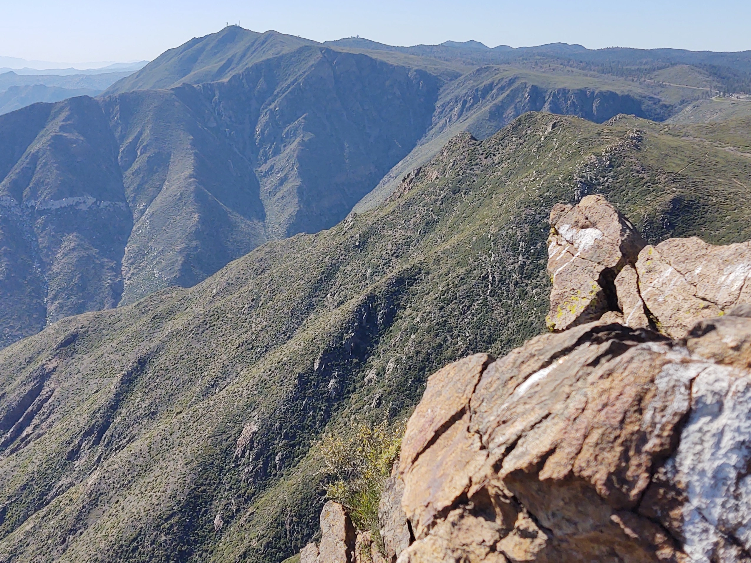
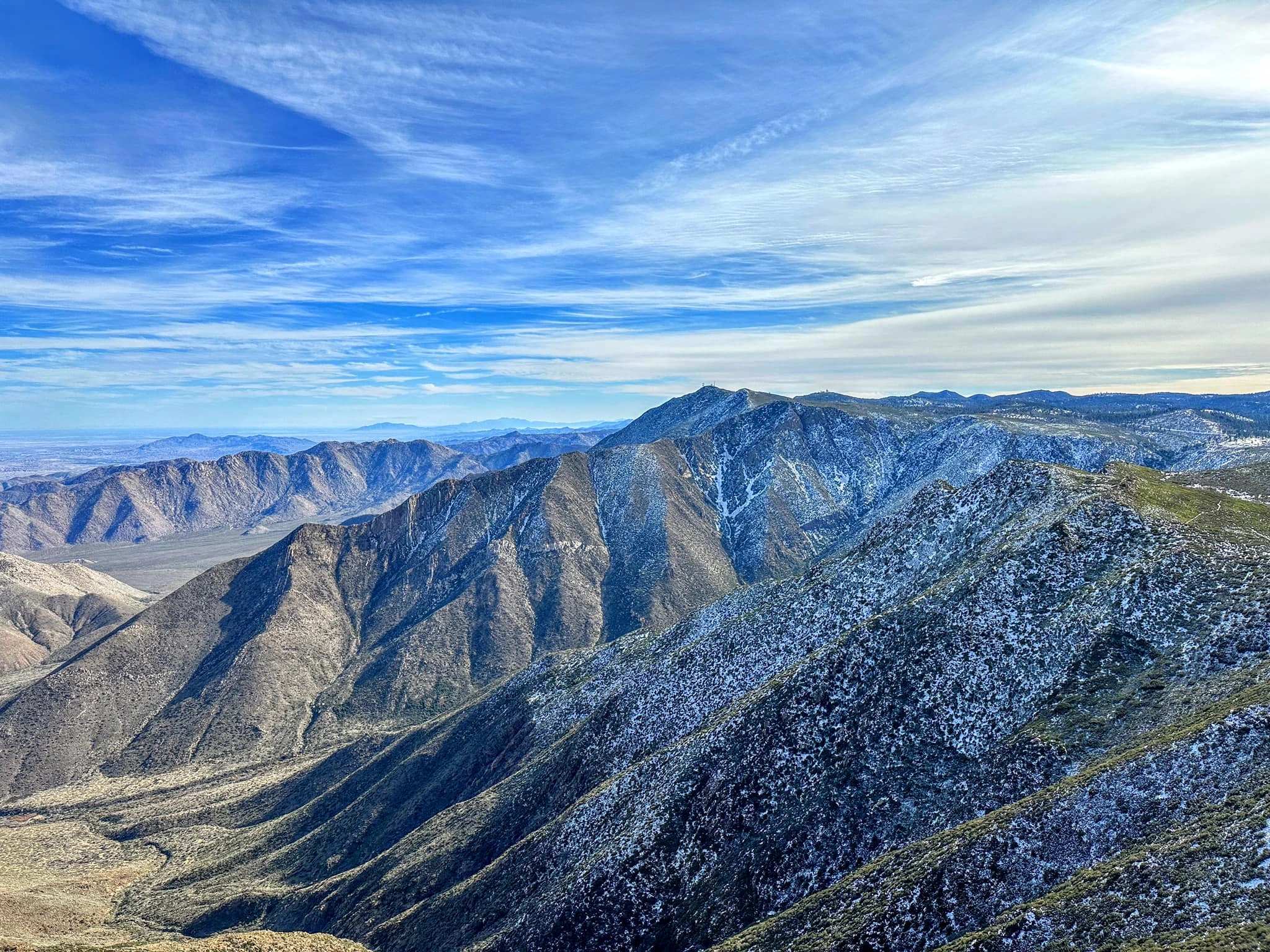
With the “grandest view point in Southern California” according to newspapers in the early 1910s, Monument Peak is the highest point of the Laguna Mountains. At 6,272 feet, the peak’s name refers to its role in early surveying of the area as it was being mapped for the first time. Over 100 years later, we still rely on its striking size, and it is now home to radio towers and many cellular repeaters. These man-made objects don’t spoil the panoramic views that offer desert, forest, and lake views that reach all the way to Mexico and the Pacific Ocean on a clear day. HPS neighboring peaks such as Granite Peak are clearly visible from the summit along with many distant mountain ranges in all directions. Monument is typically hiked together with other nearby HPS peaks include Garnet Peak, Garnet Mountain and Sheephead Mountain, which are often combined in a single outing, driving from trailhead to trailhead in a loop.
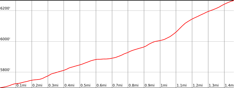
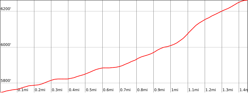
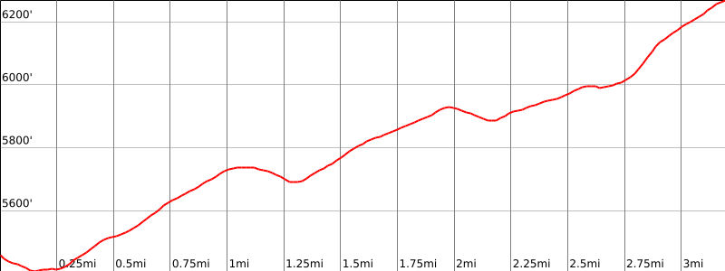
Often grouped with Garnet Peak, Monument Peak #1 has three routes to the summit, all easy and with only minor off trail travel. From the west, Route 1 starts on the Big Laguna Trail and overlaps the PCT for a short while, finally leaving the trail and ascending up the side of the peak. After passing through a NASA radio installation, the route eventually meets a paved road for the final push to the summit. Route 2 starts further south along an abandoned road that eventually meets the PCT and then follows the same path as Route 1. Entirely different from the previous two options, Route 3 starts from the north along the PCT, departing the trail up a ridge all the way to the summit. All routes can be achieved in roughly 2-3 hours.
Maps generated from CalTopo.com, reproduced with permission
Driving route
Take I-5 south to SR 78 in San Diego County.
Go east on SR 78 through Escondido to the junction with SR 79 just past the town of Julian. Turn right (south) on SR 79.
Go 6 miles to the junction with Sunrise Highway (S1) on the left. Turn left. Note your odometer and go as follows:
At 7.4 miles, a paved road on the left with a sign “Kwaaymii Point”. This is the turnoff for Garnet Mountain. Keep straight.
At 9.9 miles a parking area at a gated dirt road on the left. This is the trailhead for Garnet Peak. Keep straight.
At 11.4 miles, Laguna/El Prado Campground entrance and Foster Lodge entrance. Keep straight.
At 12.5 miles, large parking area on the left (after mile marker 25). A trail from the parking area says, “Big Laguna trail to PCT .5 miles.” Park here.
Hiking route
From the parking area (5760′), follow the Big Laguna Trail to the Pacific Crest Trail (PCT).
Turn left on the PCT and follow it to a point out of the trees where the radio installations on Monument Peak can be seen. The PCT will shortly make a sharp left turn with another fork going straight ahead.
Go straight ahead and follow this fork as it swings right and comes to a fenced enclosure with some trailers inside. (This is a NASA installation.)
Turn left and follow the fence around the left side of the installation until you come to a paved road.
Turn left on this road and follow it up to the summit.
Driving route
Take I-5 south to SR 78 in San Diego County.
Go east on SR 78 through Escondido to the junction with SR 79 just past the town of Julian. Turn right (south) on SR 79.
Go 6 miles to the junction with Sunrise Highway (S1) on the left. Turn left. Note your odometer and go as follows:
At 7.4 miles, a paved road on the left with a sign “Kwaaymii Point”. This is the turnoff for Garnet Mountain. Keep straight.
At 9.9 miles a parking area at a gated dirt road on the left. This is the trailhead for Garnet Peak. Keep straight.
At 11.4 miles, Laguna/El Prado Campground entrance and Foster Lodge entrance. Keep straight.
At 12.5 miles, large parking area on the left (after mile marker 25). A trail from the parking area says, “Big Laguna trail to PCT .5 miles.” This is the parking spot for Route 1.
Drive 1/4 mile south past the parking spot for Route 1. There is a large parking area on the left. Park here.
Hiking route
From the parking area (5760′), cross the fence at the place provided and follow a faint road leading north.
At 0.5 miles junction with the Big Laguna Trail. Turn right.
After 0.1 miles junction with the PCT. Turn left.
Follow the PCT to a point out of the trees where the radio installations on Monument Peak can be seen. The PCT will shortly make a sharp left turn with another fork going straight ahead.
Go straight ahead and follow this fork as it swings right and comes to a fenced enclosure with some trailers inside. (This is a NASA installation.)
Turn left and follow the fence around the left side of the installation until you come to a paved road.
Turn left on this road and follow it up to the summit.
Route Notes
Driving route
Hike north from the lodge (5560′) and pick up the PCT.
Follow the PCT in the Mexico direction for about 1.5 miles, past bump 5958′, to where it meets a prominent ridge going up to the left.
Go up this ridge, over a minor bump, and continue to the summit.
Hiking route
Hike north from the lodge (5560′) and pick up the PCT.
Follow the PCT in the Mexico direction for about 1.5 miles, past bump 5958′, to where it meets a prominent ridge going up to the left.
Go up this ridge, over a minor bump, and continue to the summit.
Note: Avoiding the paved road near the summit results in a route 100% different than Routes 1 and 2.
Additional Peak Information
Notes: The summit offers a fine view of the Laguna Mountains and the surrounding area. Point Loma and the Coronado Islands can be seen on a clear day.


You must be logged in to upload images.