Peak Name
Elevation
feet
Status
Region
Range
Nearby peaks
Location
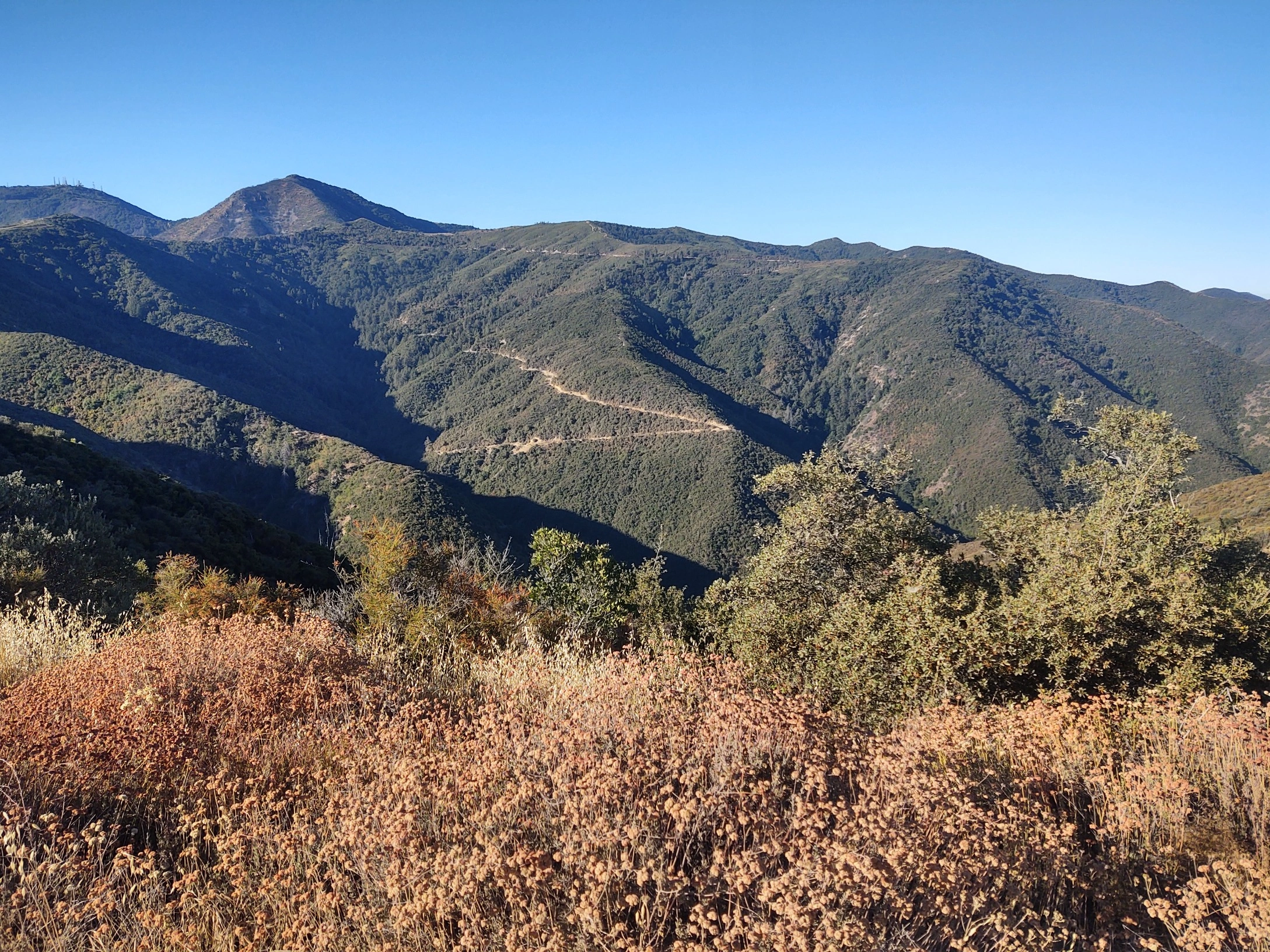
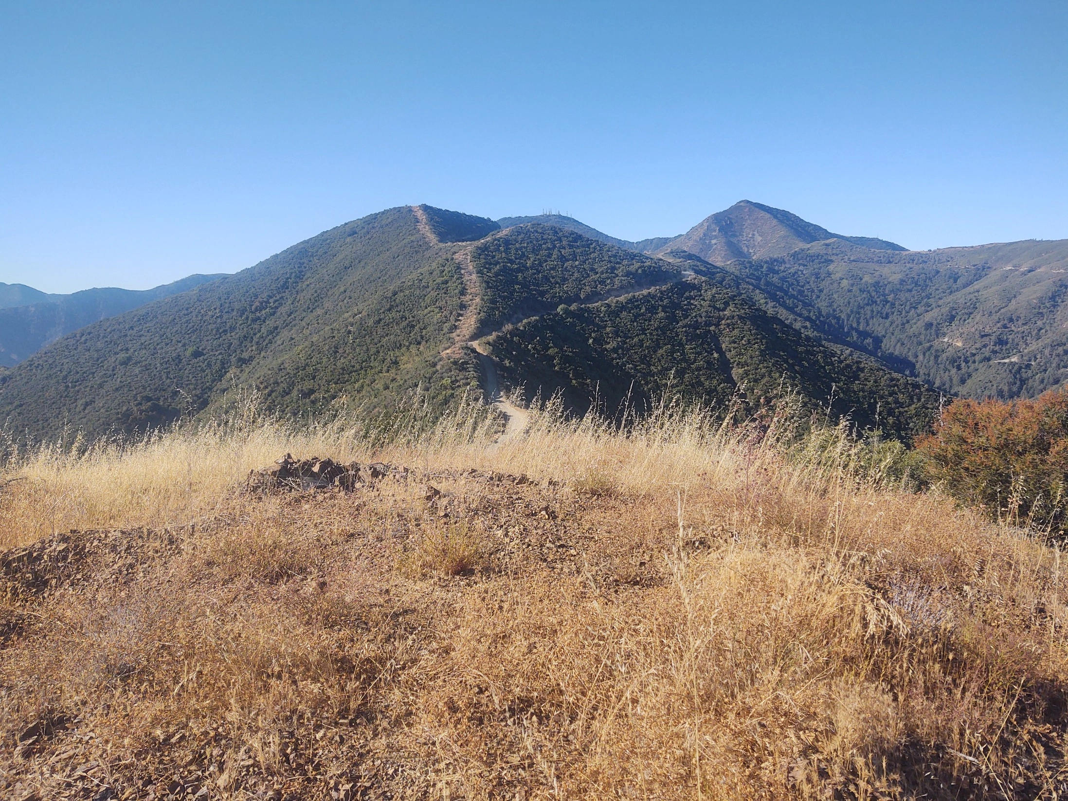
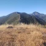
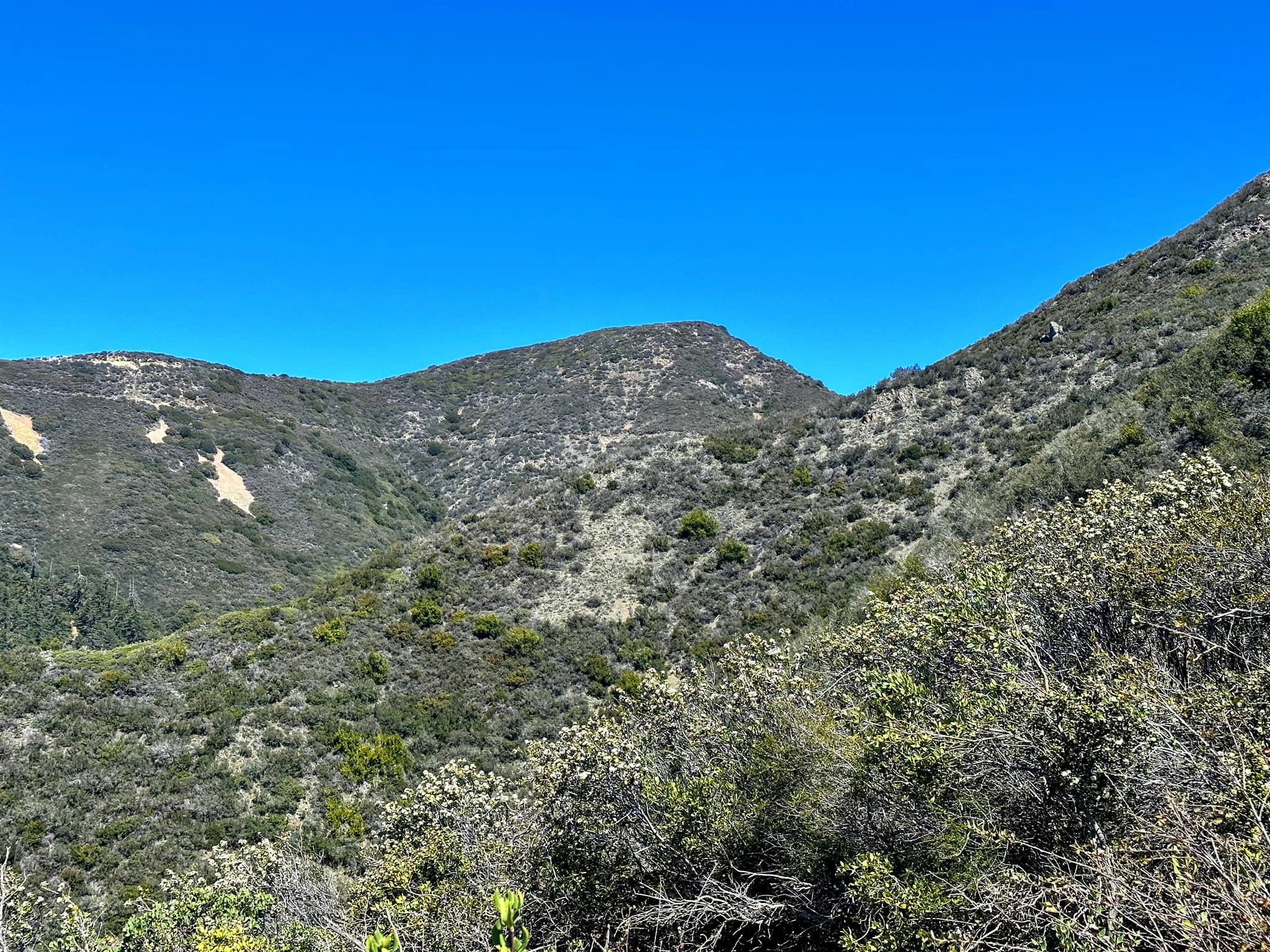
Modjeska Peak and its neighbor Santiago Peak in the Cleveland National Forest, are the only HPS peaks in Orange County. It was named for a famous actress in the late 1800s who lived here, described in the summit history. It has lovely view of the surrounding mountains and canyons, and Orange County all the way to the ocean. Its west side burned badly in the 2018 Holy Jim Fire but is regrowing. Modjeska is typically hiked in conjunction with adjacent Santiago Peak, hiking or driving between the two.
There are numerous routes to the peak. Route 1 is the route from Santiago, however you got there, to Modjeska, either on road or trail. Routes 2 and 3 are from the parking area for Santiago Route 2, so you can hike both from the same spot. Route 4 follows ridges, crossed the road, then ascends to the peak.
Maps generated from CalTopo.com, reproduced with permission
Driving route
See the Santiago Peak guide.
Hiking route
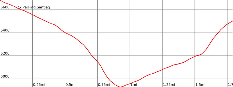
From the summit of Santiago Peak, hike down the road about 0.25 mile to a junction with the Main Divide road. Turn right (east, towards Holy Jim trail) and go a short distance to where the road widens at about 5400′.
An unsigned and not very obvious trail leaves the road on the left. Shortly the trail becomes more obvious. Note: This trail can become overgrown if not maintained regularly.
Follow this trail northwest to saddle 4988′ where the trail meets the Main Divide road, then continues to the right of the road.
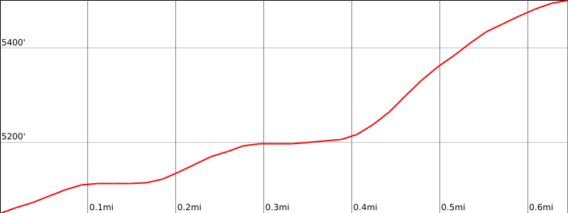
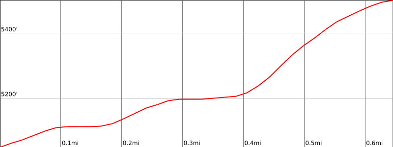
Continue on the “Modjeska Peak trail” for about 0.5 mile to a junction with an old road.
Turn right (northeast) on the road and follow it to the summit. It saves some distance to shortcut the road, taking a use trail on the right (east) of the road which runs northeast to the summit.
Notes: From Santiago Peak.
Alternate (avoiding the trail): Turn left (northwest) on the Main Divide road and follow it for about 3/4 mile to saddle 4988′, then continue about 3/4 mile to a junction with an old road going to the right (northeast). Follow the old road to the summit, or take the use trail shortcut.
The direct route from saddle 4988 to the summit is (obviously) quite brushy.
If you return to Santiago Peak, there is 700′ gain. If you return to the road going to Holy Jim Trail, it’s 450′ gain.
Driving route
See Santiago Peak Route 2
Hiking route
From the 2WD parking area, hike the road up to the summit or hike east up the ridge to the summit.
4WD vehicles may drive 1.0 mile further to the summit.
Route Notes
Driving route
From the intersection of SR 55 (Costa Mesa Freeway) and Katella Avenue in the City of Orange, go east on Katella and then southeast on Santiago Canyon Road (S18) to Silverado Canyon Road. Turn left.
Drive east 5.7 miles to the end of the pavement at a Forest Service gate. If the gate is open, pass through the gate, note your odometer, and go as follows:
At 6.5 miles, fork. Go right.
At 7.4 miles, fork. Go left.
At 7.5 miles, fork. Go right.
At 9.1 miles, fork on the left. This is the turnoff for Santiago Peak. Turn left. 2WD vehicles should park here.
4WD vehicles may drive 1.0 mile further to the summit.
Hiking route
From the 2WD parking area, hike the road up to the summit or hike east up the ridge to the summit.
Driving route
From the intersection of SR 55 (Costa Mesa Freeway) and Chapman Avenue in the City of Orange, go east on Chapman and then southeast on Santiago Canyon Road (S18) to Silverado Canyon Road. Turn left.
Drive east 5.7 miles to a Forest Service gate. If the gate is open, pass through the gate, note your odometer, and go as follows:
Drive 3 miles to the end of the pavement (3 parking spaces).
High clearance vehicles may go an additional 0.4mi to the hairpin turn where the use trail leaves the road (about 4 parking spaces).
“If the Forest Service gate is closed, you may use bicycles to get to the trailhead, noting that there are a few paved stream crossings on the road.”
Hiking route
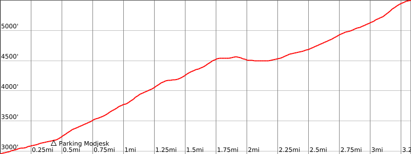
From the end of the pavement, hike the road 0.4 mile, 150′ gain, up to the next hairpin turn (3100′).
Leave the road and ascend the ridge behind the guardrail going south. This use trail crosses the road twice and continues to highpoint of ridge at 4550′.
From highpoint of ridge, descend use trail on the left (NE) side of ridge to large open area where roads converge (4500′).
Continue east on road (do not follow right fork that goes downhill) through first gate marked Maple Springs Rd.
A few yards farther, turn right onto CNF 3S04 Modjeska Peak Road (called Main Divide Truck Trail on topo maps).
Twenty yards after passing though this gate, a use trail continues up on the left. Follow this until it reaches a road.
Ten yards to your left and across the road is the continuation use trail that goes to Santiago Peak.
Turn left on the road and continue 30 yards.
Ascend the firebreak on your right to the summit of Modjeska Peak.
Route Notes
Note: From the summit of Modjeska, you can continue to Santiago Peak (3 miles, 1000′ round trip): Descend Modjeska Peak down the firebreak to the road the way you came. Turn left on the use trail, indicated above, that goes to the saddle between Modjeska and Santiago Peaks. The use trail again leaves the road just past the saddle. Follow this until it joins the road, and follow the road to the summit of Santiago Peak.
Additional Peak Information
Special conditions: Silverado Canyon Road and Bedford Road are seasonal, with fire, weather or other closings. Further, Silverado is closed at special times of the year to protect an endangered frog. Check with the Trabuco District Ranger Station, Cleveland National Forest at (951) 736-1811.
Historical note: Mme. Helena Modjeska was a world-famous dancer and artist, who lived with her husband Count Rozenta in Silverado Canyon. The peak was named for her after her death in 1909.


You must be logged in to upload images.