Peak Name
Elevation
feet
Status
Region
Range
Nearby peaks
Location
McPherson Peak is named after rancher H. M. McPherson who lived here at what is now Aliso County Park and had a hog pen after which one of the trails is named.
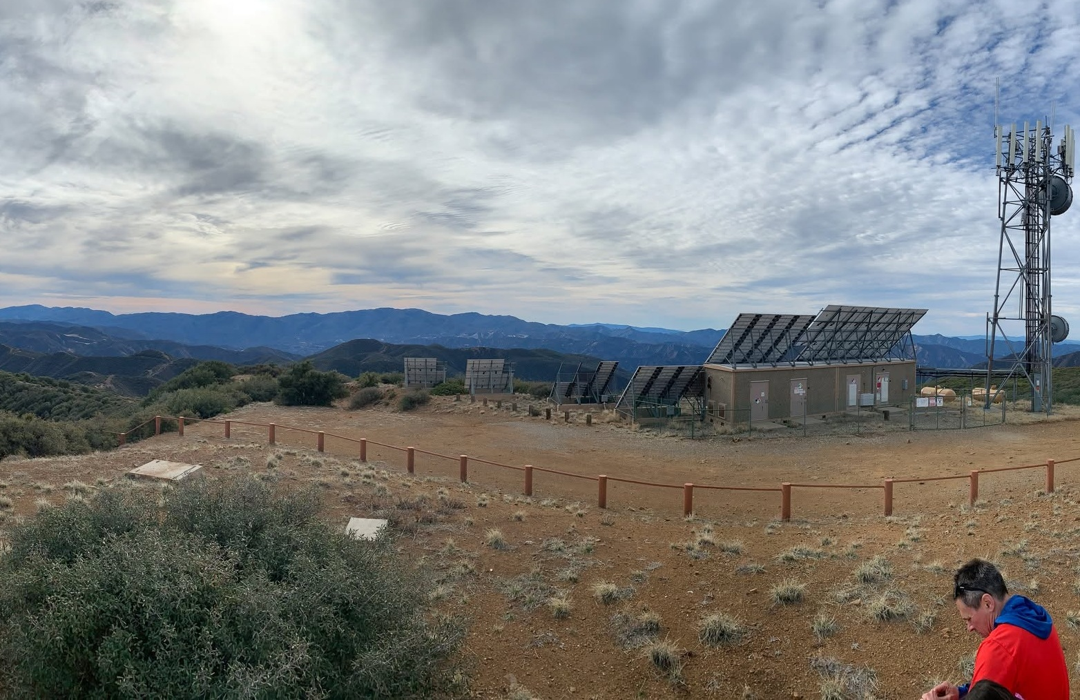
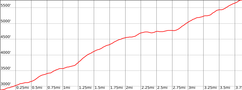
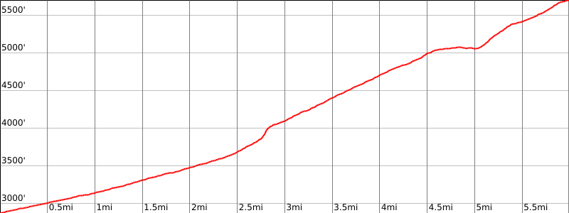
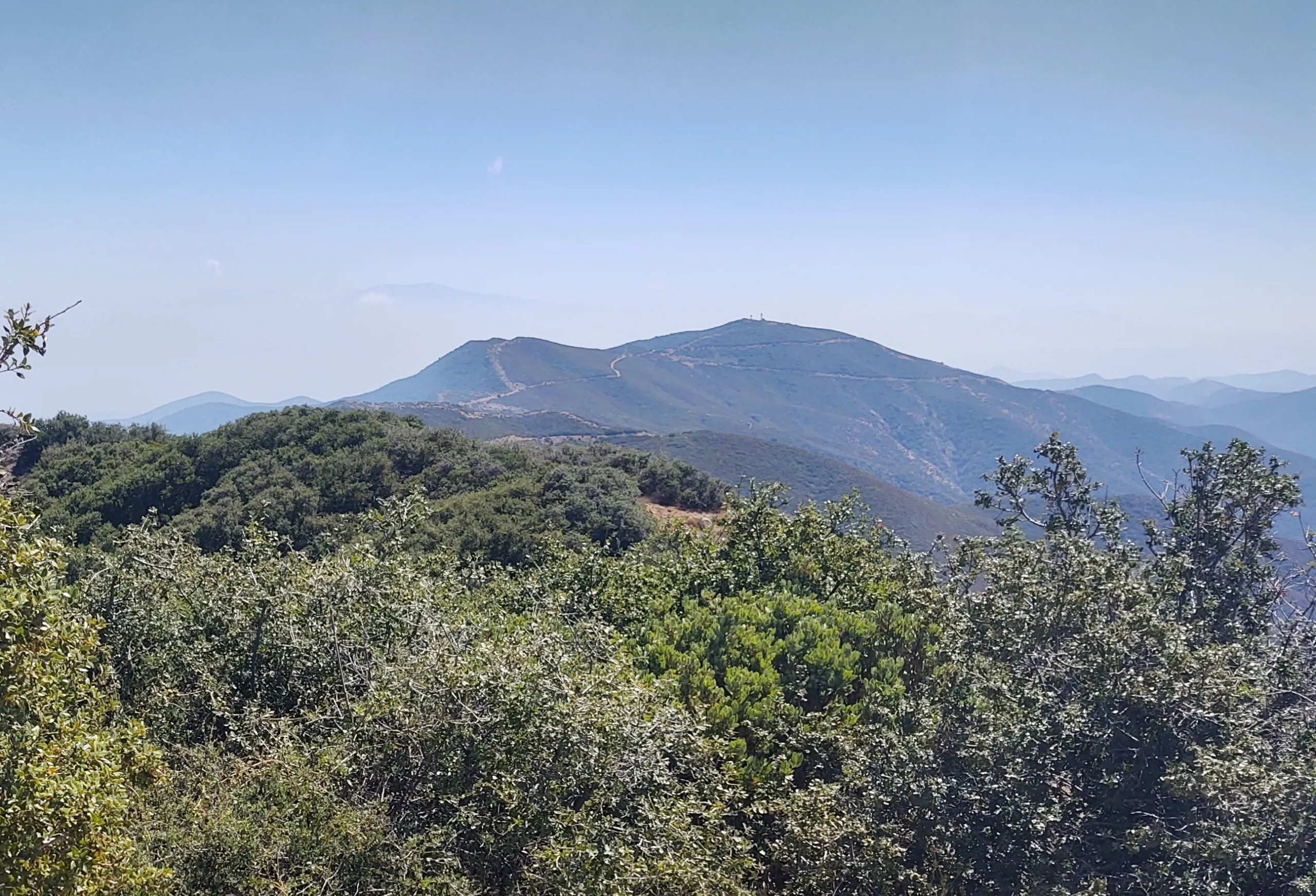
Routes 1 and 2 start at the park, which has a nice campground, picnic area and restrooms. Route 1 is a scenic and enjoyable route that crosses Aliso creek to gain a ridge that ascends across various bumps to the peak with its radio towers. Route 2 also crosses the creek, but then follows along the creek on the Hogpen Trail for a cool and beautiful hike to join the road for a 1.5 mile road walk to the summit. Route 3 is drive-up or near drive-up after a long but scenic drive up tree-lined Sierra Madre Ridge Road. McPherson is usually climbed in conjunction with nearby Peak Mountain; this is often done as one long driving day for both peaks, but misses the beautiful hike from routes 1 and 2. Hiking Peak from McPherson and back (Peak Mountain Route 2) adds 6.5 miles and 1000′ gain.
Maps generated from CalTopo.com, reproduced with permission
Driving route
Drive north on I-5 past the Grapevine, to the SR 166 off-ramp. Turn left (west).
Follow SR 166 about 46 miles to the town of New Cuyama. New Cuyama may also be reached by a shorter but slower route by driving north from Ventura through Ojai on SR 33, and then west on SR 166.
From New Cuyama, drive west on SR 166 for 2.8 miles to Aliso County Park Road (paved). Turn left.
Follow signs about 6 miles to Aliso County Park (campground, no fee). Park here.
Hiking route
From the campground (2880′), hike up the trail which starts up the ridge on the west side (not shown on the topo). It goes southwest along the ridge to join the McPherson Peak Trail, shown on the topo, at 3300′.
Follow this trail to the summit.
Driving route
Same as Driving Route 1.
Hiking route
From the campground (2880′), hike up the trail which starts up the ridge on the west side (not shown on the topo). It goes southwest along the ridge to join the McPherson Peak Trail, shown on the topo, at 3300′.
Follow this trail to the summit.
Route Notes
Driving route
Drive north on I-5 past the Grapevine, to the SR 166 off-ramp. Turn left (west).
Follow SR 166 about 46 miles to the town of New Cuyama. New Cuyama may also be reached by a shorter but slower route by driving north from Ventura through Ojai on SR 33, and then west on SR 166.
From New Cuyama, go west 12.8 miles to the Cottonwood Canyon Road (11N01). Turn left, note your odometer, and go as follows:
At 4.9 miles, fork. Go left. The road narrows here.
At 6.5 miles, White Oak Ranger Station and Campground. Keep straight.
At 6.8 miles, the pavement ends at a gate with a sign “Bates Canyon Road”.
At 12.7 miles, junction with Sierra Madre Road. Turn left (east).
At 17.5 miles, a saddle with a wide parking area on left. This is the trailhead for Peak Mountain.
At 20.6 miles, the summit of McPherson Peak.
Hiking route
Additional Peak Information
The summit area has been developed as an electronic site and is surrounded by a chain link fence. Do not enter the gated area unless the gate is open and permission to pass is available. The register may not be readily found. Hikers should be prepared to place a new register and container.


You must be logged in to upload images.