Peak Name
Elevation
feet
Status
Region
Range
Nearby peaks
Location
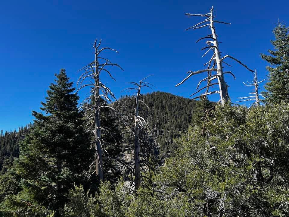
Little San Gorgonio is the second peak, counted east to west, on the Yucaipa Ridge, after Galena, to which it is connected by an exposed third class ridge that has become increasingly dangerous to traverse over time.
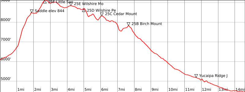
Route 1 starts at the Falls Trailhead in Forest Falls along with the Vivian Creek Trail but soon departs south up a very steep and loose gully to gain a ridge near the summit. Dangerous rockfall is a definite risk here. The route described is the safest based on our experience (deviations from that are worse) but rockfall is likely even when hiked with care. However, it is also the typical starting point of the demanding Yucaipa Ridge Traverse, which is hiked with the least elevation gain from east to west, with a car shuttle to Bearpaw Preserve. The stats given for Route 2 are for this complete traverse.
Maps generated from CalTopo.com, reproduced with permission
Driving route
Take I-10 east past San Bernardino to the Orange Street exit (SR 38).
Go one block east, then go north (left) 0.5 mile to Lugonia Avenue. Turn right on SR 38 (east).
Go about 13.0 miles to the Valley of the Falls Road on the right. Turn right.
Drive up the Valley of the Falls Road for 5 miles to the parking lot at the end of the road.
Hiking route
From the parking lot (6080′), hike east up the road past a locked gate to the road end.
Keeping on the right side of the canyon continue east to a point about 3/4 mile from the parking lot where a large wide gully can be seen to the south. This is the gully just east of Camp Creek.
Hike into this gully for about 0.1 mile to where it forks into two large gullies.
Hike straight ahead (south) up onto the wooded ridge that separates the two gullies.
Hike up this ridge making sure the gravel wash is to your right (west).
Once you are near the top of the gravel wash contour somewhat to your right (west) above the gravel wash until you meet the main ridge. This ridge is the east ridge of Camp Creek Canyon. (Do not attempt to hike up this ridge from Mill Creek as it contains unstable class 3 rocks.)
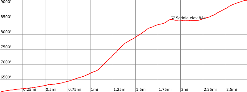
Hike south up this ridge to a small saddle at 8440’+ (UTM 112693 And 27 – see current HPS map).
Cross the saddle and sidehill to the right (south) into a gully, then up the gully to the saddle on Yucaipa Ridge east-northeast of Little San Gorgonio Peak (UTM 113689 NAD 27). The chinquapin is a bit thick in most places.
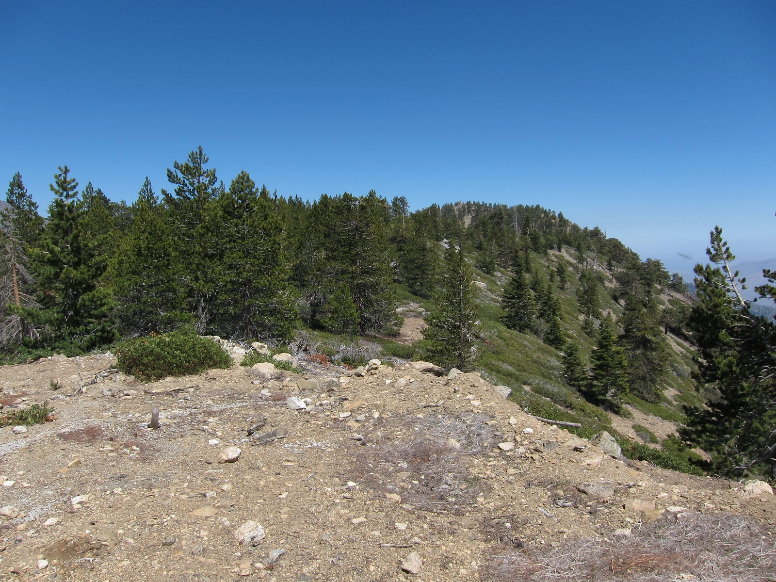
Turn right and hike up the ridge to the summit.
Warning: This route in some places is steeper than the angle of repose and can be very dangerous if one does not mitigate rock fall danger.
Driving route
See the driving instructions for Route 1 above and for Birch Mountain Route 1. This route assumes that you are hiking each peak (5 peaks) along this section of Yucaipa Ridge from east to west. Vehicles will be left at the Birch Mountain Route 1 parking area to complete the shuttle at the end of the hike.
Hiking route
See the hiking instructions for Routes 1 for Wilshire Mountain, Wilshire Peak, Cedar Mountain, and Routes 1 and 2 for Birch Mountain.
Route Notes
This is the start of the Yucaipa Ridge Traverse.
Additional Peak Information
Special conditions: The Yucaipa Ridge Traverse continues west down Yucaipa Ridge past Birch Mountain to the Allen-Birch saddle. To continue on the route you will pass through land owned by the Wildlands Conservancy, which manages the Oak Glen Preserve and Bear Paw Preserve. You must request permission to hike here at least five days in advance. You can find more information about the preserve at wildlandsconservancy.org/preserves/bearpaw.
The Preserve encourages hiking on its land but you must make arrangements at least a few days in advance of your planned hike. Email the Preserve at sbmountains@wildlandsconservancy.org or call the manager of the Bear Paw Preserve at (909) 790-3698. You will receive an email that contains an information form to complete, a liability waiver form for each hiker to fill out and return at the trailhead, and the gate code.
The USGS topo shows a trail starting at Pilgrim Pines Camp in Oak Glen and going up to a point near Cedar Mountain. This trail crosses private property and must be used only with permission. Call Pilgrim Pines at (562) 335-7697 for permission.
Notes: This peak and the four nearby peaks are normally done together as a car shuttle trip. It is possible to descend the ridge from the saddle just east of Birch Mountain to the town of Forest Falls. See the Birch Mountain guide for additional information.


You must be logged in to upload images.