Peak Name
Elevation
feet
Status
Region
Range
Nearby peaks
Location
Nordhoff Ridge Road is now open without permit from 5/15 to 12/15 except when damaged or raining.
Maps generated from CalTopo.com, reproduced with permission
Driving route
Take SR 126 to Santa Paula. Turn north on SR 150. Note your odometer here.
At 8.8 miles the Summit School (unsigned) is on the right. Just before the school, turn right on Sisar Avenue. This is a very narrow and worn paved road. Note your odometer here.
Go past some houses to where the road turns to dirt, keeping right at two forks.
At 0.8 mile a water tank. Low clearance cars should park here.
At 1.0 mile a locked gate. All cars park here.
Hiking route
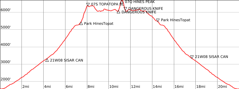
From the parking area (1850′), pass the gate and hike up the road which goes up Sisar Canyon. Continue for about 3 miles to where the road makes its second major switchback to the left.
Look for a trail sign straight in front of you, indicating 2.5 miles to the Nordhoff Ridge Road. Take this trail (21W08) up Sisar Canyon as it passes through the overgrown White Ledge Campsite and on to its junction with the Nordhoff Ridge Road (4N15). That junction is depicted in the extreme southwest corner of the Topatopa Mountains topo.
Turn right on this road and follow it 3.5 miles to its end in a saddle 0.4 mile northwest of Hines Peak.
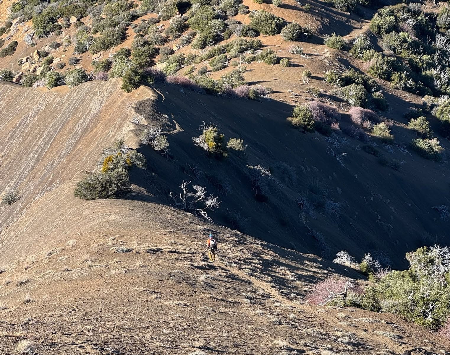
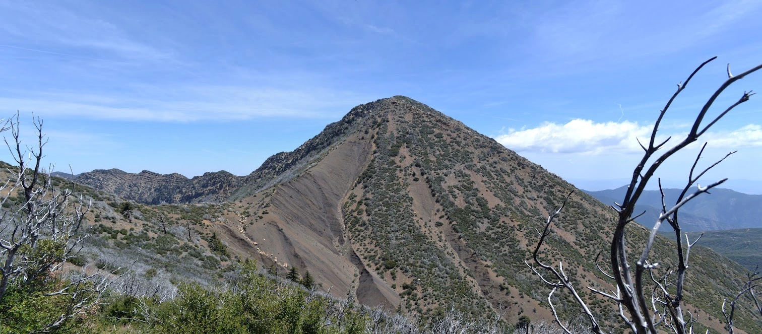
From here go southeast up the narrow ridge following a faint use trail up to the summit. This ridge has steep dropoffs on both sides and has progressively deteriorated over the years. The summit is marked by a sign “Hines Peak”.
Driving route
Take US 101 and SR 33 to the town of Ojai.
From the intersection of SR 150 and SR 33 in Ojai, go north on SR 33 for 14.7 miles to a road on the right signed “Rose Valley – 4”. Turn right.
Go 3.1 miles to a fork on the right. Turn right.
Drive into the campground. There is a road with a locked gate on the west side of the campground. Use the combination supplied with your permit to unlock the gate and lock it behind you. Note your odometer and go as follows:
At 2.2 miles, junction with the Nordhoff Ridge Road (22W15). Turn left (east).
At 3.7 miles, pass through a wire gate.
At 3.9 miles a saddle with a duck on the south side. This is the parking spot for Chief Peak.
At 7.2 miles, fork with a sign “Road Ends 3 Miles”. Keep left.
At 8.4 miles, a sign “Trail 22W08” and road forks. Take the main road (right fork).
At 10.3 miles, a permanent barrier and a sign “Trail 21W08”. Park here (limited parking). There is more parking available 0.1 mile back on bump 5479′.
Hiking route
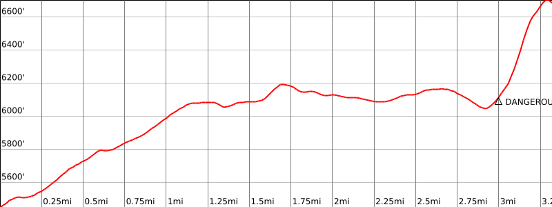
From the parking area (5440+’), hike past the gate east along the road up to saddle 6040+’ and over bump 6204′.
Go down to the next saddle 6040+’ at the end of the road.
From here go southeast up the narrow ridge following a faint use trail up to the summit. This ridge has steep dropoffs on both sides and has progressively deteriorated over the years. The summit is marked by a sign “Hines Peak”.
Route Notes
Additional Peak Information
Special conditions: The Nordhoff Ridge Road (Route 2) is open for driving (4WD vehicles only) under permit from the Forest Service. Contact the Forest Service Office in Ojai for information: (805) 448-4710. Hikers have had trouble with obtaining the correct gate combination. Below are some suggestions made by Sandy Sperling, Byron Prinzmetal and the District Ranger: First of all you need to call ahead of time or visit the Ojai Ranger Station ahead of your planned hike date to obtain your permit and the gate combination. You can not, as of this writing, obtain the permit and gate combination by visiting the ranger station the day you want the permit.
Call or visit the ranger station in Ojai Monday-Friday during business hours as close to your hiking date as possible to verify and re-verify the lock combinations.
Make sure the combination(s) you are given are for the gate you intend to go through and not some other gate.
Be aware that rain closes the gate entirely, and that the lock combinations will change more frequently in the case of rain.
Ask for the previous and next combinations as the combination changes regularly.
You may be fortunate if given the wrong combination to have someone let you in, but you will need to find someone with the correct combination who is willing to give it to you so you can get out.
When you pick up your permit, check all the other permits and permit copies in the pickup box for other combinations. Write these down in case yours doesn’t work.


You must be logged in to upload images.