Constance Peak is a small bump that rises over the pretty hamlet of Angelus Oaks, with a store and a restaurant. It is a peak that hikers often take a quick hike up on their way to or from other peaks in the area, but it itself a worthy destination, a pleasant hike through forest with panoramic summit views.
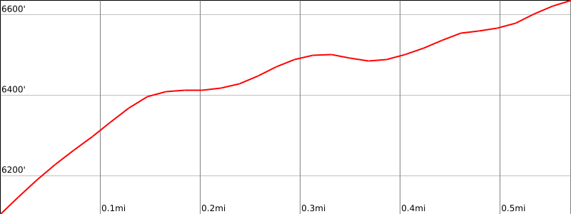
Route 1 is a 1-1/2 mile round trip along the summit ridge, with nice views of the surrounding forest.
Maps generated from CalTopo.com, reproduced with permission
Take I-10 east past San Bernardino to the Orange Street exit (SR 38).
Go one block east, then go north (left) 0.5 mile to Lugonia Avenue. Turn right on SR 38 (east).
Continue east on SR 38 about 20 miles to Angelus Oaks.
Here, turn left onto 1N12, Thomas Hunting Ground Road, just past the wide store parking area on the left. Note your odometer and go as follows:
At 0.1 mile, fork. Keep right.
At 0.45 mile, fork. Keep right.
At 1.1 miles, fork. Go left.
At 1.4 miles, the road goes over a saddle to the east side of the ridge. Park right before the saddle at the only parking spot for several cars for 1/2 mile in either direction.
Hiking route
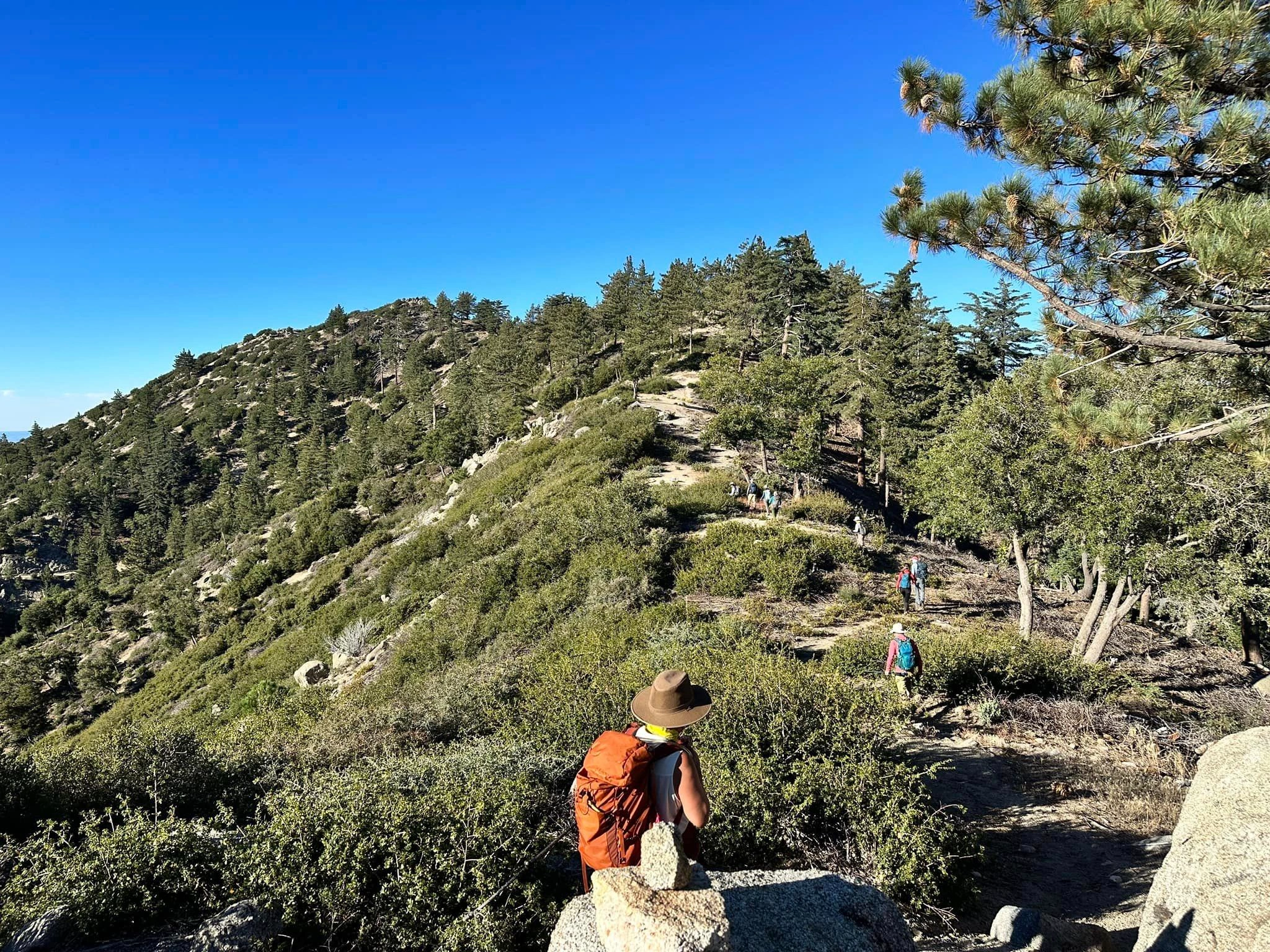
From the parking area (6100′), hike up the ridge that heads south, meeting a use trail that stays generally to the right (northwest) of and slightly below the ridgeline.
The use trail goes steeply up to a minor bump, then turns southwest and continues over a larger bump until it drops into an obvious saddle that lies just north of the summit area.
Cross over this final saddle and find a use trail that ascends south to the summit through occasional brush.