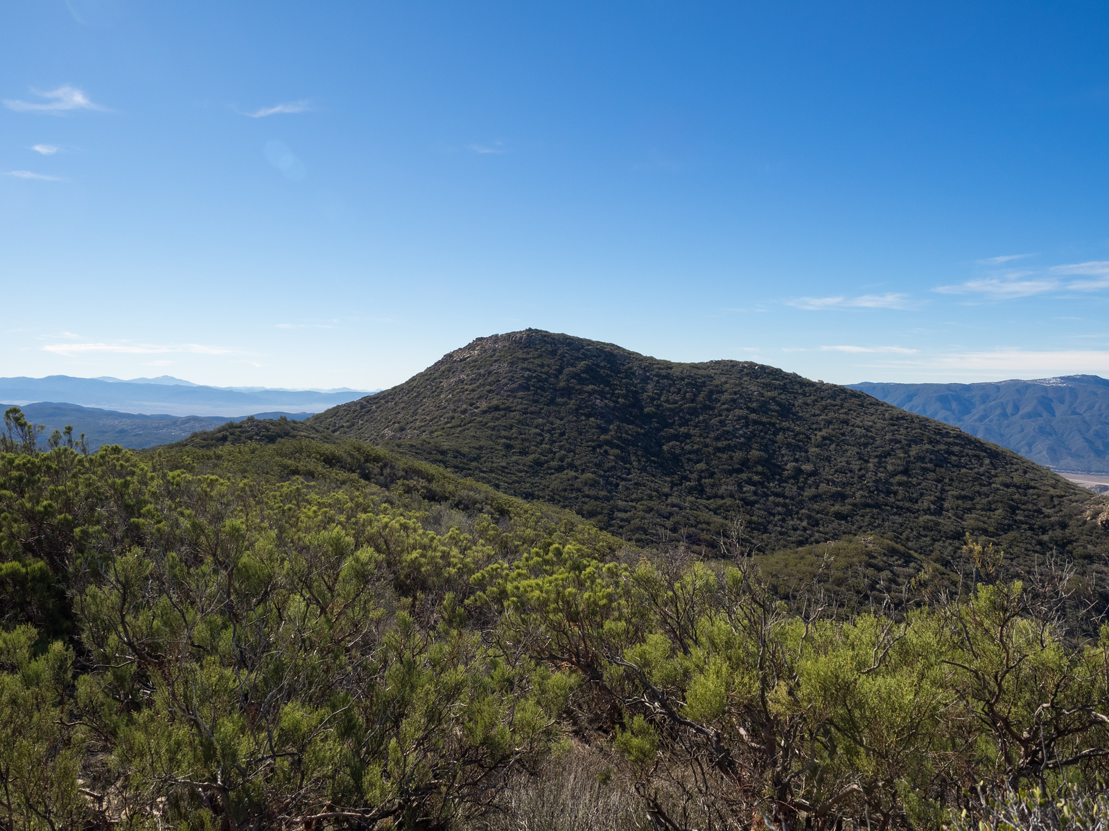
The enigmatically named Beauty Peak and its neighbor Iron Spring Mountain lie at the southernmost end of Riverside County, as it transitions into San Diego County and continues southward to Anza Borrego. They have unique panoramas, with the Desert Divide to the north, Palomar High Point to the southwest, and Hot Springs Mountain, the highest point of San Diego County, to the southeast. The two peaks are typically hiked together. Route 1 is a pretty hike that winds around chaparral on old road, trail and use trail up a gully then on to the final ridge on faint use trail, that can be quite brushy. Add a side trip to Iron Spring from the dam and your day is complete.
Maps generated from CalTopo.com, reproduced with permission
6 miles round trip cross-country (8.5 miles combined with Iron Spring Mountain); brushy, very brushy if not maintained
Estimated time
4-5 hours round trip (7-8 hours combined with Iron Spring Mountain)
Route Rating
Class 1, moderate
Leader Rating Required
“I”, normal conditions
Driving route
Take I-15 south to Temecula.
Take the South SR 79 exit. This is the second of two SR 79 exits. It says 79 South. Please make sure you have enough gas. There are plenty of gas stations along SR 79 for the first 2 miles or so.
Go east on SR 79 17.4 miles to Aguanga. Turn left on SR 371.
Go northeast 6.3 miles to Bradford Road. Turn right on paved road (not the dirt road immediately before). Note your odometer and go as follows:
At 1.1 miles, Bradford Road turns right and is named Tule Valley Road.
At 1.5 miles, go left (east) on Hernley Road (dirt). At 3.5 miles the road name changes to Elder Creek Road.
At 5.0 miles there is a “T” junction, turn right (south) on Bonny Lane.
At 5.7 miles, junction. Go left (east) on Tule Peak Road.
At 6.5 miles there is a pull off on the right, just past a cable box on the right side of the road, and opposite two roads going north. Park here.
Hiking route
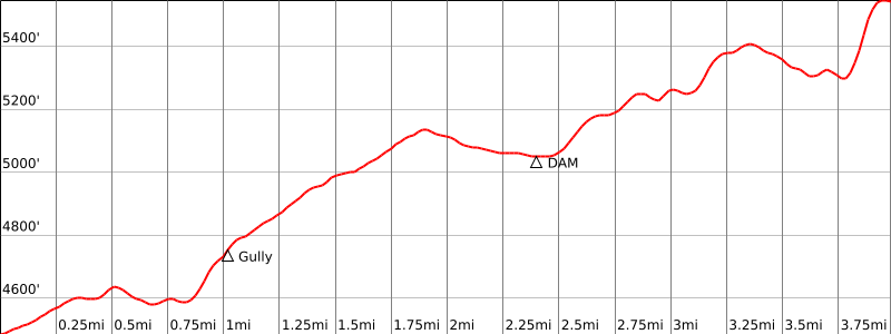
(UTM 269033 and 27). There is an old road on the right that heads southeast. From the parking area (4450′), hike along this old road (about 1/3 mile) to its end at UTM 273029 and 27.
Hike west over a hillock, avoiding brush, to the base of the major gully (0.6 mile) that runs north-south (UTM 270026 and 27).
Go up the left side of the gully (at a possible duck) until you get past a dry waterfall.
Then continue south along the gully to where it forks at an open area just before a fence (1.3 miles).
Take the right fork, cross the fence, and follow the gully southwest over a shallow saddle (brushy).
Go south down another gully to a low earthen dam with a road on it (1.8 miles). This is turnoff for Iron Spring Mountain.
Turn right (west) onto the road and hike uphill about 1/4 mile to where the road tops a ridge and starts down (2.1 miles).
Leave the road here and follow a (hopefully) clipped use trail on the ridge south over a couple of bumps, into a saddle, and up to the summit (3.0 miles).
Peak combinations: The peak is usually climbed with Iron Spring Mountain.
Alternate routes: Another way to get to Beauty Peak is from the south. Take Highway 79 through Oak Grove. Turn onto the Chihuahua Valley Road. This is a paved highway. About 3 miles east will be a turn-off to the left. It is not signed, but there may be an old wagon with the name of a ranch or farm on it at the turn-off. This is the beginning of the Cooper-Cieniga Truck Tail. This is a dirt road, but is in pretty good shape. It skirts the east side of Beauty Peak. You can hike into Beauty Peak and Iron Mountain from this truck trail, which appears on the topographic maps.
Special conditions: With the passage of time brush grows and regrows. The hiker should be prepared to find the route overgrown with brush and the clipped route obscured. Conditions in the field are dynamic and changes over time are to be expected.
Seasonal tick blooms have been observed in the major gully. Light-colored clothing and frequent inspections are recommended.
Special conditions: With the passage of time brush grows and regrows. The hiker should be prepared to find the route overgrown with brush and the clipped route obscured. Conditions in the field are dynamic and changes over time are to be expected. Seasonal tick blooms have been observed in the major gully. Light-colored clothing and frequent inspections are recommended.