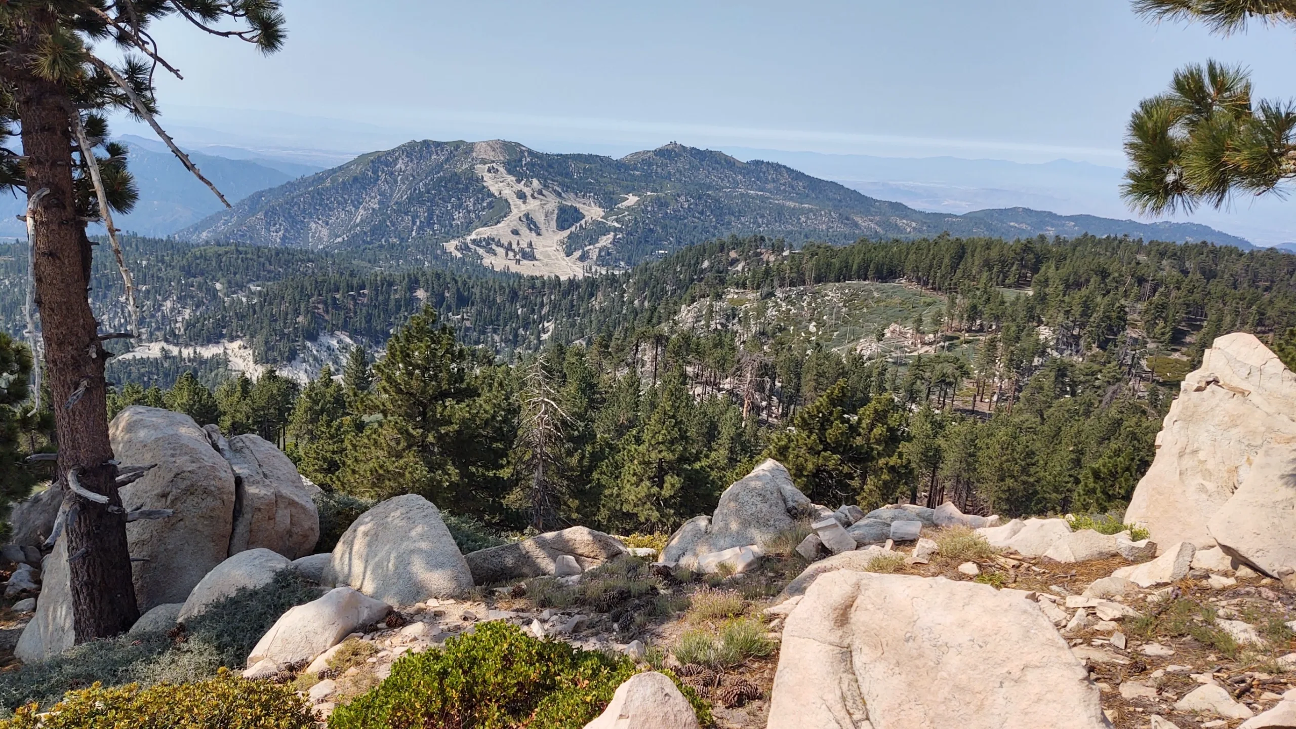
Slide is an easy hike with wonderful views of the surrounding San Bernardino Mountains. There are the remains of old ski lifts on top. Slide is usually hiked in combination with nearby Keller and Mill, all of which can be reached on paved road.
Route 1 follows use trail and old road to the peak. One can also approach over a bump from the southwest.
Maps generated from CalTopo.com, reproduced with permission
Drive east on I-10 to I-215.
Go north on I-215 to SR 210.
Go east on SR 210 to SR 330.
Go north on SR 330 to Running Springs. Continue towards Big Bear on SR 18.
Go 1.0 miles to the paved Keller Peak Road, 1N96, on the right (south). Turn right. Note your odometer and go as follows:
At 0.5 mile, fork with dirt road to the right. This is the turnoff for Mill Peak. Keep left.
At 4.0 miles, fork. Go right.
At 4.2 miles, the road passes through a gully. Park here. Parking is limited.
Hiking route
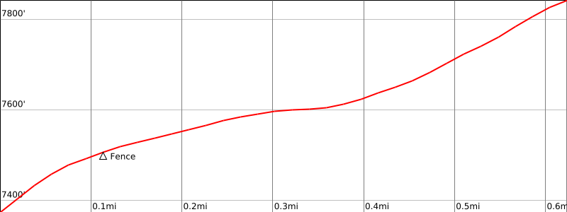
From the parking area (7380′), hike east up the gully to the top of the ridge.
Turn left and hike northeast up the ridge to a fence.
Pass under the fence and continue to a road.
Turn right on the road and follow it through two switchbacks up to the summit. The register is in the rockpile behind the ski lift tower.