Cucamonga Peak

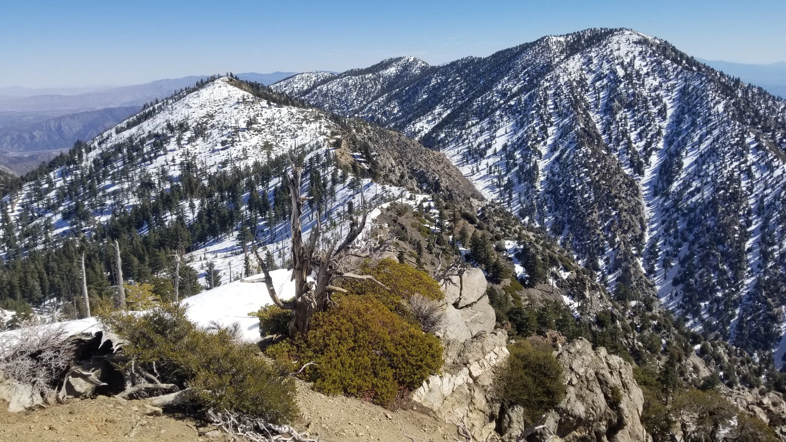
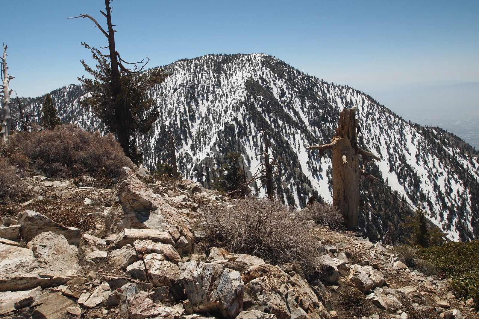
Cucamonga Peak, taken from Bighorn, Photo by Kathy Wing.

Peak Name

Cucamonga Peak
17E

Elevation

8859

 feet

Status

active

Region

Cucamonga Peak Area

Range

San Gabriel Mountains

Nearby peaks

Location

34.2227845,-117.5850533

Description

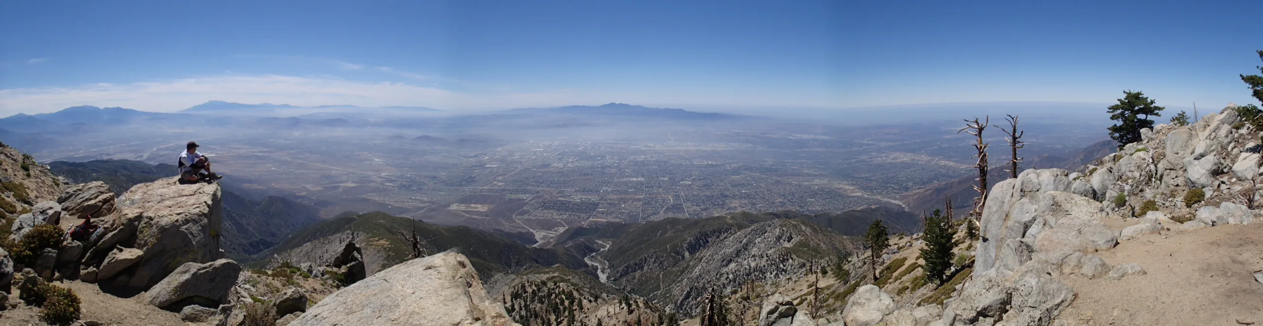
Cucamonga Peak is the most prominent of the three peaks sitting above the 210 and 15 freeways. The views from the top include the broad Inland Empire stretching towards the distant Saddleback profile; and the spectacular Three Sans (San Antonio, San Gorgonio, and San Jacinto) beckoning for more than a view. At 18 miles and 4800′ gain, this hike is for the well-conditioned experienced hiker.

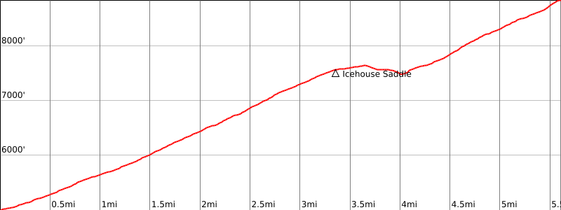
Route 1 begins at the Icehouse Canyon Trailhead and follows a beautiful forested trail, starting alongside a wonderfully sonorous creek and climbing to a scene-studded ridgeline with steep canyons dropping deeply below rugged cliffs. The trail rises and falls between Icehouse Saddle and Cucamonga Saddle and then climbs to the top. There is a right turn near the top up what appears to be a drainage. There are use trails and sometimes signage, but don’t count on it. It is easy to miss this turn and end up at Etiwanda Peak. Adding Etiwanda, Bighorn and/or Ontario Peaks can make a challenging day even more so. This area is VERY dangerous in winter conditions. The trails to both Cucamonga Peak and Ontario Peak are in the shade most of the day and they turn into sheets of ice. Route 2 starts from the east off of the I15 in the Lytle Creek area and winds its way around steep ridges to Etiwanda and Cucamonga.

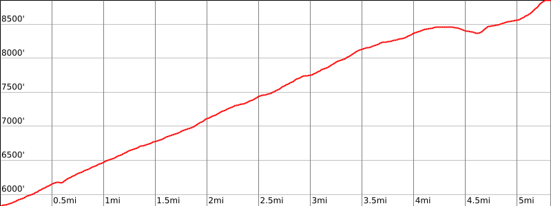
Maps generated from CalTopo.com, reproduced with permission

Route 1- From Icehouse Canyon
Elevation Gain
4200′
Navigation Difficulty
Easy
Distance
14 miles round trip on trail
Estimated time
8-9 hours round trip
Route Rating
Class 1, strenuous
Leader Rating Required
“O”, normal conditions

Driving route

Take the 210 freeway east to Baseline Road exit in the City of Claremont. Turn left (west) at the bottom of the off-ramp onto Baseline Road.
Almost immediately, take the first right (north) onto Padua Ave.
Go 1.8 miles north on Padua to the intersection with Mount Baldy Rd. Turn right (northeast).
Take this road northeast and then north about seven miles to Mt. Baldy Village.
Continue another two and a half miles (through Baldy Village) to a fork at Icehouse Canyon. Turn right.
Go a short distance to a parking lot. Park here.

Hiking route

From the parking area (5000′), trail 7W07 starts just to the right of the old Icehouse Lodge foundation.
Hike up this trail about 3/4 mile to a trail junction with the Chapman Trail.
Continue straight up the canyon past Columbine Spring to another junction with the Chapman Trail.
Turn right and follow the trail up to Icehouse Saddle. It is also possible to take the Chapman Trail. It adds about 1 1/2 miles to Icehouse Saddle.
Take trail 7W04 which goes southeast toward Cucamonga Peak.
Follow it along the east side of Bighorn Peak, through a saddle, and up switchbacks.
At the top of the switchbacks there is a trail junction with a sign “Cucamonga Peak”. Take the trail to the right up to the summit.

Route Notes

Printable Route

Road Type

Paved

Google Maps Link to Trailhead 

Route 2- From South Fork Lytle Creek
Elevation Gain
3200′
Navigation Difficulty
Easy
Distance
13 miles round trip
Estimated time
7-8 hours round trip
Route Rating
Class 1, strenuous
Leader Rating Required
“O”, normal conditions

Driving route

Take I-10 east and I-15 north to Sierra Avenue. Turn left at the bottom of the off-ramp.
Go 1.6 miles to a dirt road on the left. Turn left. Note your odometer and go as follows:
At 1.0 mile, junction at a power line. Go straight.
At 5.6 miles, fork with 1N36 (closed) on the left. Keep straight.
At 7.7 miles, fork. Keep straight. (This is the turnoff for San Sevaine.)
At 9.5 miles, fork. Keep right. (This is the parking spot for Buck Point.)
At 11.6 miles, fork. Turn right into the Joe Elliot Tree Memorial. Park here.
The road may become too rough for 2WD vehicles past the 8.2 mile point.

Hiking route

From the parking area (about 6000′), hike up the road which becomes a trail.
At the Wilderness boundary, the trail forks. Take the right fork.
Continue to about 8300′ where the trail reaches a saddle south of elevation 8386′. This is the turnoff for Etiwanda Peak.
Continue on the trail another 1 3/4 miles to a trail fork with a sign “Cucamonga Peak”. Take the left fork up to the summit.

Route Notes

Notes: The road from Sierra Avenue is closed except in the fall season. Contact the USFS (see below) for details.
Lytle Creek Ranger Station
San Bernardino National Forest
Star Route 100
Fontana, CA 92336
(909) 382-2851

Printable Route

Road Type

High-clearance

Google Maps Link to Trailhead 

Additional Peak Information

Special conditions: Cucamonga Peak is in the Cucamonga Wilderness. A permit is required. Day use and overnight permits can be reserved through the San Gorgonio Wilderness Association on their web site swga.org.

Historical notes: This summit is named for the great Rancho Cucamonga (est. 1839) in the valley to the south. That, in turn, is an old Shoshonean place name which anthropologists tell us could mean any of (1) sandy place, (2) place of many springs, or (3) lewd woman, from a legend that an Indian Chief sent his wayward daughter to live on the peak.

Nearby Peaks

Backus Peak
Owens Peak
Black Mountain #5
Morris Peak

External Links

mountain 1

Peakbagger.com

Click Here

ranger-tower 1

Nearest ranger station

Click Here

g311

NOAA Forecast

Click Here

worldwide 1

Google Earth

Click Here

Photo Gallery