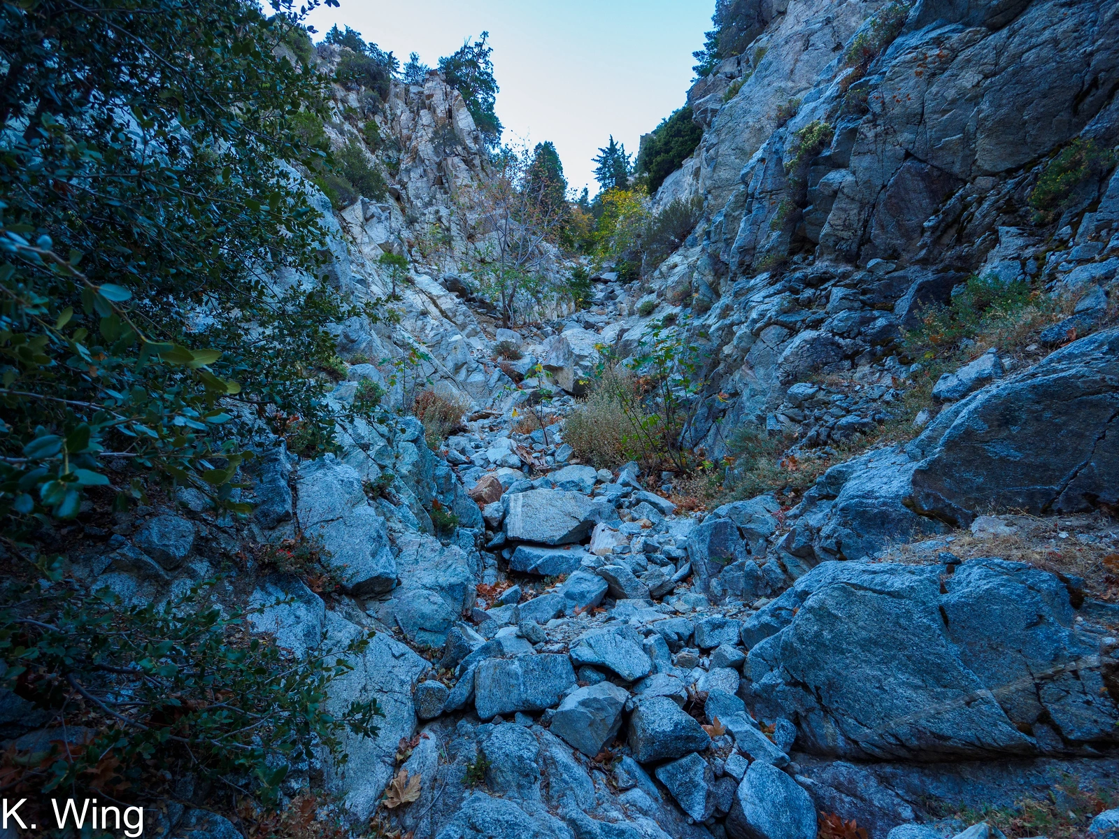
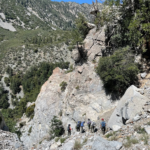
Falling Rock Canyon on the way to Sugarloaf, photo by Kathy Wing
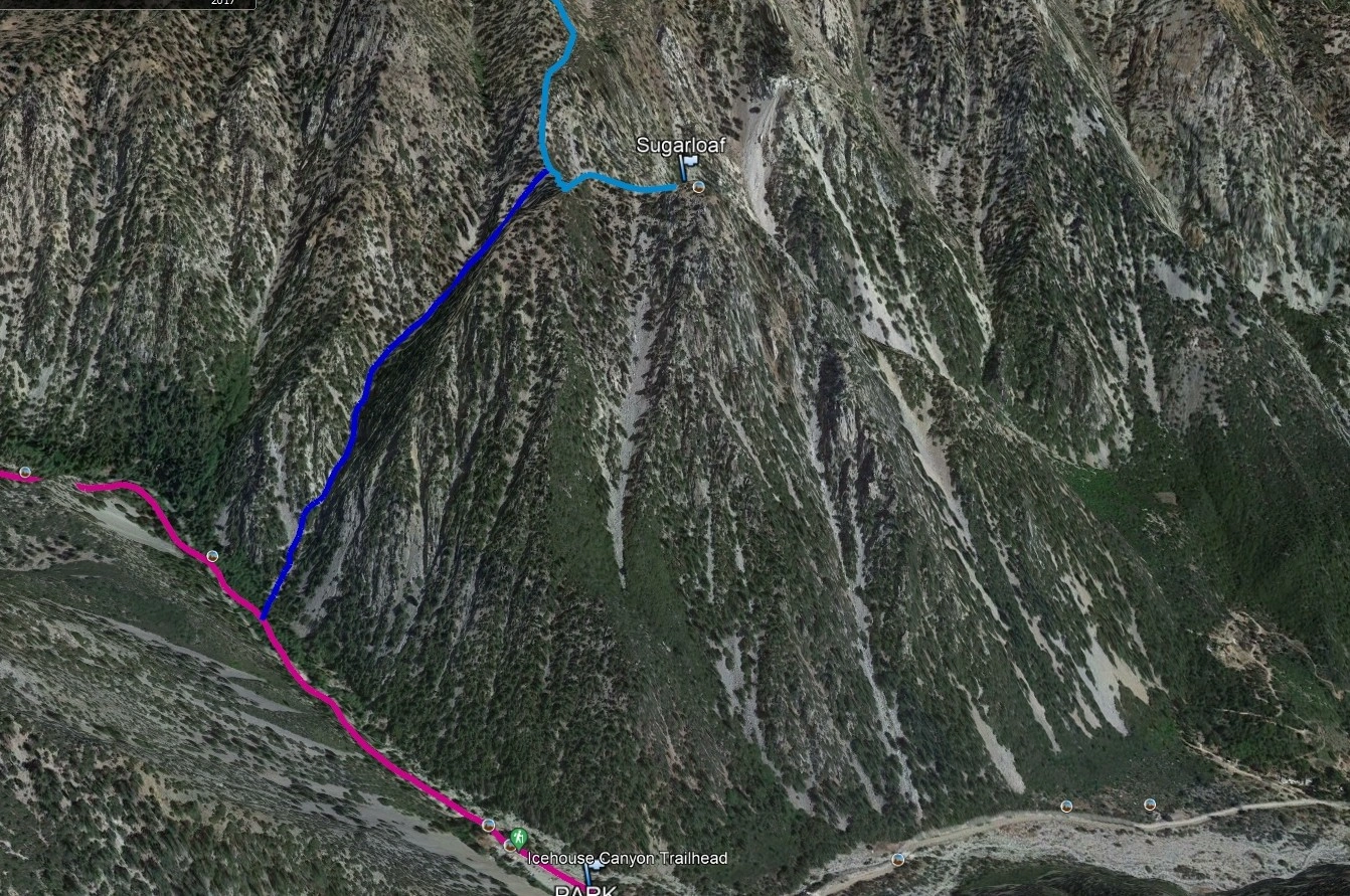
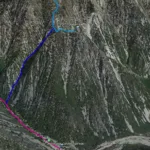
Sugarloaf Peak, photo by Google Earth
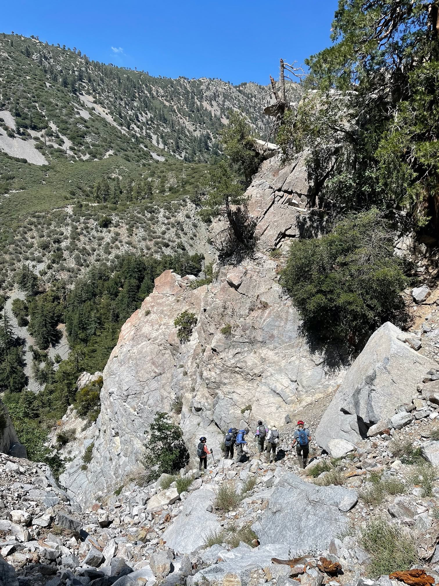
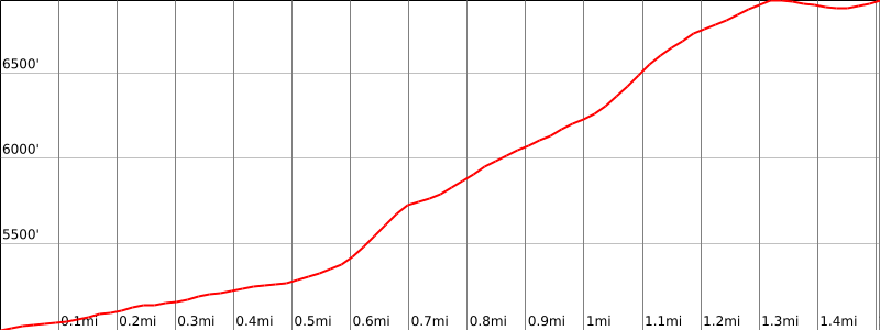
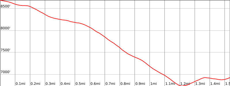
Falling Rock Canyon, descending from Sugarloaf Peak, photo by Bill Simpson


Peakbagger.com

Nearest ranger station

NOAA Forecast

Google Earth


