Mount Hillyer

Mount Hillyer, Photo by Google Earth.

Peak Name

Mount Hillyer
10I

Elevation

6200

 feet

Status

active

Region

Pacifico Mountain Area

Range

San Gabriel Mountains

Nearby peaks

Location

34.3494435,-118.015901

Description

This unassuming peak has quite a colorful history, as recounted in the summit history, including being one of the hideouts of the notorious outlaw Tiburcio Vasquez. The peak has lovely views of Pacifico Mountain to the north and the Chilao area and the peaks of the Angeles front country to the south. It is often hiked in conjunction with Bare Mountain or other nearby peaks.
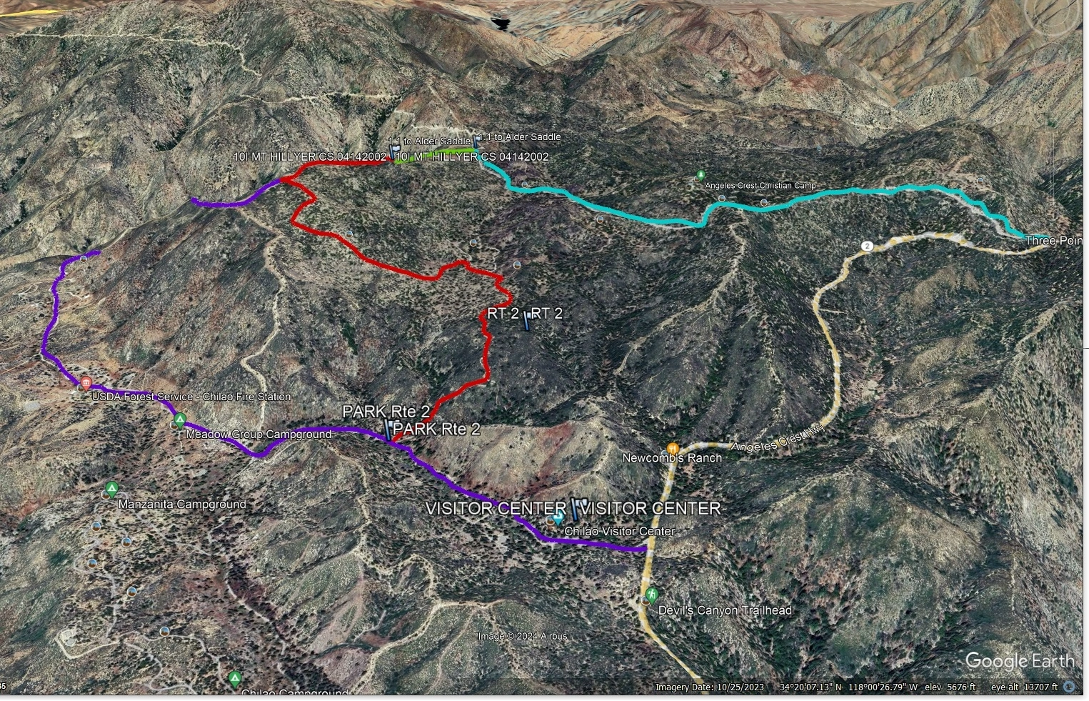
Route 1 starts from Angeles Crest Highway and follows the Silver Moccasin Trail. It is an easy hike that is quite scenic and enjoyable. Route 2 starts from Santa Clara Divide Road, for a short hike along a ridge. This road is sometimes closed during bad weather.

Maps generated from CalTopo.com, reproduced with permission

Route 1
Elevation Gain
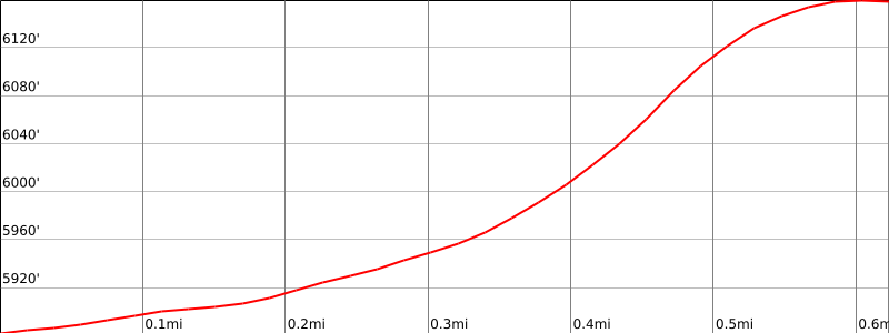
300′
Navigation Difficulty
Easy
Distance
1.5 miles round trip on trail
Estimated time
1 hour round trip
Route Rating
Class 1, easy
Leader Rating Required
“O”, normal conditions

Driving route

From the intersection of Angeles Crest Highway and I-210, drive north on Angeles Crest Highway for 26.5 miles to the intersection with Sulphur Springs Road (Three Points). Turn left (north).
Drive 2.8 miles to a parking area on the left side of the road. Park here.

Hiking route

From the parking area, hike southwest on an old dirt road which becomes a trail.
Follow this trail south up to the summit which is just before the trail turns left and goes downhill.
The register is located in a pile of rocks off to the right just before this point.

Route Notes

Printable Route

Road Type

Paved

Google Maps Link to Trailhead 

Route 2
Elevation Gain
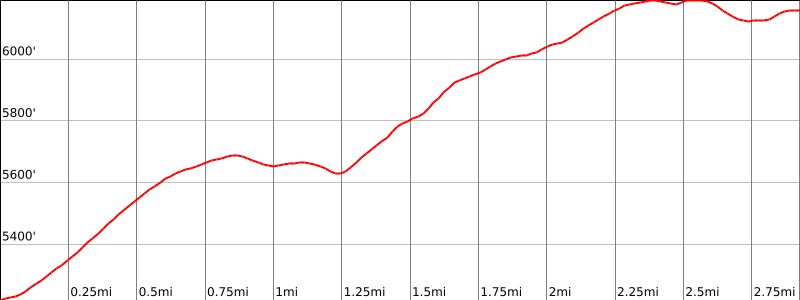
900′
Navigation Difficulty
Easy
Distance
6 miles round trip on trail
Estimated time
3 hours round trip
Route Rating
Class 1, easy
Leader Rating Required
“O”, normal conditions

Driving route

From the intersection of Angeles Crest Highway and I-210, drive north on Angeles Crest Highway for just under 26 miles to the entrance to the Chilao Flats Visitor Center. Turn left (west).
Drive 0.5 mile past the Visitor Center to a parking area at the Silver Moccasin Trail, 11W06. Park here.

Hiking route

From the parking area (5240′), hike north 1 1/2 miles on the trail to where it goes through Horse Flats Campground.
Continue on this faint trail as it goes west and then north up to the summit.

Route Notes

Printable Route

Road Type

Paved

Google Maps Link to Trailhead 

Additional Peak Information

Special conditions: The summit is the southernmost of the two 6200′ contours on the topo despite the fact that elevation 6162′, 0.3 mile to the northeast, is shown on the topo as the summit.

Nearby Peaks

Backus Peak
Owens Peak
Black Mountain #5
Morris Peak

External Links

mountain 1

Peakbagger.com

Click Here

ranger-tower 1

Nearest ranger station

Click Here

g311

NOAA Forecast

Click Here

worldwide 1

Google Earth

Click Here

Photo Gallery