Little Berdoo Peak

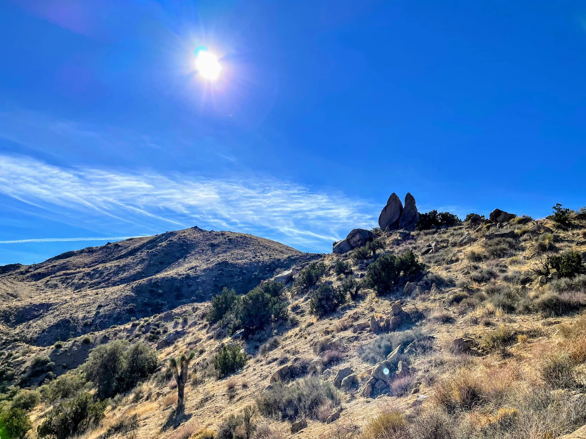
Little Berdoo Peak, Photo by Sunny Yi.

Peak Name

Little Berdoo Peak
26G

Elevation

5440

 feet

Status

active

Region

Little San Bernardino Mountains

Range

Joshua Tree Ranges

Nearby peaks

Location

33.8613,-116.088963

Description

Little Berdoo and its nearby cousin Bernard Peak are two of Joshua Tree National Park’s more remote peaks. Although the park extends far south from here, in this area we are already far into the transition from Mojave to Colorado desert, with ocotillo, mallow, and barrel and other varieties of cactus less commonly seen further north in the park. The rock has also changed. The iconic quartz monzonite seen ubiquitously elsewhere and so loved by climbers is rare here (and there is not a single climbing route for miles). The solitude is palpable, which adds to the experience. There are a wealth of views from the summit, San Gorgonio, San Jacinto, Palm Springs, and the Salton Sea among them. Berdoo and Bernard are typically hiked together.

Route 1 starts up a pretty canyon, leaving it to follow the southeast ridge of Bernard to its summit, then descends and climbs again to Little Berdoo’s north ridge. Route 2 follows a sandy wash (in common with Bernard Route 2), exiting it to ascend a gully to the summit ridge. There are various route combinations, and Routes 1 and 2 can be combined for a loop hike with a short road walk or car shuttle.

Maps generated from CalTopo.com, reproduced with permission

Route 1
Elevation Gain
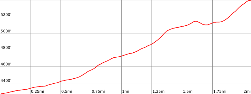
1400′
Navigation Difficulty
Moderate
Distance
5 1/2 miles round trip cross-country
Estimated time
3 hours round trip
Route Rating
Class 1, easy
Leader Rating Required
“I”, normal conditions

Driving route

Take I-10 east past Banning to the intersection with SR 62.
Go north on SR 62 to the Park Road in the town of Joshua Tree with a sign “Joshua Tree National Park”. Turn right. Pay fee at entrance station.
Drive 16 miles on this road to the intersection with the Keys View Road. Keep left.
Continue 5.3 miles on the Loop Road to the Geology Tour Road on the right (south). This dirt road also goes to Squaw Tank. Note your odometer and go as follows:
At 5.6 miles, fork. Go left (one way road) and cross a dry lake.
At 7.9 miles, fork. Go left (south) on Berdoo Canyon Road.
At 11.4 miles, fork. Go straight.
At 12.5 miles, the road crosses a wash just before the end of a ridge on the right. Park here. Parking is limited.

Hiking route

From the parking area (4270′), hike northwest up the wash 3/4 mile to a shallow saddle.
Turn right and follow the ridge northwest about a mile over one bump and up to a point just south of Bernard.
From here hike southwest along the ridge about a mile over one bump to the summit.

Route Notes

National Park Service entrance fee is required.

Printable Route

Road Type

High-clearance

Google Maps Link to Trailhead 

Route 2
Elevation Gain
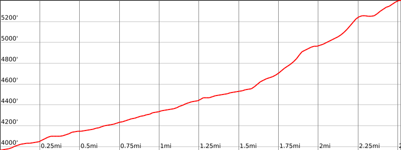
1500′
Navigation Difficulty
Moderate
Distance
6 miles round trip cross-country
Estimated time
3-4 hours round trip
Route Rating
Class 1, easy
Leader Rating Required
“I”, normal conditions

Driving route

Take I-10 east past Banning to the intersection with SR 62.
Go north on SR 62 to the Park Road in the town of Joshua Tree with a sign “Joshua Tree National Park”. Turn right. Pay fee at entrance station.
Drive 16 miles on this road to the intersection with the Keys View Road. Keep left.
Continue 5.3 miles on the Loop Road to the Geology Tour Road on the right (south). This dirt road also goes to Squaw Tank. Note your odometer and go as follows:
At 5.6 miles, fork. Go left (one way road) and cross a dry lake.
At 7.9 miles, fork. Go left (south) on Berdoo Canyon Road.
At 11.4 miles, fork. Go straight.
At 12.5 miles, the road crosses a wash just before the end of a ridge on the right. This is the parking spot for Route 1.
Continue south 0.5 mile. Park where convenient.

Hiking route

From the parking area (4150′), hike west-northwest across a number of small gullies to a large sandy wash, shown as an intermittent stream on the topo.
Go northwest up this wash about 1 1/2 miles, ignoring all side gullies, to where it narrows down and divides into two washes, one heading north (with a dead tree in it), and the other heading west. There may ducks on each side of the wash at this point. The wash heading west heads for Little Berdoo. The wash heading north heads for Bernard.
Ascend the west fork to a saddle just north of Little Berdoo. Turn left (south) and go up to the summit.

Route Notes

National Park Service entrance fee is required.

Printable Route

Road Type

High-clearance

Google Maps Link to Trailhead 

Additional Peak Information

Notes: This peak is normally done as a loop trip in combination with Bernard Peak. Route 2 statistics for the loop: about 6 1/2 miles, 1800′ gain.

Nearby Peaks

Backus Peak
Owens Peak
Black Mountain #5
Morris Peak

External Links

mountain 1

Peakbagger.com

Click Here

ranger-tower 1

Nearest ranger station

Click Here

g311

NOAA Forecast

Click Here

worldwide 1

Google Earth

Click Here

Photo Gallery