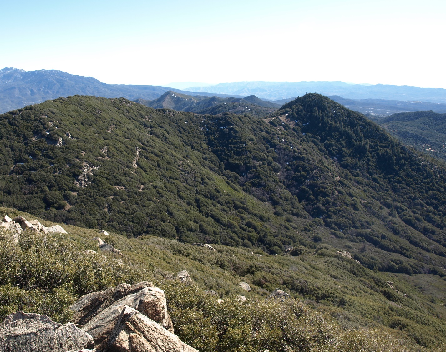
Now reaching the lower half of the Desert divide, we find Lion and its companions Pyramid and Pine #2 along the Pacific Crest Trail. Lion overlooks Garner Valley and the HPS peaks Butterfly and Rock Point. The San Jacinto high country now seems more distant, and the Santa Rosa Mountains to the south nearer. Lion is usually hiked together with its neighbors Pine and Pyramid, or other peaks on the Desert Divide.
Route 1 starts from the Cedar Springs Trail near Morris Ranch and ascends to the PCT past Pyramid Peak and a short distance off-trail to the peak.
Maps generated from CalTopo.com, reproduced with permission
Go south on I-215 to the Ramona Expressway. Turn left (east).
Go east and then southeast on the Ramona Expressway until it ends at SR 74. Turn left (east).
Go east on SR 74 to Mountain Center.
Continue east on SR 74 for 8.7 miles to Morris Ranch Road on the left at a fire station. Turn left.
Go north on Morris Ranch Road for 3.7 miles to an iron gate on the right with a sign “Cedar Springs Trail”. Park off the pavement near this spot.
Hiking route
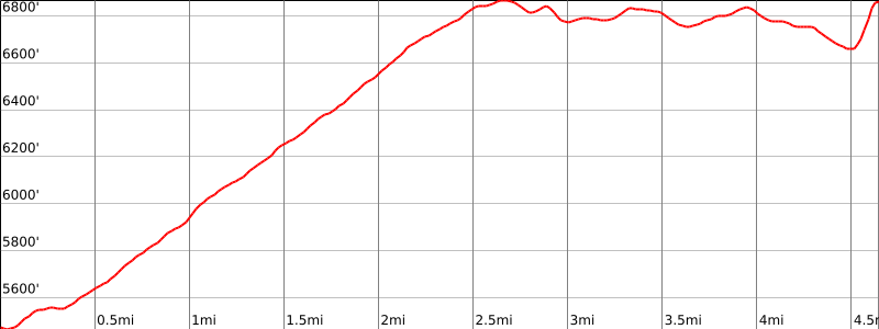
From your parking spot, hike down the road to the trailhead (5430′).
Go through the gate. (There are several gates on this trail. Be sure to close each gate as you pass through it.) Immediately on the left is another gate. Ignore it. It is another access to the trail for equestrian riders in the area.
Continue up the road past a water tank to another gate. The trail turns left just before the gate.
Soon you come to another gate. Go through this gate. Here you leave the fences behind as this is the National Forest boundary.
Continue up the road as it becomes a trail and it begins to climb until you come to another gate. This is not a boundary but is part of a cattle drift fence. This keeps range cattle out of selected sections of the National Forest.
Continue up to a saddle at 6800′-. This is the junction of the Cedar Springs Trail and the Pacific Crest Trail (PCT) on the Desert Divide.
Turn right on the PCT and follow it east and then south until you reach a saddle just southeast of Pyramid Peak. This is the turnoff for Pyramid Peak.
Continue on the PCT about 1/4 mile to a trail on the left marked by ducks. This is the turnoff for Pine Mountain #2.
Continue on the PCT past a high point (6880’+) and down to the saddle northeast of Lion Peak.
Leave the PCT and follow a use trail up to the summit.