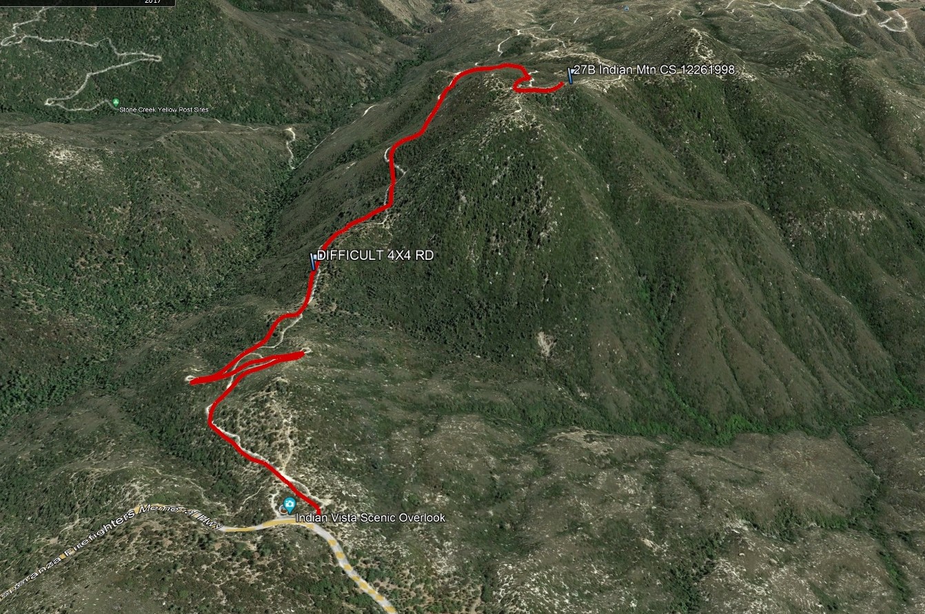
Indian Mountain

Indian Mountain, Photo by Google Earth.

Peak Name

Indian Mountain
27B

Elevation

5790

 feet

Status

active

Region

San Jacinto Area

Range

San Jacinto Mountains

Nearby peaks

Location

33.7816861,-116.7886306

Description

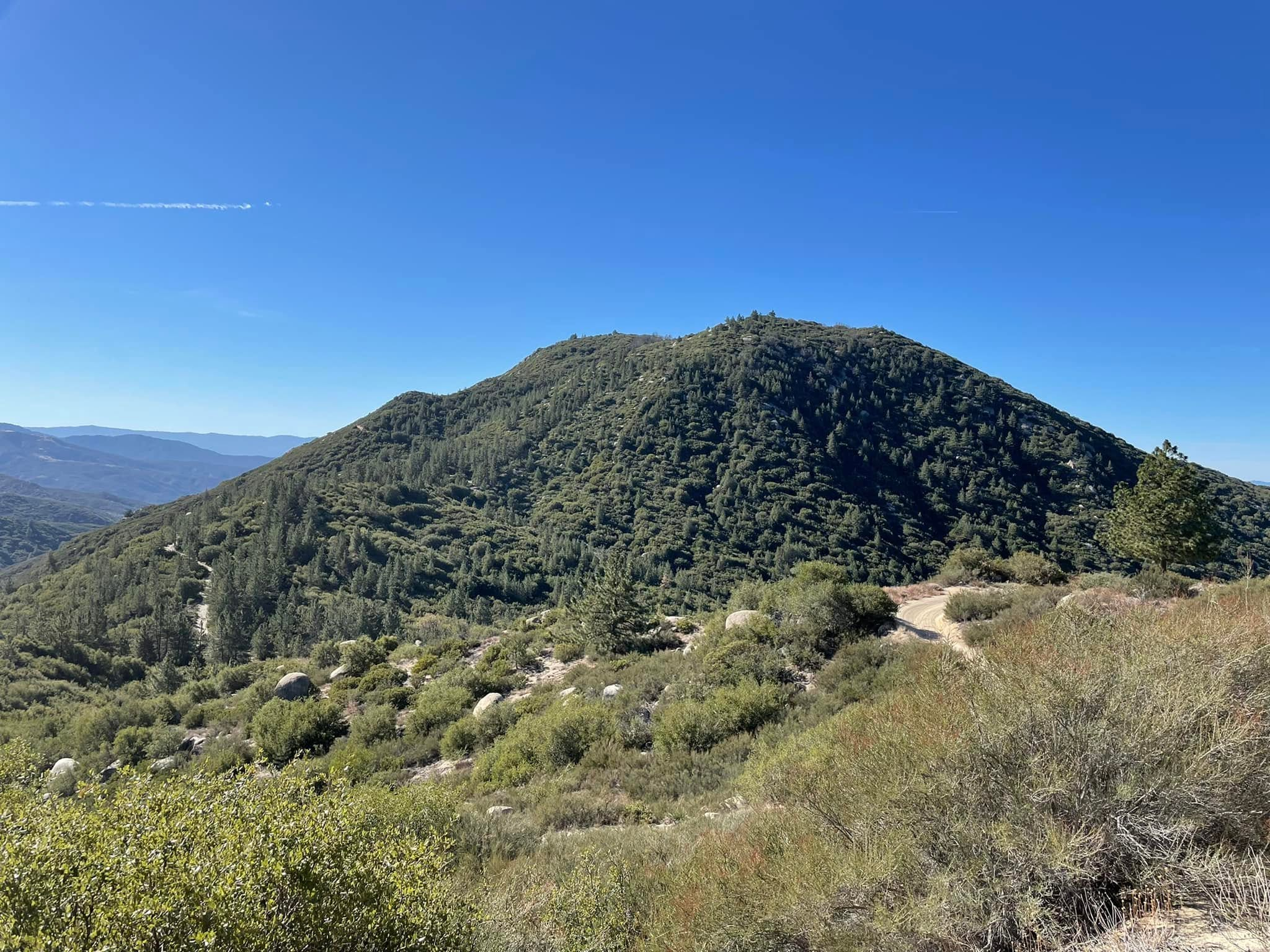
Indian’s name traces back to a Soboba tradition of naming creeks running through their land, possession of which they almost lost until an 1883 report, co-authored by Helen Hunt Jackson (author of the famed novel Ramona), contributed to the establishment of the Soboba Indian Reservation. The Los Angeles Aqueduct has drained aquifers in the area and the terrain is drier than it once was. The summit has unique views of the distant San Gabriels, the nearer San Bernardinos, San Jacinto, and Palomar areas.

Route 1 is an easy and scenic hike on Forest Service road. Driving is not recommended on this poor road, even for 4×4 vehicles, though some do.

Maps generated from CalTopo.com, reproduced with permission

Route 1
Elevation Gain
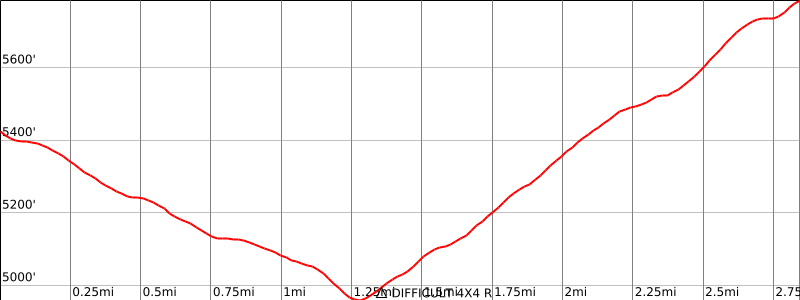
1300′ total, 800′ out plus 500′ on return
Navigation Difficulty
Easy
Distance
6 miles round trip on road
Estimated time
2-3 hours round trip
Route Rating
Class 1, easy
Leader Rating Required
“I”, normal conditions

Driving route

Drive I-10 to Banning. Exit at 8th Street (SR 243). Note your odometer and go as follows:
At 0.2 mile, turn left.
At 0.7 mile, turn right on San Gorgonio Avenue.
At 1.4 miles, keep left on SR 243.
At 9.1 miles, Poppet Flat Road goes right. Continue straight.
At 11.6 miles, fork with 4S06 on the right. Keep straight.
At 11.8 miles, pass the Vista Grande Ranger Station.
At 12.8 miles, fork on the left with 2E05 and a sign “Black Mountain Trail”. Keep straight.
At 15.6 miles, fork on the right with 4S21, Indian Mountain Road, and Indian Vista. Park here.
Driving beyond this point is not recommended for 2WD vehicles.

If the brush has been cleared recently, the road beyond is passable in high clearance 4WD vehicles:
Turn right on 4S21. Note your odometer again and go as follows:
At 1.3 miles, pass through a low saddle.
At 2.9 miles, the road tops a hill and starts downhill. Park on the road shoulder and hike to the summit.

If approaching from the south along SR 243, Indian Mountain Road (4S21) is 9.7 miles from the Chevron station in Idyllwild.

Driving beyond this point is not recommended for 2WD vehicles. If the brush has been cleared recently, the road is passable in high clearance 4WD vehicles.

Instead of parking, turn right on 4S21. Note your odometer again and go as follows:
At 1.3 miles, pass through a low saddle.
At 2.9 miles, the road tops a hill and starts downhill. Park on the road shoulder and hike to the summit.

Hiking route

From the parking area on the highway described above, hike west 2.9 miles on 4S21 to a high point on the road where it starts a definite downhill descent.

Route Notes

Printable Route

Road Type

Paved

Google Maps Link to Trailhead 

Nearby Peaks

Backus Peak
Owens Peak
Black Mountain #5
Morris Peak

External Links

mountain 1

Peakbagger.com

Click Here

ranger-tower 1

Nearest ranger station

Click Here

g311

NOAA Forecast

Click Here

worldwide 1

Google Earth

Click Here

Photo Gallery