Bohna Peak

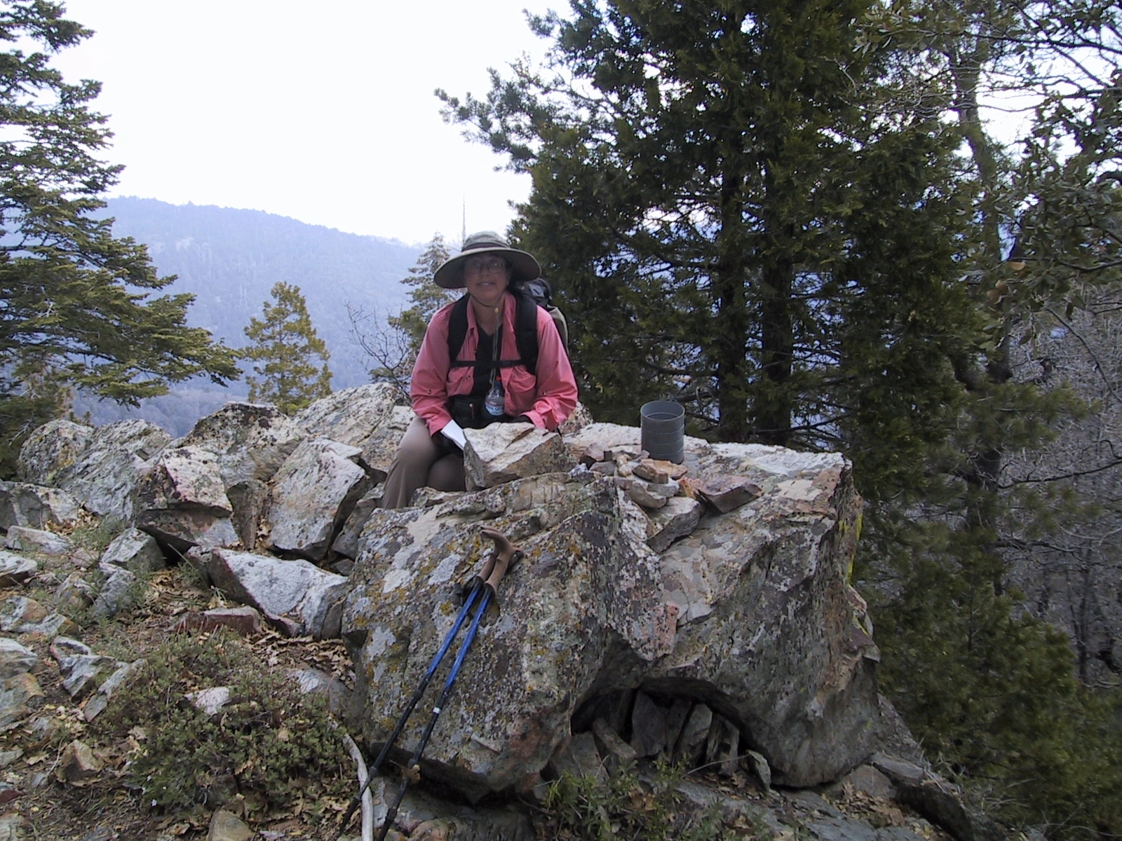
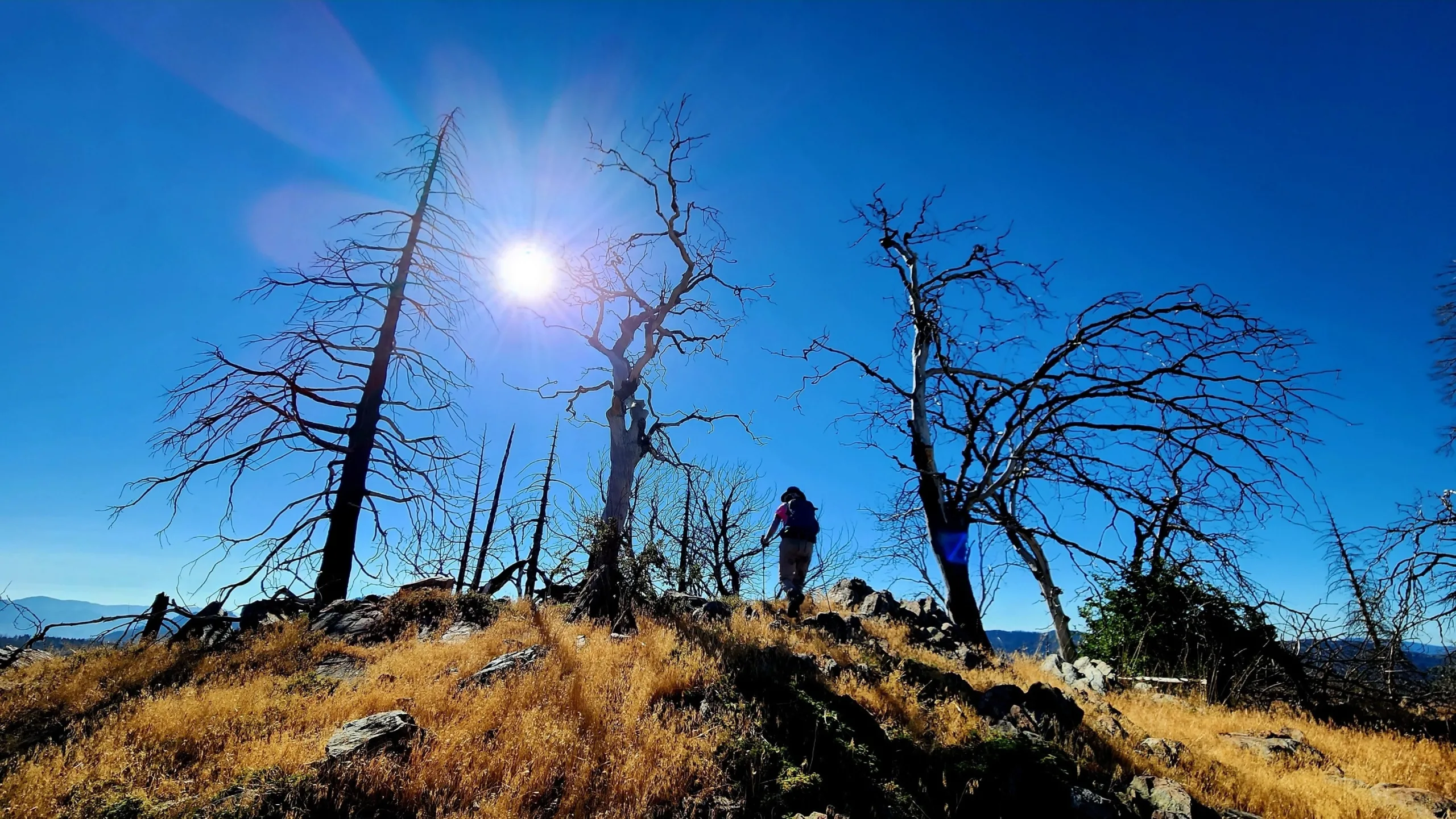
Bohna Peak, near summit, Photo by Tao Zhang.

Peak Name

Bohna Peak
01B

Elevation

6760

 feet

Status

active

Region

Southern Sierra North Of Hwy 178

Range

Greenhorn Mountains

Nearby peaks

Location

35.7599514,-118.5942544

Description

Bohna Peak and its sister Sunday Peak are in the Sequoia National Forest and are the northernmost peaks on the HPS list. They are situated at the southwest end of the Sierra Nevada, with summit views that can extend as far as Mt Whitney and the Great Western Divide. Before the Cedar Fire in 2016, their pretty trails wound gradually through a beautiful forest of green ferns and tall pines; sadly, the fire destroyed some of Sunday’s forest and much of Bohna’s. Nevertheless, the area is regrowing, and the views remain as spectacular as ever.

Route 1 ascends on forested trail to a saddle with a bit of cross-country to reach the summit. Route 2 follows a brushy ridge to the peak. Bohna is often hiked with Sunday, along the steep ridge connecting them.

Maps generated from CalTopo.com, reproduced with permission

Route 1
Elevation Gain
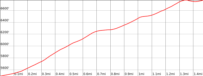
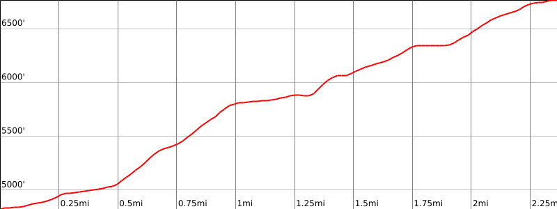
1400′
Navigation Difficulty
Easy
Distance
3 miles round trip on use trail and cross-country
Estimated time
2 hours round trip
Route Rating
Class 1, easy
Leader Rating Required
“O”, normal conditions

Driving route

From Lake Isabella (city) drive north on SR 155 for 7.0 miles to where it turns left in Wofford Heights. Turn left.
Drive 7.7 miles farther to Greenhorn Summit. This is the turnoff point for Sunday Peak, Split Mountain and Black Mountain #5. Continue straight on SR 155.
Drive 5.8 miles farther to a dirt road 24S07 on the right. Turn right.
Drive 2.0 miles to a jeep road on the right. Park near here.

Hiking route

From the parking area (5480′), follow the jeep road east. It soon becomes a use trail.
Follow this use trail 1 1/2 miles to saddle 6480′.
Turn right (south) and ascend cross-country less 1/2 mile to the summit.

Route Notes

Note: Sandy Creek Canyon Road Gate (24S07) off of SR155 is seasonal. Call Greenhorn Ranger District at (760) 379-5646 for road condition and gate closure information. If you are hiking 24S07, the old jeep road is 0.1 mile past a sharp turn west. If you reach McFarland Creek (gully) you have gone 0.2 mile too far.

Printable Route

Road Type

Dirt

Google Maps Link to Trailhead 

Route 2
Elevation Gain
2000′
Navigation Difficulty
Moderate
Distance
4 miles round trip cross-country
Estimated time
3-4 hours round trip
Route Rating
Class 1, moderate
Leader Rating Required
“I”, normal conditions

Driving route

From Lake Isabella (city) drive north on SR 155 for 7.0 miles to where it turns left in Wofford Heights. Turn left. Continue on SR 155 to Cedar Creek Campground on the right. Park here.

Hiking route

From the campground (4800′), hike upstream along the canyon for more than 1/4 mile.
After climbing past two waterfalls and then past a large pool above them, begin looking on the west side of the stream for a use trail.
Take the use trail, which zigzags through brush to gain the east ridge of Bohna Peak.
Continue west along this ridge to the summit.

Route Notes

Printable Route

Road Type

Paved

Google Maps Link to Trailhead 

Additional Peak Information

Alternative routes: Bohna can be climbed from a trail junction near Sunday Peak. The Sunday Peak Route 2 guide describes this route.

Nearby Peaks

Backus Peak
Owens Peak
Black Mountain #5
Morris Peak

External Links

mountain 1

Peakbagger.com

Click Here

ranger-tower 1

Nearest ranger station

Click Here

g311

NOAA Forecast

Click Here

worldwide 1

Google Earth

Click Here

Photo Gallery