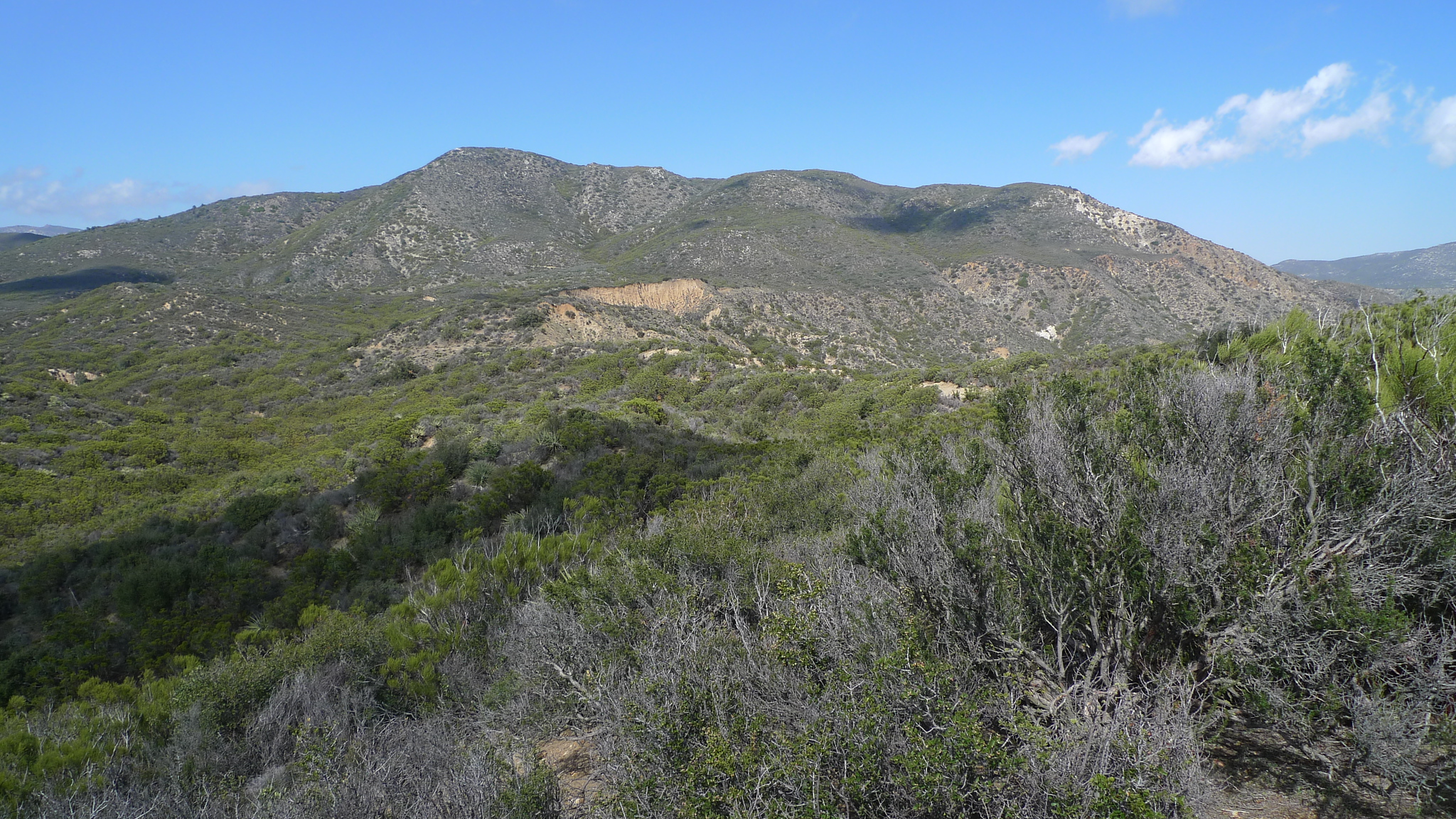
Lookout Mountain #1 is situated at a crossroads of sorts. It sits at the bottom of the Desert Divide that descends from the north, displaying its entire inspiring profile to the viewer, with the South Fork San Jacinto River Wilderness and Thomas Mountain descending finger-like from the northwest, the Santa Rosa Mountains arising to the east and the start of the great expanse of the Anza Borrego Wilderness to the south. The views are thus quite noteworthy and worth the trip.
Property development has eliminated all previous routes, prompting the developing of the current Route 3 which follows the PCT from the north until ascending steeply on somewhat loose terrain up the south face of the peak. One can also hike up the PCT from the south to join the route. In case it needs to be said, which it shouldn’t, avoid the temptation to hop the electrified fences to find a shorter or easier legal route, there is none.
Maps generated from CalTopo.com, reproduced with permission
Go south on I-215 to the Ramona Expressway. Turn left (east).
Go east and then southeast on the Ramona Expressway until it ends at SR 74. Turn left (east).
Go east on SR 74 to Mountain Center.
Continue east on SR 74 for 12.5 miles to the intersection with SR 371.
From the junction of SR 74 and SR 371 in Garner Valley, drive east 1.0 mile on SR 74 to the signed PCT parking lot on the left (north) side of the highway. 62500 Pines to Palms Hwy (SR74), Anza. This is also the parking area for Route 1 for Ken Point. Park here.
Hiking route
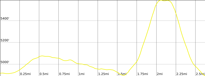
From the parking area (4919′), cross to the south side of the highway and observe a gate accessing the Pacific Crest Trail (PCT).
Pass through the gate, close it, and follow the PCT which initially heads south, then contours around Lookout Mountain.
After 0.5 mile the PCT reaches a shallow saddle (5040+’).
Continue downhill to a point 1.5 miles from SR74 (4880/4900′) to a gully that heads north toward the summit.
Follow the gully approximately 1/3 mile to where the track leaves the gully to the left (steep for approximately 30 yards) to gain the ridge.
Continue on the ridge to the summit approximately 0.7 mile after leaving the PCT.
Route Notes
Note: Avoid hiking through the private property via previous Routes 1 and 2, which cross private property and are now fenced and closed to entry.