
|
|

|

|


** Use at Your Own Risk **
08A |
Liebre Mountain |
5760' |
Location: Los Angeles County, about 19 miles southeast of Gorman, 70 miles from Los Angeles
Maps
| Auto Club | Los Angeles and Vicinity |
| Forest Service | Angeles National Forest |
| USGS Topo | Liebre Mountain 7½ |
| Official HPS Maps | TPO file - Save to your computer then open with National Geographic TOPO! |
| Viewable PDF file - Approximately 4.2 megs | |
| GPX file or Google Earth KML file to download to GPS units and other map software (How to use GPX and KML files) | |
| Routes as shown on CalTopo using the above files (How to use CalTopo) |
Nearby Peaks: Burnt Peak, Sawtooth Mountain
ROUTE 1
(USFS Adventure Pass may be required)- Distance: 7 miles round trip
- Gain: 1850'
- Time: 3 hours round trip
- Rating: Class 1, moderate
- Navigation: Easy
- Leader Rating: "O", normal conditions
Original: John Backus and Al Campbell, 1969
DRIVING ROUTE 1
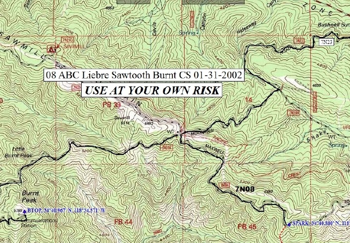
- Take I-5 north to SR 138.
- Go 4 miles east on SR 138 to a paved road signed as Old Ridge Route Road, which is the beginning of Los Angeles County Road N2. Turn right.
- Go 2.2 miles east to Pine Canyon Road (which is a continuation of N2). Turn left.
- Go 4.2 miles east on N2 passing mile marker 13.6. Turn right onto dirt road.
- Go 0.1 mile on dirt road to end and park here.
HIKING ROUTE 1
- From the parking area (3960'), the southbound Pacific Crest Trail (PCT) goes right (west) past a sign 50' up the trail. Follow the PCT as it goes south and up Liebre Mountain to the broad summit area.
- Once in the broad summit area, hike roughly 0.4 mile on relatively level ground, watching for a flimsy fence a few yards off the trail to the right. Pass through the fence to a jeep track beyond.
- The summit cairn is in the grove of trees to the right (west) of the jeep track, about 50 yards past the fence.
ROUTE 2
(USFS Adventure Pass may be required)- Distance: 250' round trip
- Gain: None
- Time: None
- Rating: Class 1, easy
- Navigation: Easy
- Leader Rating: "O", normal conditions
Original: John Backus and Al Campbell, 1969
DRIVING ROUTE 2
- Take I-5 north to the town of Castaic and exit on Lake Hughes Road.
- Take Lake Hughes Road northeast for 23.6 miles to where it ends at a junction with N2, Pine Canyon Road. Turn left (west).
- Go 4.7 miles to Bushnell summit with a junction with 7N23 on the left. Turn left. Note your odometer and go as follows:
- At 2.0 miles, fork. Go right.
- At 3.2 miles, junction. Go right (west) on 7N23.
- At 4.6 miles, Sawmill Campground.
- At 6.5 miles, fork. Keep straight.
- At 9.7 miles, Bear Campground. Keep straight.
- At 11.2 miles, a wide spot in the road. Park here.
A shorter driving route on the return is as follows:
- From the parking area, go west on 7N23.
- At 6.6 miles, intersect 7N22. Continue straight on 7N23.
- At 7.2 miles turn right (north) on 8N04.
- 8N04 turns into N2. This portion of N2 is called the Old Ridge Route.
- At 12.6 miles turn left (west) onto SR 138.
- Continue west on SR 138 and meet I-5 at 16.8 miles.
HIKING ROUTE 2
- From the parking area (5760'), walk 250' north-northwest to a cairn.
History of Summit Signature
Climbing Archives
Please report any corrections or changes to the Mountain Records Chair.